
How Can We Help?

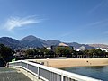
Yufu volcano (left)
Mount Tsurumi (鶴見岳, Tsurumi-dake) is a 1,374.5 m (4,510 ft) volcano in Beppu, Ōita, Japan.
Outline
Mount Tsurumi is a lava dome. It has several peaks, including Mount Kuranoto, Mount Uchi, and Mount Garan. This mountain is one of the Japan 300 mountains, and a part of Aso Kujū National Park.
Route
The easiest way to reach to the top of Mount Tsurumi is to use Kintetsu Beppu Ropeway. When walking up to the top, it takes about two hours from Toriimae Bus Stop and two and half hours from Higashi Tozanguchi Bus Stop.
Access
- Tsurumi Sanjo Station
- Toriimae Bus Stop
- Higashi Tozanguchi Bus Stop
Gallery
-
 ESE side
 -
 West side


See also
External links
- Tsurumidake and Garandake: National catalogue of the active volcanoes in Japan - Japan Meteorological Agency
- Tsurumi Dake - Geological Survey of Japan
- "Yufu-Tsurumi". Global Volcanism Program. Smithsonian Institution. Retrieved 2021-06-24.
| International | |
|---|---|
| National | |
| Geographic | |

Recent Comments