
How Can We Help?
Subcategories
This category has the following 12 subcategories, out of 12 total.
Media in category "Distance indicators"
The following 75 files are in this category, out of 75 total.
-

-
 100 yds (2074499684).jpg 1,712 × 2,560; 2.26 MB
-
 91 miles 13 chains.JPG 2,464 × 1,632; 1.62 MB
-
 Bidston Hill - DSC04343.JPG 3,648 × 2,736; 3.54 MB
-
 Bidston Hill - DSC04345.JPG 2,736 × 3,648; 3.63 MB
-
 Bidston Hill, Distance Marker - geograph.org.uk - 1405212.jpg 480 × 640; 94 KB
-
 Blaudruckerei 3 km, 2023 Mözs.jpg 1,704 × 2,272; 1.39 MB
-
 Bodö Airport (4).jpg 2,604 × 3,543; 2.74 MB
-
 Camino de Santiago desde Benidorm.jpg 2,336 × 4,160; 3.2 MB
-
 Candes-Saint-Martin Distances Navigation R01.jpg 3,558 × 3,348; 8.86 MB
-
 Cocklesign wp.JPG 2,112 × 2,816; 1.91 MB
-
 Control city sign near Warsaw, Poland.jpg 619 × 438; 102 KB
-
 Direction arrows from Nagoya; February 2019.jpg 4,350 × 2,445; 4.31 MB
-
 Distance indicator in Gildetun, 2012 June.jpg 3,600 × 2,380; 5.36 MB
-
 Distance indicator in Gildetun, 2014 August.jpg 3,000 × 2,000; 3.33 MB
-
 Distance Marker, Forth and Clyde Canal - geograph.org.uk - 731898.jpg 640 × 428; 137 KB
-
 Distance signs in Viljandi Estonia.JPG 2,481 × 3,722; 2.9 MB
-
 Distances from Coolabah, New South Wales, 2007.jpg 960 × 1,280; 161 KB
-
 District-Semporna Sabah Balung-Semporna-Road-03.jpg 4,032 × 2,688; 9.26 MB
-
 DOD Bubenečský tunel 2014, směrovky k nouzovým východům.jpg 3,264 × 2,448; 869 KB
-
 Dollymount Beach - North Bull Island - panoramio (25).jpg 6,000 × 4,000; 22.31 MB
-
 EMERALD POOL (37536299204).jpg 4,032 × 3,024; 3.66 MB
-
 Entfernungstafel, Straße 6204, 2023 Martonvásár.jpg 2,272 × 1,704; 1.06 MB
-
 Forth and Clyde Canal, Townhead - geograph.org.uk - 422257.jpg 640 × 440; 121 KB
-
 George Lane, Read.jpg 3,005 × 4,007; 4.14 MB
-

-
 Guldbergs Plads 07.jpg 2,560 × 1,920; 2.82 MB
-
 Hafen, 95m C-8, 2022 Barcs.jpg 1,704 × 2,272; 1.19 MB
-
 Himoinen distance post.jpg 2,164 × 3,794; 2.09 MB
-
-
 It's a Long Way to Tipperary compass, Tipp town.jpg 2,448 × 3,264; 2.93 MB
-
 Jasper Train Station Alberta (CA) September 2019 (50123801971).jpg 2,304 × 1,728; 1.01 MB
-
 Jávorka Szakképző Iskola és Kollégium. Testvériskolák. - Tata, Új út.JPG 1,704 × 2,272; 1,008 KB
-
 Kangerlussuaq (6137157335).jpg 3,968 × 2,232; 1.91 MB
-
 Kilometer Zero, Bratislava.JPG 3,648 × 2,736; 4.69 MB
-

-
 Lehrpfad, Wegweiser S, 2023 Bag.jpg 1,704 × 2,272; 1.7 MB
-
 Lehrpfad, Wegweiser, 2023 Bag.jpg 1,704 × 2,272; 1.58 MB
-
 Livgardens Historiske Samling 20.jpg 1,920 × 2,560; 2.71 MB
-
 Marienweg Wegweiser, Strasse 7319, 2021 Sümeg.jpg 2,272 × 1,704; 1,016 KB
-
 Multi Distance Signs, Bursa.jpg 1,536 × 2,048; 2.5 MB
-
 Murijev vrelec Jezersko Slovenija Bad Vellach Avstrija 3.JPG 3,264 × 2,448; 4.28 MB
-
 Murska Sobota (8621880773).jpg 3,000 × 4,000; 2.72 MB
-
 Northpole polarstern hg.jpg 1,963 × 2,955; 564 KB
-
 Odległości klimczok.jpg 4,512 × 3,320; 5.24 MB
-
 PancarteDistanceDjerba Dec2012 1.JPG 4,320 × 3,240; 5.37 MB
-
 Panneau GT20.jpg 3,000 × 3,000; 4.3 MB
-
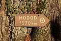 Panneau Hodod à Boigny-sur-Bionne (Loiret).jpg 4,001 × 2,667; 6.39 MB
-
 Parabolic transition curve.JPG 1,025 × 770; 323 KB
-
 Parque Natural Municipal Morro do Baú - Liu Idárraga Orozco (12).jpg 4,000 × 2,660; 4.45 MB
-
 Parque Natural Municipal Morro do Baú - Liu Idárraga Orozco (29).jpg 6,016 × 4,000; 3.59 MB
-
 Plaque atop Snaefell Mountain - Isle of Man - kingsley - 24-JUN-09.jpg 2,560 × 1,920; 1.09 MB
-
 Roupov (hrad), turistický rozcestník.jpg 4,000 × 3,000; 4.59 MB
-
 Saint Philip, Barbados 004.jpg 1,944 × 2,592; 2.8 MB
-
 Scale kilometres miles.svg 400 × 75; 8 KB
-
 Scale metres yards.svg 520 × 75; 7 KB
-
 Sign-1040982, Dingle Peninsula, Co. Kerry, Ireland.jpg 4,896 × 3,672; 2.4 MB
-
 Sign-1080100, Dingle Peninsula, Co. Kerry, Ireland.jpg 3,672 × 4,896; 2.34 MB
-
 Sign-1090981, Dingle Peninsula, Co. Kerry, Ireland.jpg 4,896 × 3,672; 8.82 MB
-

-
 Signpost at Tropical Farms (16789576809).jpg 3,648 × 5,472; 8.35 MB
-
 Signs on Carian Trail.jpg 3,888 × 2,592; 3.39 MB
-
 Singapore Road Signs - Information Sign - Expressway Distance Marker Post.svg 2,147 × 2,147; 14 KB
-
 Southport Waterfront Park (July 2023) 08.jpg 4,000 × 6,000; 5.46 MB
-
 Spejdernes Lejr 2022 - Afstande.jpg 1,944 × 2,592; 2.86 MB
-
 Stirling Point Signpost, Bluff (5585763492).jpg 900 × 507; 89 KB
-
 Tamanrasset distances 1981 79.jpg 2,100 × 1,500; 540 KB
-
 Techum Shabbat (English).png 800 × 861; 56 KB
-
 Thana Pass, Albania 2018 01.jpg 1,800 × 868; 707 KB
-
 Three Thousand Feet (136146993).jpeg 2,048 × 1,463; 1.02 MB
-
 Twin town fingerpost at Szechenyi Square, 2016 Bonyhad.jpg 1,704 × 2,272; 969 KB
-
 Táncsics Mihály Straße, Wegweiser, 2021 Kőszeg.jpg 1,704 × 2,272; 1.48 MB
-
 Where to next^ - geograph.org.uk - 758733.jpg 480 × 640; 105 KB
-
 Yellow dots at the Groninger station, Groningen (2018) 02.jpg 3,840 × 2,160; 3.16 MB
-
 Zeltweg10 Radfahrpunkt46.jpg 3,456 × 5,421; 12.73 MB


Recent Comments