How Can We Help?
You are here:
< Back
Size of this preview: 800 × 409 pixels. Other resolutions: 320 × 164 pixels | 640 × 327 pixels | 1,024 × 524 pixels | 1,280 × 655 pixels | 2,560 × 1,310 pixels | 4,896 × 2,505 pixels.
Original file (4,896 × 2,505 pixels, file size: 1.62 MB, MIME type: image/jpeg)
Summary
DescriptionSaint Peter Port from Victoria Tower.jpg |
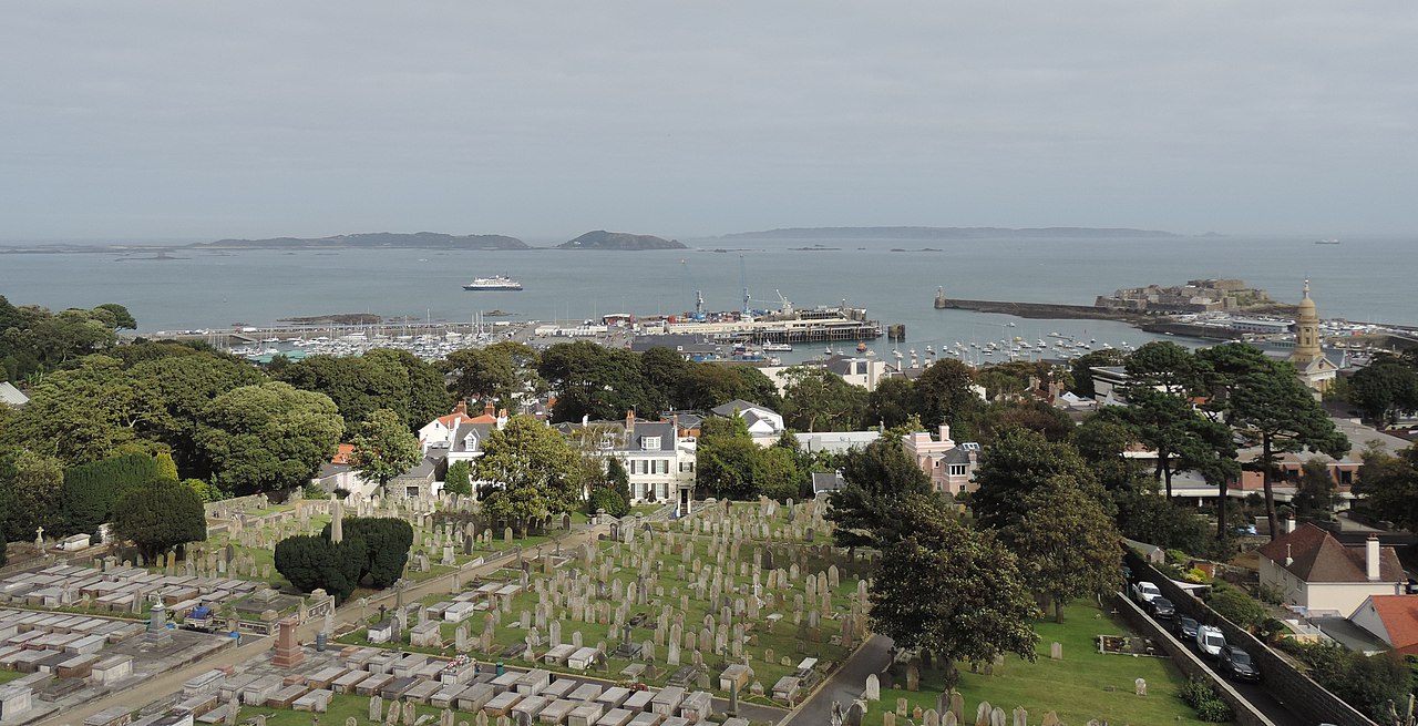
English: View over Saint Peter Port, Guernsey, towards the sea and harbour from Victoria Tower. |
Date | |
Source | Own work |
Author | Daniel Kraft |
Camera location | 49° 27′ 29.56″ N, 2° 32′ 34.31″ W | View this and other nearby images on: OpenStreetMap | 49.458211; -2.542864 |
---|
Licensing
I, the copyright holder of this work, hereby publish it under the following license:
This file is licensed under the Creative Commons Attribution-Share Alike 3.0 Unported license.
- You are free:
- to share – to copy, distribute and transmit the work
- to remix – to adapt the work
- Under the following conditions:
- attribution – You must give appropriate credit, provide a link to the license, and indicate if changes were made. You may do so in any reasonable manner, but not in any way that suggests the licensor endorses you or your use.
- share alike – If you remix, transform, or build upon the material, you must distribute your contributions under the same or compatible license as the original.
Annotations InfoField | This image is annotated: View the annotations at Commons |
3849
919
502
202
4896
2505
Castle Cornet
441
1543
3164
955
4896
2505
Candie Cemetery
1916
735
502
171
4896
2505
Jethou
233
735
1548
171
4896
2505
Herm
2540
668
1763
220
4896
2505
Sark
4315
925
337
478
4896
2505
St. James Concert Hall
Items portrayed in this file
depicts
Saint Peter Port
port
cemetery
cityscape
creator
some value
author name string: Daniel Kraft
Wikimedia username: Domob
copyright status
copyrighted
copyright license
Creative Commons Attribution-ShareAlike 3.0 Unported
captured with
Nikon Coolpix P520
source of file
original creation by uploader
coordinates of the point of view
49°27'29.560"N, 2°32'34.310"W
inception
5 September 2016
exposure time
0.001 second
f-number
3.1
focal length
5.3 millimetre
ISO speed
80
media type
image/jpeg
instance of
photograph
File history
Click on a date/time to view the file as it appeared at that time.
Date/Time | Thumbnail | Dimensions | User | Comment | |
---|---|---|---|---|---|
current | 12:57, 7 June 2020 | 4,896 × 2,505 (1.62 MB) | Domob | Uploaded own work with UploadWizard |
File usage
The following pages on the English Wikipedia use this file (pages on other projects are not listed):
Metadata
This file contains additional information, probably added from the digital camera or scanner used to create or digitize it.
If the file has been modified from its original state, some details may not fully reflect the modified file.
Camera manufacturer | NIKON |
---|---|
Camera model | COOLPIX P520 |
Exposure time | 1/1,000 sec (0.001) |
F-number | f/3.1 |
ISO speed rating | 80 |
Date and time of data generation | 16:01, 5 September 2016 |
Lens focal length | 5.3 mm |
Latitude | 49° 27′ 29.56″ N |
Longitude | 2° 32′ 34.31″ W |
Altitude | 130.9 meters above sea level |
Horizontal resolution | 300 dpi |
Vertical resolution | 300 dpi |
Software used | GIMP 2.10.8 |
File change date and time | 14:56, 7 June 2020 |
Y and C positioning | Co-sited |
Exposure Program | Normal program |
Exif version | 2.3 |
Date and time of digitizing | 16:01, 5 September 2016 |
Meaning of each component |
|
Image compression mode | 4 |
Exposure bias | 0 |
Maximum land aperture | 3.2 APEX (f/3.03) |
Metering mode | Pattern |
Light source | Unknown |
Flash | Flash did not fire, compulsory flash suppression |
Supported Flashpix version | 1 |
Color space | sRGB |
File source | Digital still camera |
Scene type | A directly photographed image |
Custom image processing | Normal process |
Exposure mode | Auto exposure |
White balance | Auto white balance |
Digital zoom ratio | 0 |
Focal length in 35 mm film | 30 mm |
Scene capture type | Standard |
Scene control | None |
Contrast | Normal |
Saturation | Normal |
Sharpness | Normal |
Subject distance range | Unknown |
GPS time (atomic clock) | 15:01 |
GPS date | 5 September 2016 |
GPS tag version | 0.0.3.2 |
Categories
-
Annuals36
-
Bulbs, Corms & Tubers41
-
Ferns27
-
Fruits3
-
Garden Plants23
-
Grasses26
-
Herb17
-
Insects1
-
Mammals1
-
Midwest Native Plants0
-
Northeast Native Plants112
-
Perennials123
-
Rose1
-
Shrubs47
-
Trees112
-
Tropical Plants53
-
Upland Birds5
-
Vines18
-
Viola Tricolor1
-
Water Gardening & Plants9
-
Waterfowl0
-
Wetland Birds0
-
Wetland Plants4
-
Wildbirds172
-
Wildflowers1
-
Woodland Plants29
Table of Contents
Recent Comments