The Indiana Portal
Various indigenous peoples inhabited what would become Indiana for thousands of years, some of whom the U.S. government expelled between 1800 and 1836. Indiana received its name because the state was largely possessed by native tribes even after it was granted statehood. Since then, settlement patterns in Indiana have reflected regional cultural segmentation present in the Eastern United States; the state's northernmost tier was settled primarily by people from New England and New York, Central Indiana by migrants from the Mid-Atlantic states and adjacent Ohio, and Southern Indiana by settlers from the Upland South, particularly Kentucky and Tennessee.
Indiana has a diverse economy with a gross state product of $352.62 billion in 2021. It has several metropolitan areas with populations greater than 100,000 and a number of smaller cities and towns. Indiana is home to professional sports teams, including the NFL's Indianapolis Colts and the NBA's Indiana Pacers. The state also hosts several notable competitive events, such as the Indianapolis 500, held at Indianapolis Motor Speedway. (Full article...)
Selected article -
The Indianapolis Motor Speedway is a motor racing circuit located in Speedway, Indiana, an enclave suburb of Indianapolis, Indiana. It is the home of the Indianapolis 500 and the Brickyard 400 and formerly the home of the United States Grand Prix and Indianapolis motorcycle Grand Prix. It is located six miles (9.7 km) west of Downtown Indianapolis.
Constructed in 1909, it is the second purpose-built, banked oval racing circuit after Brooklands and the first to be called a 'speedway'. It is the third-oldest permanent automobile race track in the world, behind Brooklands and the Milwaukee Mile. With a permanent seating capacity of 257,325, it is the highest-capacity sports venue in the world. (Full article...)Selected image -
Did you know -
- ... that after the Wolverines released their "Moose" for his fifth season, he went on to win another Big Ten championship with the Hoosiers?
- ... that an "army" of women were congratulated by Pat Nixon for their fundraising efforts to bring public TV to Indianapolis?
- ... that William N. Salin was twice decorated with the Sagamore of the Wabash?
- ... that a woman hitchhiked from Indiana to Washington, D.C., to protest the sale of the radio station where she worked?
- ... that Ganggang, an Indianapolis-based cultural development firm for Black artists, created a fine art fair called "Butter" that also included a dance party called "Melt"?
- ... that the veto of an Indiana law that bans transgender girls from participating in school sports was overridden by the state legislature?
Related portals
Selected geographic article -
Selected biography -

Jonathan Jennings (March 27, 1784 – July 26, 1834) was an American politician who was the first governor of the State of Indiana and a nine-term congressman from Indiana. Born in either Hunterdon County, New Jersey, or Rockbridge County, Virginia, he studied law before migrating to the Indiana Territory in 1806. Jennings initially intended to practice law, but took jobs as an assistant at the federal land office at Vincennes and assistant to the clerk of the territorial legislature to support himself and pursued interests in land speculation and politics. Jennings became involved in a dispute with the territorial governor, William Henry Harrison, that soon led him to enter politics and set the tone for his early political career. In 1808 Jennings moved to the eastern part of the Indiana Territory and settled near Charlestown, in Clark County. He was elected as the Indiana Territory's delegate to the U.S. Congress by dividing the pro-Harrison supporters and running as an anti-Harrison candidate. By 1812, he was the leader of the anti-slavery and pro-statehood faction of the territorial government. Jennings and his political allies took control of the territorial assembly and dominated governmental affairs after the resignation of Governor Harrison in 1812. As a congressional delegate Jennings aided passage of the Enabling Act in 1816, which authorized the organization of Indiana's state government and state constitution. He was elected president of the Indiana constitutional convention, held in Corydon in June 1816, where he helped draft the state's first constitution. Jennings supported the effort to ban slavery in the state and favored a strong legislative branch of government.
In August 1816, Jennings was elected to serve as the first governor of Indiana at age 32, and re-elected for an additional term. He pressed for the construction of roads and schools, and negotiated the Treaty of St. Mary's to open up central Indiana to American settlement. His opponents attacked his participation in the treaty negotiations as unconstitutional and brought impeachment proceedings against him, a measure that was narrowly defeated by a vote of 15 to 13 after a month-long investigation and the resignation of the lieutenant governor. During his second term and following the panic of 1819, Jennings encountered financial problems, a situation exacerbated by his inability to keep up with his business interests and run the state government simultaneously. Ineligible for another term as Indiana governor under the state constitution, Jennings looked for other means of financial support. Shortly before completion of his second term as governor in 1822, Jennings was elected to the U.S. House of Representatives, before retiring from public service in 1831. In Congress Jennings promoted federal spending on internal improvements. (Full article...)Selected quote
General images
Topics
- Economy: AM General - ATA Airlines - Casinos - Cummins - Delta - ITT - JayC - Lilly - Limestone - Manufacturing - NiSource - Shoe Carnival - Simon Property Group - Soybeans - Studebaker - Vectren - WellPoint
- Geography: Caves - Lakes - Rivers - State forests - Watersheds
Categories
Attractions
 |
Recognized content
Good articles
- 1963 Indiana State Fairgrounds Coliseum gas explosion
- 2006 Brickyard 400
- 2011 South Bend mayoral election
- 2015 South Bend mayoral election
- 2019 South Bend mayoral election
- 2021 NCAA Division I men's basketball championship game
- Max Bielfeldt
- The Fault in Our Stars (film)
- Hurley Goodall
- R. Ames Montgomery
- Proposed South Shore Line station in South Bend
- Richmond, Indiana, facility fire
- WCAE
Featured pictures
-
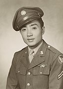
Kenje Ogata 1943
-
Kurt Vonnegut by Bernard Gotfryd (1965)
-
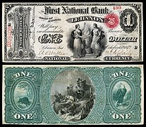
US-NBN-IL-Lebanon-2057-Orig-1-400-C
WikiProjects
Things you can do
 |
Here are some tasks awaiting attention:
|
Associated Wikimedia
The following Wikimedia Foundation sister projects provide more on this subject:
-
 Commons
Free media repository -
 Wikibooks
Free textbooks and manuals -
 Wikidata
Free knowledge base -
 Wikinews
Free-content news -
 Wikiquote
Collection of quotations -
 Wikisource
Free-content library -
 Wikiversity
Free learning tools -
 Wikivoyage
Free travel guide -
 Wiktionary
Dictionary and thesaurus
- ^ a b "Elevations and Distances in the United States". U.S Geological Survey. 29 April 2005. Retrieved 2006-11-06.













Recent Comments