How Can We Help?
You are here:
< Back
Size of this preview: 800 × 600 pixels. Other resolutions: 320 × 240 pixels | 640 × 480 pixels | 1,024 × 768 pixels | 1,280 × 960 pixels | 2,560 × 1,920 pixels | 4,000 × 3,000 pixels.
Original file (4,000 × 3,000 pixels, file size: 7.86 MB, MIME type: image/jpeg)
Summary
DescriptionBoracay paraw sailboats 010.jpg |
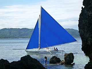
English: Boracay paraw sailboats |
Date | |
Source | https://www.flickr.com/photos/rickmccharles/6485468957/ |
Author | Rick McCharles |
Camera location | 11° 57′ 14.4″ N, 121° 55′ 45.6″ E | View this and other nearby images on: OpenStreetMap | 11.954000; 121.929333 |
---|
Licensing
This file is licensed under the Creative Commons Attribution 2.0 Generic license.
- You are free:
- to share – to copy, distribute and transmit the work
- to remix – to adapt the work
- Under the following conditions:
- attribution – You must give appropriate credit, provide a link to the license, and indicate if changes were made. You may do so in any reasonable manner, but not in any way that suggests the licensor endorses you or your use.
This image was originally posted to Flickr by Rick McCharles at https://flickr.com/photos/71035721@N00/6485468957. It was reviewed on 20 June 2022 by FlickreviewR 2 and was confirmed to be licensed under the terms of the cc-by-2.0. |
20 June 2022
Items portrayed in this file
depicts
Paraw
crab claw sail
trimaran
Bangka
outrigger
creator
some value
author name string: Rick McCharles
copyright status
copyrighted
copyright license
Creative Commons Attribution 2.0 Generic
coordinates of the point of view
11°57'14"N, 121°55'44"E
heading: 180 degree
exposure time
0.003125 second
f-number
5.8
focal length
20.3 millimetre
ISO speed
160
media type
image/jpeg
instance of
photograph
source of file
file available on the internet
operator: Flickr
described at URL: https://www.flickr.com/photos/rickmccharles/6485468957
checksum
ae88ebaf8e639df30650ee126d5205428680d03a
determination method: SHA-1
data size
8,239,824 byte
height
3,000 pixel
width
4,000 pixel
File history
Click on a date/time to view the file as it appeared at that time.
Date/Time | Thumbnail | Dimensions | User | Comment | |
---|---|---|---|---|---|
current | 15:04, 20 June 2022 | 4,000 × 3,000 (7.86 MB) | Obsidian Soul | Uploaded a work by Rick McCharles from https://www.flickr.com/photos/rickmccharles/6485468957/ with UploadWizard |
File usage
The following pages on the English Wikipedia use this file (pages on other projects are not listed):
Global file usage
The following other wikis use this file:
- Usage on uz.wikipedia.org
Metadata
This file contains additional information, probably added from the digital camera or scanner used to create or digitize it.
If the file has been modified from its original state, some details may not fully reflect the modified file.
Camera manufacturer | Panasonic |
---|---|
Camera model | DMC-TS3 |
Exposure time | 1/320 sec (0.003125) |
F-number | f/5.8 |
ISO speed rating | 160 |
Date and time of data generation | 08:45, 10 December 2011 |
Lens focal length | 20.3 mm |
Latitude | 11° 57′ 14.4″ N |
Longitude | 121° 55′ 45.6″ E |
Altitude | 35 meters above sea level |
Short title | P1060104 |
Orientation | Normal |
Horizontal resolution | 72 dpi |
Vertical resolution | 72 dpi |
Software used | QuickTime 7.6.6 |
File change date and time | 13:05, 10 December 2011 |
Exposure Program | Normal program |
Exif version | 2.2 |
Date and time of digitizing | 08:45, 10 December 2011 |
Image compression mode | 4 |
Exposure bias | 0 |
Maximum land aperture | 5.0703125 APEX (f/5.8) |
Metering mode | Pattern |
Light source | Unknown |
Flash | Flash did not fire, compulsory flash suppression |
Supported Flashpix version | 1 |
Color space | sRGB |
Sensing method | One-chip color area sensor |
Custom image processing | Normal process |
Exposure mode | Auto exposure |
White balance | Auto white balance |
Digital zoom ratio | 0 |
Focal length in 35 mm film | 114 mm |
Scene capture type | Standard |
Contrast | Normal |
Saturation | Normal |
Sharpness | Normal |
GPS time (atomic clock) | 02:30 |
Satellites used for measurement | 4 |
Receiver status | Measurement in progress |
Measurement mode | 2-dimensional measurement |
Measurement precision | Fair (3.2) |
Reference for direction of image | Magnetic direction |
Direction of image | 180 |
Geodetic survey data used | WGS-84 |
GPS tag version | 2.3.0.0 |
IIM version | 2 |
Categories
-
Annuals36
-
Bulbs, Corms & Tubers41
-
Ferns27
-
Fruits3
-
Garden Plants23
-
Grasses26
-
Herb17
-
Insects1
-
Mammals1
-
Midwest Native Plants0
-
Northeast Native Plants112
-
Perennials123
-
Rose1
-
Shrubs47
-
Trees112
-
Tropical Plants53
-
Upland Birds5
-
Vines18
-
Viola Tricolor1
-
Water Gardening & Plants9
-
Waterfowl0
-
Wetland Birds0
-
Wetland Plants4
-
Wildbirds172
-
Wildflowers1
-
Woodland Plants29
Table of Contents
Recent Comments