
How Can We Help?
Size of this preview: 800 × 600 pixels. Other resolutions: 320 × 240 pixels | 640 × 480 pixels | 1,024 × 768 pixels | 1,280 × 960 pixels | 2,560 × 1,920 pixels | 4,608 × 3,456 pixels.
Original file (4,608 × 3,456 pixels, file size: 6.18 MB, MIME type: image/jpeg)
Summary
| Description |
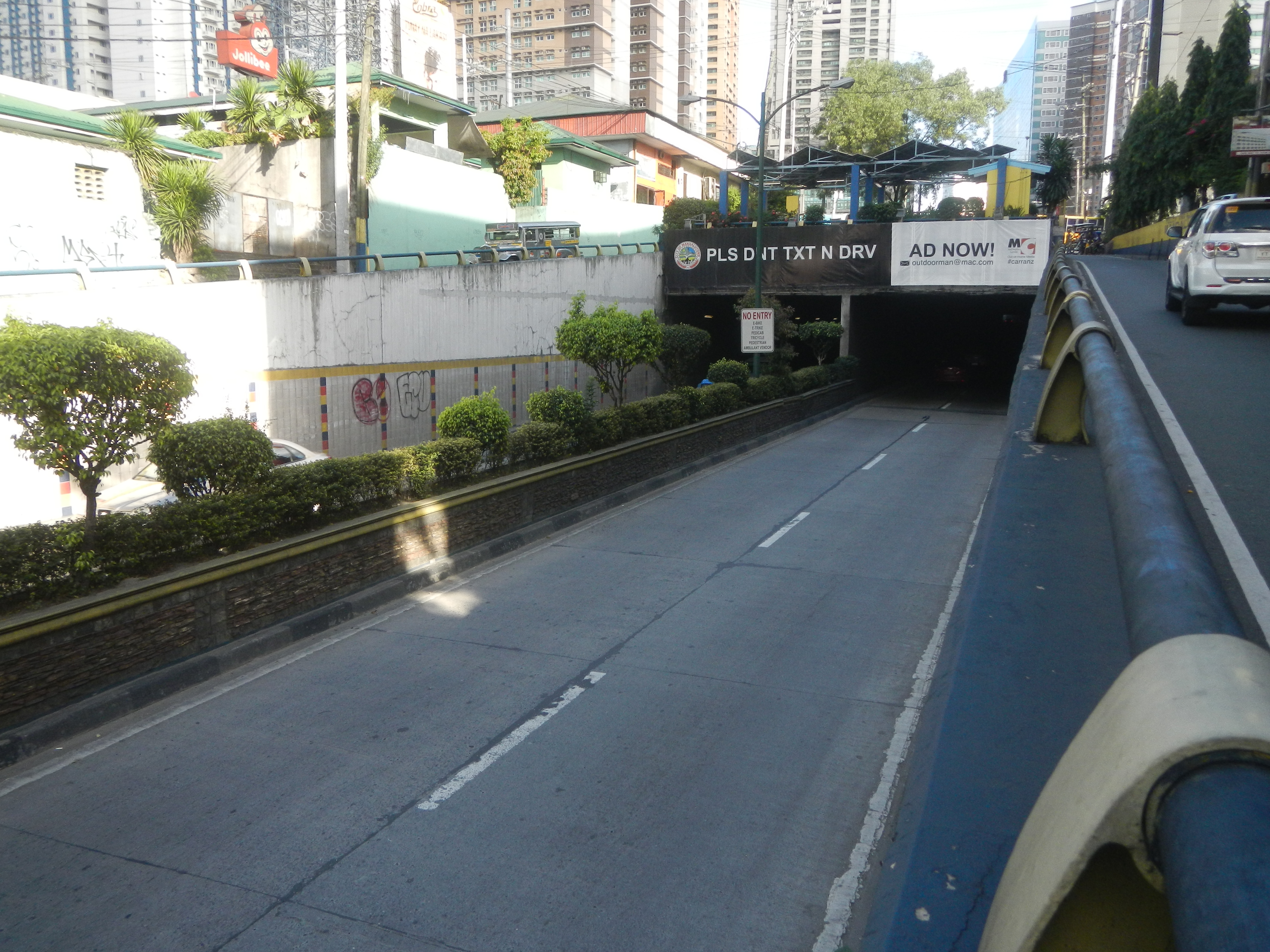
English: List of barangays of Metro Manila, Barangay Barangka Ilaya 14°34'21"N 121°3'2"E Mandaluyong City along Boni Avenue (Mandaluyong) 14°34'36"N 121°2'5"E Boni Avenue starts from Aglipay Street to Boni Avenue corner Pulog Street, Mayon Street & Lion's Road Mayon Street14°34'28"N 121°2'45"E Pulog Street 14°34'26"N 121°2'42"E gateway to EDSA-Boni Avenue Tunnel - Solar-powered LED Lighting EDSA-Boni Avenue 14°34'19"N 121°2'52"E A 280-meter long tunnel underneath EDSA (Epifanio de los Santos Avenue) connecting Boni Avenue on its western-end and Pioneer Street on the east 4.0 meters vertical clearance Grid-tied Solar-powered LED Lighting Inaugurated May 15, 2012 by Philips Electronics and Lighting, Inc., PNOC-Renewables Corporation, Metropolitan Manila Development Corporation Grid-connected photovoltaic power system Benjamin Abalos, Jr. Benjamin de Castro Abalos, Jr. (born 19 July 1962) Mandaluyong City (Note: Judge Florentino Floro, the owner, to repeat, Donor Florentino Floro of all these photos hereby donate gratuitously, freely and unconditionally all these photos to and for Wikimedia Commons, exclusively, for public use of the public domain, and again without any condition whatsoever). |
| Date | |
| Source | Own work |
| Author | Judgefloro |
| Camera location | | View this and other nearby images on: OpenStreetMap |
|---|
EDSA-Boni Avenue 14°34'19"N 121°2'52"E
Licensing
| I, the copyright holder of this work, release this work into the public domain. This applies worldwide. In some countries this may not be legally possible; if so: I grant anyone the right to use this work for any purpose, without any conditions, unless such conditions are required by law. |
File history
Click on a date/time to view the file as it appeared at that time.
| Date/Time | Thumbnail | Dimensions | User | Comment | |
|---|---|---|---|---|---|
| current | 16:10, 3 November 2016 | | 4,608 × 3,456 (6.18 MB) | Judgefloro | User created page with UploadWizard |
File usage
The following pages on the English Wikipedia use this file (pages on other projects are not listed):

Recent Comments