
Waupaca Municipal Airport (ICAO: KPCZ, FAA LID: PCZ) is a city owned public use airport located three nautical miles (6 km) southeast of the central business district of Waupaca, a city in Waupaca County, Wisconsin, United States.[1] The airport is also known as Brunner Field, which opened in November 1944.[3] It is located adjacent to U.S. Route 10. It is included in the Federal Aviation Administration (FAA) National Plan of Integrated Airport Systems for 2021–2025, in which it is categorized as a local general aviation facility.[4]
Although most U.S. airports use the same three-letter location identifier for the FAA and IATA, this airport is assigned PCZ by the FAA but has no designation from the IATA.[5]
Facilities and aircraft
Waupaca Municipal Airport covers an area of 386 acres (156 ha)[1] at an elevation of 840 feet (256 m) above mean sea level.[2] It has two asphalt paved runways: the primary runway 10/28 is 5,200 by 100 feet (1,585 x 30 m) with approved GPS approaches and the crosswind runway 13/31 is 3,899 by 75 feet (1,188 x 23 m).[1]
KlattAero, LLC. is the fixed-base operator and also provides aircraft maintenance and inspections. Celestial Kinetics Flight Academy, LLC and Waupaca Aviation, LLC provide flight instruction and aircraft rentals.
EAA Chapter 444 meets every second Saturday at 10am and hosts multiple events during the warmer months.
For the 12-month period ending September 14, 2022, the airport had 20,160 aircraft operations, an average of 55 per day: 99% general aviation, 1% air taxi and less than 1% military. In April 2024, there were 49 aircraft based at this airport: 43 single-engine, 4 multi-engine and 2 jet.[1]
Images
-
 Entrance sign
 -
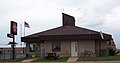 Terminal


See also
References
- ^ a b c d e FAA Airport Form 5010 for PCZ PDF, effective April 18, 2024.
- ^ a b Waupaca Municipal Airport at Wisconsin DOT Airport Directory
- ^ a b Waupaca Municipal Airport, official website
- ^ "NPIAS Report 2019-2023 Appendix A" (PDF). Federal Aviation Administration. October 3, 2018. Retrieved October 12, 2018.
- ^ Great Circle Mapper: KPCZ - Waupaca Municipal Airport - Waupaca, Wisconsin
External links
- FAA Terminal Procedures for PCZ, effective June 13, 2024
- Resources for this airport:
- FAA airport information for PCZ
- AirNav airport information for KPCZ
- FlightAware airport information and live flight tracker
- NOAA/NWS weather observations: current, past three days
- SkyVector aeronautical chart, Terminal Procedures
Civil aviation in Wisconsin | ||
|---|---|---|
| Primary airports | ||
| Airlines | ||
| Museums | ||
| Aviation related | ||
| People | ||

Recent Comments