
How Can We Help?
The Mole Gap Trail is a 10-kilometre (6.2 mi) official walking route alongside the River Mole, linking the Surrey towns of Dorking and Leatherhead.[1] The trail is marked on Ordnance Survey maps.[2] The trail runs through Norbury Park, the village of Westhumble and across Denbies Wine Estate.
Gallery
-
 The trail is marked with metal direction signs, designed to look hand-written
 -
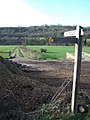 Footpath from Cowslip Farm to Norbury Park


See also
References
- ^ "Mole Gap Trail" (PDF). Diamonds in the Landscape. Natural England. 5 October 2011. Archived from the original (PDF) on 30 September 2011.
- ^ Kirby, James. "Mole Gap Trail". Long Distance Paths. Long Distance Walkers' Association. Retrieved 5 October 2011.
External links
51°15′55″N 0°20′12″W / 51.2652°N 0.3366°W

Recent Comments