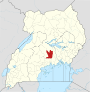
The Kampala–Bombo Expressway is a proposed four-lane, dual carriage highway in the Central Region of Uganda, connecting, Kampala , the capital city, and Bombo, in Luweero District.[1]
Location
The road starts at Wandegeya in the Kawempe Division of Kampala, Uganda's capital city. It continues north through Bwaise, Kawempe, and Matugga to end at Bombo, in Luweero District, a distance of approximately 32 kilometres (20 mi).[2] The approximate coordinates of the road, near the town of Matugga are 0°28'28.0"N, 32°31'06.0"E (Latitude:0.474440; Longitude:32.518338).[3]
Overview
The government of Uganda plans to widen the current bitumen-surfaced road to a four-lane dual carriage highway, as part of efforts to decongest Kampala.[4] It is planned to fund the road construction under a public-private partnership (PPP) arrangement.[1]
Construction costs
As at February 2016, the construction budget for the highway has not been developed, pending finalization of road design.[5][6]
See also
References
- ^ a b UNRA (12 February 2016). "Uganda Public Roads Projects: Kampala–Bombo Expressway". Kampala: Uganda National Roads Authority (UNRA). Retrieved 12 February 2016.
- ^ GFC (12 February 2016). "Distance between Wandegeya Market, Kampala, Central Region, Uganda and Bombo Police Station, Bombo, Central Region, Uganda". Globefeed.com (GFC). Retrieved 12 February 2016.
- ^ Google (12 February 2016). "Location of Kampala–Bombo Expressway" (Map). Google Maps. Google. Retrieved 12 February 2016.
- ^ Kasaija, Matia (11 June 2015). "2015/16 Budget speech". The Observer (Uganda). Kampala.
- ^ AIC (23 October 2013). "Ugandan government joins World Bank to build $1.5b road projects". Africainvestor.com (AIC). Retrieved 12 February 2016.
- ^ Musisi, Frederic (23 January 2016). "Work on Shs5 trillion Jinja Expressway to start in March". Daily Monitor. Kampala. Retrieved 12 February 2016.
External links
- Uganda National Road Authority Homepage
- Ugandan Government Increases Road Network Funding
- The government plans to build 4 Turnpikes
Capital: Luweero | ||
| Towns and villages | ||
| Economy | ||
| Education |
| |
| Notable landmarks | ||
| Health | ||
| Transport |
| |
| Notable people | ||
-
Annuals36
-
Bulbs, Corms & Tubers41
-
Ferns27
-
Fruits3
-
Garden Plants23
-
Grasses26
-
Herb17
-
Insects1
-
Mammals1
-
Midwest Native Plants0
-
Northeast Native Plants112
-
Perennials123
-
Rose1
-
Shrubs47
-
Trees112
-
Tropical Plants53
-
Upland Birds5
-
Vines18
-
Viola Tricolor1
-
Water Gardening & Plants9
-
Waterfowl0
-
Wetland Birds0
-
Wetland Plants4
-
Wildbirds172
-
Wildflowers1
-
Woodland Plants29


Recent Comments