
How Can We Help?

Size of this preview: 372 × 599 pixels. Other resolutions: 149 × 240 pixels | 298 × 480 pixels | 477 × 768 pixels | 636 × 1,024 pixels | 1,448 × 2,332 pixels.
Original file (1,448 × 2,332 pixels, file size: 1.38 MB, MIME type: image/jpeg)
Summary
| Description |
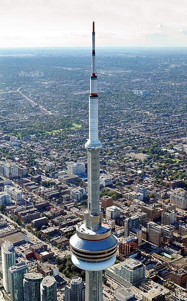
Deutsch: Toronto: Luftaufnahme des Turmkorbs, dem Sky Pod und der Antenne des CN Tower vom Hubschrauber aus. English: Toronto: Aerial view of main pod and antenna of the CN Tower from helicopter |
| Date | |
| Source | Own work |
| Author | Wladyslaw |
| Object location | | View this and other nearby images on: OpenStreetMap |
|---|
Licensing
Wladyslaw, the copyright holder of this work, hereby publishes it under the following licenses:
| Copyleft: This work of art is free; you can redistribute it and/or modify it according to terms of the Free Art License. You will find a specimen of this license on the Copyleft Attitude site as well as on other sites. |

|
Permission is granted to copy, distribute and/or modify this document under the terms of the GNU Free Documentation License, Version 1.2 or any later version published by the Free Software Foundation; with no Invariant Sections, no Front-Cover Texts, and no Back-Cover Texts. A copy of the license is included in the section entitled GNU Free Documentation License. |
| This file is licensed under the Creative Commons Attribution-Share Alike 3.0 Unported license. | ||
| Attribution: Wladyslaw | ||
| ||
| This licensing tag was added to this file as part of the GFDL licensing update. |
You may select the license of your choice.
Original upload log
The original description page was here. All following user names refer to de.wikipedia.
- 2008-09-27 20:14 Taxiarchos228 1308×2292× (1249561 bytes) {{Information |Beschreibung = Toronto: Antennespitze des CN Tower vom Hubschrauber |Quelle = selbst fotografiert |Urheber = ~~~ |Datum = 10. September 2008 |Genehmigung = |Andere Versionen = |Anmerkungen = }}
This image has been assessed using the Quality image guidelines and is considered a Quality image.
|

|
This image has been assessed under the valued image criteria and is considered the most valued image on Commons within the scope: Baskets of CN Tower. You can see its nomination here. |
File history
Click on a date/time to view the file as it appeared at that time.
| Date/Time | Thumbnail | Dimensions | User | Comment | |
|---|---|---|---|---|---|
| current | 20:50, 6 July 2011 | | 1,448 × 2,332 (1.38 MB) | Taxiarchos228 | new version, better light balancing |
| 13:23, 30 May 2009 |  | 1,308 × 2,292 (1.19 MB) | GeorgHH | {{Information |Description={{de|Toronto: Luftaufnahme der Turmkörbe und Antennenspitze des CN Tower vom Hubschrauber aus. }} |Source=Transferred from [http://de.wikipedia.org de.wikipedia]<br/> (Original text : ''selbst fotografiert'') |Date=10. Septembe |
File usage
The following pages on the English Wikipedia use this file (pages on other projects are not listed):
Global file usage
The following other wikis use this file:
- Usage on de.wikipedia.org
- Usage on id.wikipedia.org
- Usage on mr.wikipedia.org

Recent Comments