
How Can We Help?
No higher resolution available.
The_Holme,_Regent's_Park_-_geograph.org.uk_-_1161575.jpg (640 × 480 pixels, file size: 144 KB, MIME type: image/jpeg)
Summary
| Description |
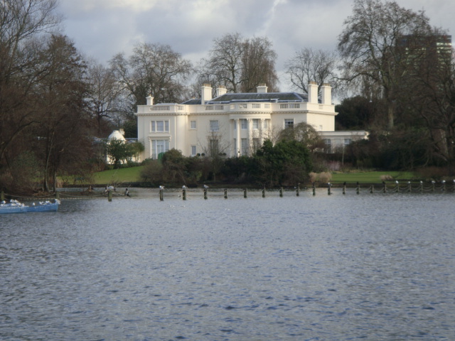
English: The Holme, Regent's Park. It is hard to imagine that this beautiful villa is right in the centre of London. The Holme is one of two villas remaining from the early 19th century when Regent's Park was laid out by the architect John Nash. Seen here, across the boating lake, it could be easily mistaken for a country house. |
| Date | |
| Source | From geograph.org.uk |
| Author | Sheila Madhvani |
| Attribution (required by the license) | Sheila Madhvani / The Holme, Regent's Park / |
| Camera location | | View this and other nearby images on: OpenStreetMap |
|---|
| Object location | | View this and other nearby images on: OpenStreetMap |
|---|
Licensing

|
This image was taken from the Geograph project collection. See this photograph's page on the Geograph website for the photographer's contact details. The copyright on this image is owned by Sheila Madhvani and is licensed for reuse under the Creative Commons Attribution-ShareAlike 2.0 license.
|
This file is licensed under the Creative Commons Attribution-Share Alike 2.0 Generic license.
Attribution: Sheila Madhvani
- You are free:
- to share – to copy, distribute and transmit the work
- to remix – to adapt the work
- Under the following conditions:
- attribution – You must give appropriate credit, provide a link to the license, and indicate if changes were made. You may do so in any reasonable manner, but not in any way that suggests the licensor endorses you or your use.
- share alike – If you remix, transform, or build upon the material, you must distribute your contributions under the same or compatible license as the original.
File history
Click on a date/time to view the file as it appeared at that time.
| Date/Time | Thumbnail | Dimensions | User | Comment | |
|---|---|---|---|---|---|
| current | 15:13, 25 February 2011 | | 640 × 480 (144 KB) | GeographBot | == {{int:filedesc}} == {{Information |description={{en|1=The Holme, Regent's Park It is hard to imagine that this beautiful villa is right in the centre of London. The Holme is one of two villas remaining from the early 19th century when Regent's Park was |
File usage
The following pages on the English Wikipedia use this file (pages on other projects are not listed):
Global file usage
The following other wikis use this file:

_heading:67.00&language=en)
_heading:67.00&language=en)
Recent Comments