How Can We Help?
You are here:
< Back
Size of this preview: 799 × 290 pixels. Other resolutions: 320 × 116 pixels | 640 × 232 pixels | 1,024 × 372 pixels | 1,280 × 465 pixels | 4,433 × 1,609 pixels.
Original file (4,433 × 1,609 pixels, file size: 3.42 MB, MIME type: image/jpeg)
Summary
DescriptionTesuque Creek.jpg |
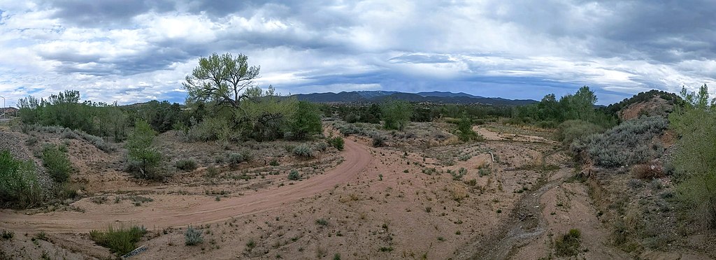
English: A tributary of the Rio Tesuque, possibly Tesuque Creek, from US highway 84/285 looking east between Tesuque Pueblo and the town of Tesuque, New Mexico |
Date | |
Source | Own work |
Author | Dicklyon |
Camera location | 35° 46′ 47.46″ N, 105° 56′ 51.32″ W | View this and other nearby images on: OpenStreetMap | 35.779850; -105.947589 |
---|
Licensing
I, the copyright holder of this work, hereby publish it under the following license:
This file is licensed under the Creative Commons Attribution-Share Alike 4.0 International license.
- You are free:
- to share – to copy, distribute and transmit the work
- to remix – to adapt the work
- Under the following conditions:
- attribution – You must give appropriate credit, provide a link to the license, and indicate if changes were made. You may do so in any reasonable manner, but not in any way that suggests the licensor endorses you or your use.
- share alike – If you remix, transform, or build upon the material, you must distribute your contributions under the same or compatible license as the original.
Items portrayed in this file
depicts
Tesuque Creek
creator
some value
object has role: photographer
author name string: Dicklyon
Wikimedia username: Dicklyon
copyright status
copyrighted
copyright license
Creative Commons Attribution-ShareAlike 4.0 International
inception
21 May 2021
coordinates of the point of view
35°46'47.46"N, 105°56'51.32"W
captured with
Pixel 3
source of file
original creation by uploader
media type
image/jpeg
File history
Click on a date/time to view the file as it appeared at that time.
Date/Time | Thumbnail | Dimensions | User | Comment | |
---|---|---|---|---|---|
current | 05:03, 2 June 2021 | 4,433 × 1,609 (3.42 MB) | Dicklyon | Uploaded own work with UploadWizard |
File usage
The following pages on the English Wikipedia use this file (pages on other projects are not listed):
Global file usage
The following other wikis use this file:
- Usage on ceb.wikipedia.org
- Usage on www.wikidata.org
Metadata
This file contains additional information, probably added from the digital camera or scanner used to create or digitize it.
If the file has been modified from its original state, some details may not fully reflect the modified file.
Camera manufacturer | |
---|---|
Camera model | Pixel 3 |
Date and time of data generation | 13:06, 21 May 2021 |
Latitude | 35° 46′ 47.46″ N |
Longitude | 105° 56′ 51.32″ W |
Altitude | 1,979.34 meters above sea level |
Width | 5,576 px |
Height | 1,609 px |
Orientation | Normal |
Software used | Picasa |
File change date and time | 13:06, 21 May 2021 |
Subsampling ratio of Y to C |
|
Exif version | 2.2 |
Date and time of digitizing | 13:06, 21 May 2021 |
Light source | Unknown |
DateTime subseconds | 080 |
DateTimeOriginal subseconds | 080 |
DateTimeDigitized subseconds | 080 |
Color space | sRGB |
Unique image ID | e5989b02aed327d30000000000000000 |
GPS time (atomic clock) | 19:06 |
GPS date | 21 May 2021 |
GPS tag version | 2.2.0.0 |
Panorama left crop | 1,571 |
Panorama top crop | 1,616 |
Panorama cropped width | 4,433 |
Panorama cropped height | 1,609 |
Panorama full width | 7,462 |
Panorama full height | 4,693 |
Initial view heading (degrees) | 182 |
Initial view roll (degrees) | 0 |
Projection type | Equirectangular |
Categories
-
Annuals36
-
Bulbs, Corms & Tubers41
-
Ferns27
-
Fruits3
-
Garden Plants23
-
Grasses26
-
Herb17
-
Insects1
-
Mammals1
-
Midwest Native Plants0
-
Northeast Native Plants112
-
Perennials123
-
Rose1
-
Shrubs47
-
Trees112
-
Tropical Plants53
-
Upland Birds5
-
Vines18
-
Viola Tricolor1
-
Water Gardening & Plants9
-
Waterfowl0
-
Wetland Birds0
-
Wetland Plants4
-
Wildbirds172
-
Wildflowers1
-
Woodland Plants29
Table of Contents
Recent Comments