How Can We Help?
You are here:
< Back
![File:Skytten 2, Södertälje, 2017.jpg](https://upload.wikimedia.org/wikipedia/commons/thumb/7/70/Skytten_2%2C_S%C3%B6dert%C3%A4lje%2C_2017.jpg/800px-Skytten_2%2C_S%C3%B6dert%C3%A4lje%2C_2017.jpg)
Size of this preview: 800 × 555 pixels. Other resolutions: 320 × 222 pixels | 640 × 444 pixels | 1,024 × 710 pixels | 1,280 × 888 pixels | 2,560 × 1,775 pixels | 4,615 × 3,200 pixels.
Original file (4,615 × 3,200 pixels, file size: 3.28 MB, MIME type: image/jpeg)
Summary
DescriptionSkytten 2, Södertälje, 2017.jpg |
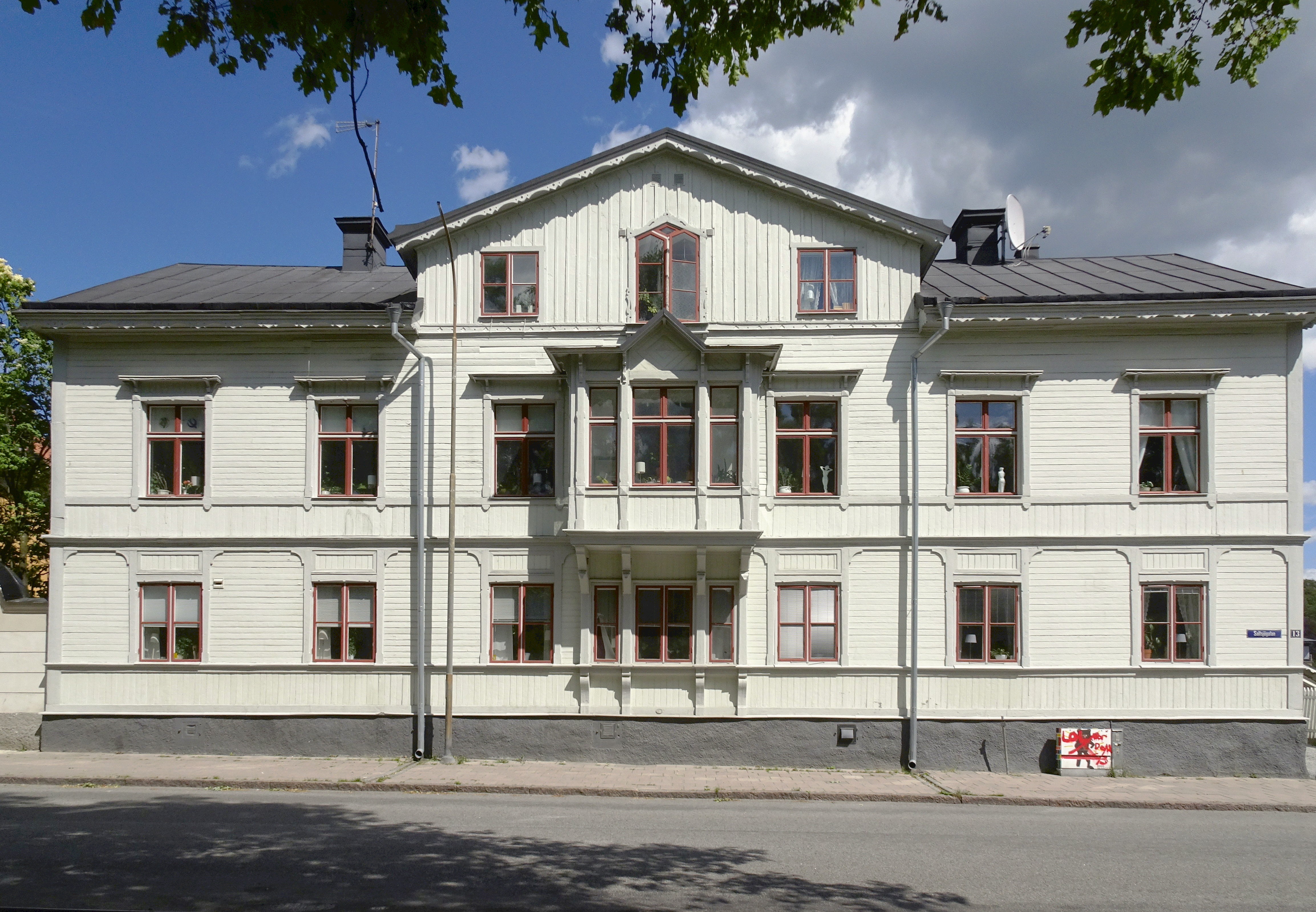
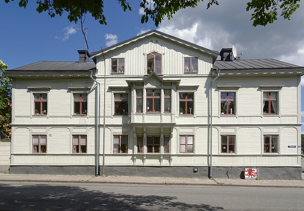
Svenska: Kvarteret Skytten 2, Saltsjögatan 13. Troligen en av Södertäljes äldsta flerfamiljshus i trä. Byggnaden är uppförd 1854 i tidstypisk panelarkitektur. Enligt kommunen har byggnaden, med uthus och trädgård, ett stort arkitektoniskt och miljöskapande värde. |
Date | |
Source | Own work |
Author | Holger.Ellgaard |
Camera location | 59° 11′ 33.03″ N, 17° 37′ 43.02″ E ![]() | View this and other nearby images on: OpenStreetMap | ![]() |
---|
Licensing
I, the copyright holder of this work, hereby publish it under the following license:
![w:en:Creative Commons](https://upload.wikimedia.org/wikipedia/commons/thumb/7/79/CC_some_rights_reserved.svg/90px-CC_some_rights_reserved.svg.png)
![attribution](https://upload.wikimedia.org/wikipedia/commons/thumb/1/11/Cc-by_new_white.svg/24px-Cc-by_new_white.svg.png)
![share alike](https://upload.wikimedia.org/wikipedia/commons/thumb/d/df/Cc-sa_white.svg/24px-Cc-sa_white.svg.png)
This file is licensed under the Creative Commons Attribution-Share Alike 4.0 International license.
- You are free:
- to share – to copy, distribute and transmit the work
- to remix – to adapt the work
- Under the following conditions:
- attribution – You must give appropriate credit, provide a link to the license, and indicate if changes were made. You may do so in any reasonable manner, but not in any way that suggests the licensor endorses you or your use.
- share alike – If you remix, transform, or build upon the material, you must distribute your contributions under the same or compatible license as the original.
Captions
Add a one-line explanation of what this file represents
Items portrayed in this file
depicts
copyright status
copyrighted
copyright license
Creative Commons Attribution-ShareAlike 4.0 International
inception
2 July 2017
coordinates of the point of view
59°11'33.029"N, 17°37'43.018"E
captured with
Sony Cyber-shot DSC-HX90V
source of file
original creation by uploader
exposure time
0.000625 second
f-number
3.5
focal length
4.1 millimetre
ISO speed
80
instance of
photograph
media type
image/jpeg
File history
Click on a date/time to view the file as it appeared at that time.
Date/Time | Thumbnail | Dimensions | User | Comment | |
---|---|---|---|---|---|
current | 14:38, 3 July 2017 | ![]() | 4,615 × 3,200 (3.28 MB) | Holger.Ellgaard | User created page with UploadWizard |
File usage
The following pages on the English Wikipedia use this file (pages on other projects are not listed):
Global file usage
The following other wikis use this file:
- Usage on el.wikipedia.org
- Usage on sv.wikipedia.org
Metadata
This file contains additional information, probably added from the digital camera or scanner used to create or digitize it.
If the file has been modified from its original state, some details may not fully reflect the modified file.
Camera manufacturer | SONY |
---|---|
Camera model | DSC-HX90V |
Exposure time | 1/1,600 sec (0.000625) |
F-number | f/3.5 |
ISO speed rating | 80 |
Date and time of data generation | 13:01, 2 July 2017 |
Lens focal length | 4.1 mm |
Latitude | 59° 11′ 33.03″ N |
Longitude | 17° 37′ 43.02″ E |
Altitude | 21.3 meters below sea level |
Orientation | Normal |
Horizontal resolution | 350 dpi |
Vertical resolution | 350 dpi |
Software used | ArcSoft PhotoStudio |
File change date and time | 16:36, 3 July 2017 |
Y and C positioning | Co-sited |
Exposure Program | Normal program |
Exif version | 2.2 |
Date and time of digitizing | 13:01, 2 July 2017 |
Meaning of each component |
|
Image compression mode | 3 |
APEX brightness | 10.4703125 |
Exposure bias | 0 |
Maximum land aperture | 3.6171875 APEX (f/3.5) |
Metering mode | Pattern |
Light source | Unknown |
Flash | Flash did not fire, compulsory flash suppression |
Supported Flashpix version | 1 |
Color space | sRGB |
File source | Digital still camera |
Scene type | A directly photographed image |
Custom image processing | Normal process |
Exposure mode | Auto exposure |
White balance | Auto white balance |
Digital zoom ratio | 1 |
Focal length in 35 mm film | 24 mm |
Scene capture type | Standard |
Contrast | Normal |
Saturation | Normal |
Sharpness | Normal |
GPS time (atomic clock) | 12:01 |
Receiver status | Measurement in progress |
Measurement mode | 3-dimensional measurement |
Measurement precision | Poor (2.4) |
Speed unit | Kilometers per hour |
Speed of GPS receiver | 1.16 |
Reference for direction of movement | True direction |
Direction of movement | 350.44 |
Geodetic survey data used | WGS-84 |
GPS date | 2 July 2017 |
Categories
-
Annuals36
-
Bulbs, Corms & Tubers41
-
Ferns27
-
Fruits3
-
Garden Plants23
-
Grasses26
-
Herb17
-
Insects1
-
Mammals1
-
Midwest Native Plants0
-
Northeast Native Plants112
-
Perennials123
-
Rose1
-
Shrubs47
-
Trees112
-
Tropical Plants53
-
Upland Birds5
-
Vines18
-
Viola Tricolor1
-
Water Gardening & Plants9
-
Waterfowl0
-
Wetland Birds0
-
Wetland Plants4
-
Wildbirds172
-
Wildflowers1
-
Woodland Plants29
Table of Contents
Recent Comments