
How Can We Help?
Size of this preview: 640 × 599 pixels. Other resolutions: 256 × 240 pixels | 900 × 843 pixels.
Original file (900 × 843 pixels, file size: 299 KB, MIME type: image/png)
Summary
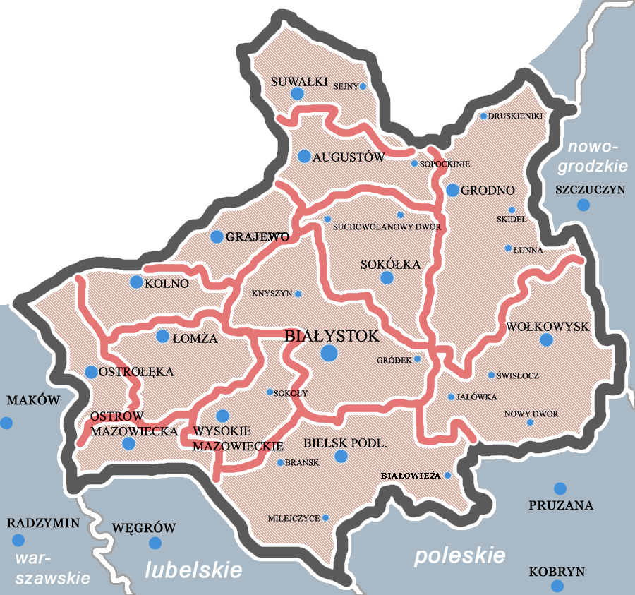
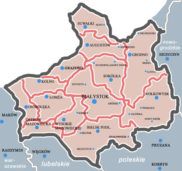
| Description | Podział administracyjny województwa białostockiego, rok 1937. |
| Date | |
| Source | Own work |
| Author | Graffer |
Licensing
| This work has been released into the public domain by its author, I, Graffer. This applies worldwide. In some countries this may not be legally possible; if so: I, Graffer grants anyone the right to use this work for any purpose, without any conditions, unless such conditions are required by law. |
File history
Click on a date/time to view the file as it appeared at that time.
| Date/Time | Thumbnail | Dimensions | User | Comment | |
|---|---|---|---|---|---|
| current | 18:14, 22 February 2017 | | 900 × 843 (299 KB) | Poeticbent | bad colors and bad names, missing parts to conform with the rest of the series, Szczuczyn is somewhere else, this is Grajewo |
| 09:42, 8 June 2011 |  | 900 × 843 (274 KB) | Irdyb | ort. | |
| 23:57, 25 July 2007 |  | 900 × 843 (242 KB) | Graffer~commonswiki | {{Information |Description= Podział administracyjny województwa białostockiego, rok 1937. |Source=self-made |Date= |Author= Graffer }} Category:Locator maps of voivodeships of Poland 1921-1939 |
File usage
The following pages on the English Wikipedia use this file (pages on other projects are not listed):
Global file usage
The following other wikis use this file:
- Usage on be-tarask.wikipedia.org
- Usage on be.wikipedia.org
- Usage on el.wikipedia.org
- Usage on lt.wikipedia.org
- Usage on lt.wikibooks.org
- Usage on pl.wikipedia.org
- Usage on ru.wikipedia.org
- Usage on uk.wikipedia.org
- Usage on vi.wikipedia.org
- Usage on www.wikidata.org

Recent Comments