Original file (3,024 × 4,032 pixels, file size: 5.29 MB, MIME type: image/jpeg)
Summary
DescriptionPalace Kilwa Kisiwani.jpg |
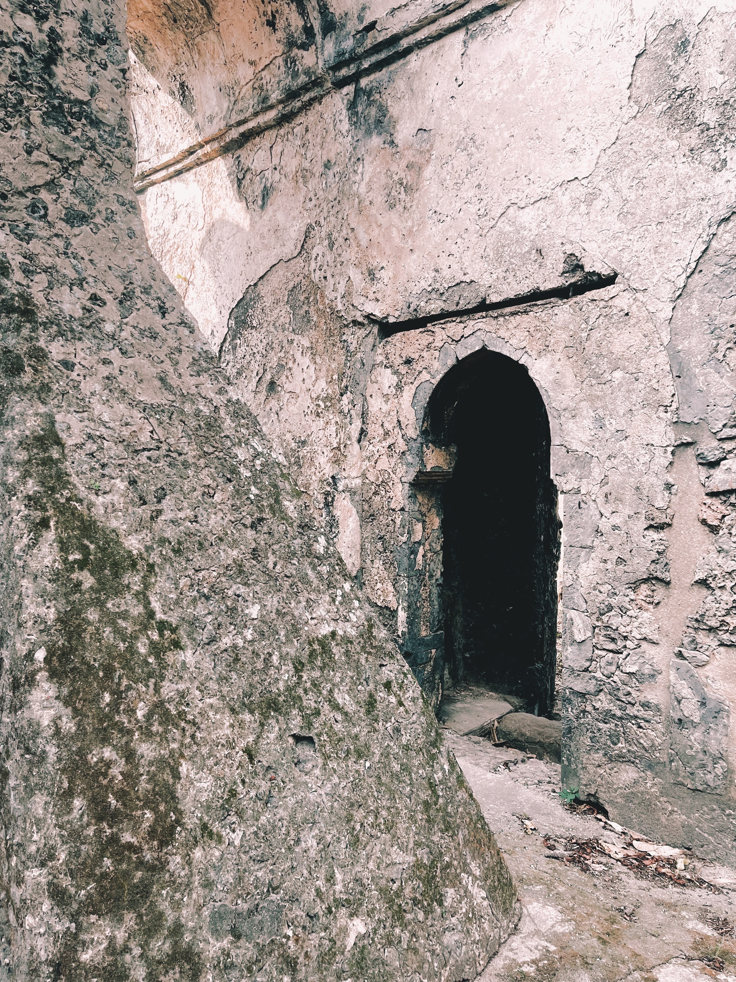
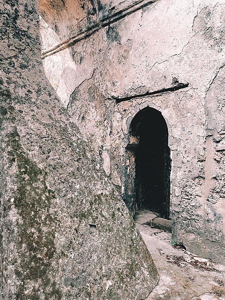
English: Palace in Kilwa Kisiwani in Kilwa Masoko Ward, Kilwa District, Lindi Region, UNESCO WHS |
Date | |
Source | Own work |
Author | Halidtz |
Camera location | 8° 57′ 33.18″ S, 39° 29′ 54.16″ E | View this and other nearby images on: OpenStreetMap | -8.959217; 39.498378 |
---|
Licensing
- You are free:
- to share – to copy, distribute and transmit the work
- to remix – to adapt the work
- Under the following conditions:
- attribution – You must give appropriate credit, provide a link to the license, and indicate if changes were made. You may do so in any reasonable manner, but not in any way that suggests the licensor endorses you or your use.
- share alike – If you remix, transform, or build upon the material, you must distribute your contributions under the same or compatible license as the original.
This image was uploaded as part of Wiki Loves Earth 2022.
aragonés ∙ asturianu ∙ azərbaycanca ∙ Bahasa Indonesia ∙ Bahasa Melayu ∙ brezhoneg ∙ català ∙ čeština ∙ Cymraeg ∙ dagbanli ∙ Deutsch ∙ eesti ∙ English ∙ español ∙ euskara ∙ français ∙ galego ∙ hrvatski ∙ italiano ∙ latviešu ∙ Nederlands ∙ norsk ∙ norsk bokmål ∙ português ∙ polski ∙ português do Brasil ∙ română ∙ shqip ∙ sicilianu ∙ slovenščina ∙ svenska ∙ Tagalog ∙ Türkçe ∙ Ελληνικά ∙ беларуская (тарашкевіца) ∙ български ∙ македонски ∙ русский ∙ српски / srpski ∙ українська ∙ ქართული ∙ հայերեն ∙ नेपाली ∙ मराठी ∙ বাংলা ∙ മലയാളം ∙ ไทย ∙ 한국어 ∙ 日本語 ∙ 中文 ∙ 中文(台灣) ∙ 中文(简体) ∙ 中文(繁體) ∙ עברית ∙ اردو ∙ العربية ∙ فارسی ∙ |
Items portrayed in this file
depicts
creator
some value
copyright status
copyrighted
copyright license
Creative Commons Attribution-ShareAlike 4.0 International
source of file
original creation by uploader
inception
8 July 2021
coordinates of the point of view
8°57'33.181"S, 39°29'54.161"E
participant in
Wiki Loves Earth 2022
File history
Click on a date/time to view the file as it appeared at that time.
Date/Time | Thumbnail | Dimensions | User | Comment | |
---|---|---|---|---|---|
current | 07:54, 2 July 2022 | 3,024 × 4,032 (5.29 MB) | Mnazini | Uploaded own work with UploadWizard |
File usage
Global file usage
The following other wikis use this file:
- Usage on fr.wikipedia.org
Metadata
This file contains additional information, probably added from the digital camera or scanner used to create or digitize it.
If the file has been modified from its original state, some details may not fully reflect the modified file.
Image title | Created with RNI Films app. Preset 'Fuji Natura 1600 +' |
---|---|
Camera manufacturer | Apple |
Camera model | iPhone 12 Pro Max |
Exposure time | 1/315 sec (0.0031746031746032) |
F-number | f/1.6 |
ISO speed rating | 32 |
Date and time of data generation | 16:11, 8 July 2021 |
Lens focal length | 5.1 mm |
Latitude | 8° 57′ 33.18″ S |
Longitude | 39° 29′ 54.16″ E |
Altitude | 10.668 meters above sea level |
Horizontal resolution | 72 dpi |
Vertical resolution | 72 dpi |
Software used | 14.6 |
File change date and time | 15:14, 11 July 2021 |
Exposure Program | Normal program |
Exif version | 2.32 |
Date and time of digitizing | 16:11, 8 July 2021 |
Meaning of each component |
|
Shutter speed | 8.3008464027882 |
APEX aperture | 1.3561438092556 |
APEX brightness | 6.3083432304038 |
Exposure bias | 0 |
Metering mode | Pattern |
Flash | Flash did not fire, compulsory flash suppression |
DateTimeOriginal subseconds | 946 |
DateTimeDigitized subseconds | 946 |
Supported Flashpix version | 1 |
Color space | sRGB |
Sensing method | One-chip color area sensor |
Scene type | A directly photographed image |
Exposure mode | Auto exposure |
White balance | Auto white balance |
Focal length in 35 mm film | 26 mm |
Scene capture type | Standard |
Unique image ID | ed4923790bbf0d040000000000000000 |
Speed unit | Kilometers per hour |
Speed of GPS receiver | 0.11463809450397 |
Reference for direction of image | Magnetic direction |
Direction of image | 55.966087325138 |
Reference for bearing of destination | Magnetic direction |
Bearing of destination | 55.966087325138 |
GPS tag version | 2.2.0.0 |
IIM version | 2 |
-
Annuals36
-
Bulbs, Corms & Tubers41
-
Ferns27
-
Fruits3
-
Garden Plants23
-
Grasses26
-
Herb17
-
Insects1
-
Mammals1
-
Midwest Native Plants0
-
Northeast Native Plants112
-
Perennials123
-
Rose1
-
Shrubs47
-
Trees112
-
Tropical Plants53
-
Upland Birds5
-
Vines18
-
Viola Tricolor1
-
Water Gardening & Plants9
-
Waterfowl0
-
Wetland Birds0
-
Wetland Plants4
-
Wildbirds172
-
Wildflowers1
-
Woodland Plants29
Recent Comments