How Can We Help?
You are here:
< Back
Size of this preview: 800 × 532 pixels. Other resolutions: 320 × 213 pixels | 640 × 425 pixels | 1,024 × 680 pixels | 1,280 × 851 pixels | 2,560 × 1,701 pixels | 4,912 × 3,264 pixels.
Original file (4,912 × 3,264 pixels, file size: 8.05 MB, MIME type: image/jpeg)
Summary
DescriptionOranda Zaka Nagasaki Japan04s5.jpg |
Camera: Sony SLT-A55 Lens: Sony SAL1680Z (Carl Zeiss) |
Date | |
Source | Own work |
Author | 663highland |
Permission (Reusing this file) |
GFDL+creative commons2.5 |
Camera location | 32° 44′ 16.93″ N, 129° 52′ 24.38″ E | View this and other nearby images on: OpenStreetMap | 32.738035; 129.873438 |
---|
Licensing
I, the copyright holder of this work, hereby publish it under the following licenses:
Permission is granted to copy, distribute and/or modify this document under the terms of the GNU Free Documentation License, Version 1.2 or any later version published by the Free Software Foundation; with no Invariant Sections, no Front-Cover Texts, and no Back-Cover Texts. A copy of the license is included in the section entitled GNU Free Documentation License.http://www.gnu.org/copyleft/fdl.htmlGFDLGNU Free Documentation Licensetruetrue |
This file is licensed under the Creative Commons Attribution-Share Alike 3.0 Unported license. | ||
| ||
This licensing tag was added to this file as part of the GFDL licensing update.http://creativecommons.org/licenses/by-sa/3.0/CC BY-SA 3.0Creative Commons Attribution-Share Alike 3.0truetrue |
This file is licensed under the Creative Commons Attribution 2.5 Generic license.
- You are free:
- to share – to copy, distribute and transmit the work
- to remix – to adapt the work
- Under the following conditions:
- attribution – You must give appropriate credit, provide a link to the license, and indicate if changes were made. You may do so in any reasonable manner, but not in any way that suggests the licensor endorses you or your use.
You may select the license of your choice.
Items portrayed in this file
depicts
copyright status
copyrighted
copyright license
Creative Commons Attribution 2.5 Generic
Creative Commons Attribution-ShareAlike 3.0 Unported
GNU Free Documentation License, version 1.2 or later
inception
23 December 2011
source of file
original creation by uploader
coordinates of the point of view
32°44'16.926"N, 129°52'24.377"E
File history
Click on a date/time to view the file as it appeared at that time.
Date/Time | Thumbnail | Dimensions | User | Comment | |
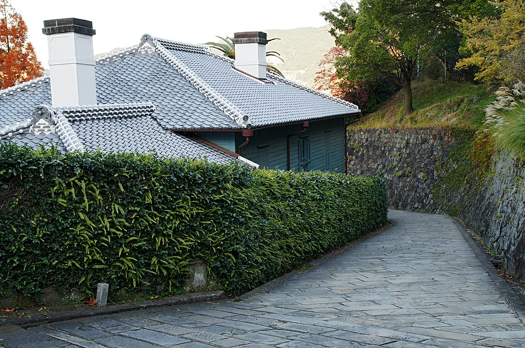
---|---|---|---|---|---|
current | 23:50, 24 December 2011 | 4,912 × 3,264 (8.05 MB) | 663highland | {{Information |Source={{own}} |Description={{en|'''Oranda Zaka''' (The Dutch slope), Higashiyamate, Nagasaki, Nagasaki prefecture, Japan}} {{ja|'''オランダ坂''', 長崎県長崎市東山手}} |Author=[[:ja: |
File usage
The following pages on the English Wikipedia use this file (pages on other projects are not listed):
Global file usage
The following other wikis use this file:
- Usage on ja.wikipedia.org
- Usage on zh.wikipedia.org
Metadata
This file contains additional information, probably added from the digital camera or scanner used to create or digitize it.
If the file has been modified from its original state, some details may not fully reflect the modified file.
Image title |
|
---|---|
Camera manufacturer | SONY |
Camera model | SLT-A55V |
Exposure time | 1/50 sec (0.02) |
F-number | f/8 |
ISO speed rating | 640 |
Date and time of data generation | 08:17, 23 December 2011 |
Lens focal length | 30 mm |
Latitude | 32° 44′ 16.93″ N |
Longitude | 129° 52′ 24.38″ E |
Altitude | 13.7 meters above sea level |
Orientation | Normal |
Horizontal resolution | 350 dpi |
Vertical resolution | 350 dpi |
Software used | Adobe Photoshop CS2 Windows |
File change date and time | 08:16, 25 December 2011 |
Y and C positioning | Co-sited |
Exposure Program | Aperture priority |
Exif version | 2.3 |
Date and time of digitizing | 08:17, 23 December 2011 |
Meaning of each component |
|
Image compression mode | 4 |
APEX brightness | 4.25 |
Exposure bias | −0.3 |
Maximum land aperture | 4 APEX (f/4) |
Metering mode | Pattern |
Light source | Unknown |
Flash | Flash did not fire, compulsory flash suppression |
Supported Flashpix version | 1 |
Color space | sRGB |
File source | Digital still camera |
Scene type | A directly photographed image |
Custom image processing | Normal process |
Exposure mode | Auto exposure |
White balance | Auto white balance |
Focal length in 35 mm film | 45 mm |
Scene capture type | Standard |
Contrast | Normal |
Saturation | Normal |
Sharpness | Normal |
GPS time (atomic clock) | 23:17 |
Receiver status | Measurement in progress |
Measurement mode | 3-dimensional measurement |
Speed unit | Kilometers per hour |
Speed of GPS receiver | 0.1 |
Reference for direction of movement | True direction |
Direction of movement | 198.67 |
Geodetic survey data used | WGS-84 |
GPS date | 22 December 2011 |
GPS differential correction | 0 |
GPS tag version | 0.0.3.2 |
Supported Flashpix version | 1 |
Image width | 4,912 px |
Image height | 3,264 px |
Date metadata was last modified | 17:16, 25 December 2011 |
IIM version | 2 |
Categories
-
Annuals36
-
Bulbs, Corms & Tubers41
-
Ferns27
-
Fruits3
-
Garden Plants23
-
Grasses26
-
Herb17
-
Insects1
-
Mammals1
-
Midwest Native Plants0
-
Northeast Native Plants112
-
Perennials123
-
Rose1
-
Shrubs47
-
Trees112
-
Tropical Plants53
-
Upland Birds5
-
Vines18
-
Viola Tricolor1
-
Water Gardening & Plants9
-
Waterfowl0
-
Wetland Birds0
-
Wetland Plants4
-
Wildbirds172
-
Wildflowers1
-
Woodland Plants29
Table of Contents
Recent Comments