
How Can We Help?
Size of this preview: 800 × 591 pixels. Other resolutions: 320 × 236 pixels | 640 × 473 pixels | 999 × 738 pixels.
Original file (999 × 738 pixels, file size: 1.46 MB, MIME type: image/png)
Summary
| Description |
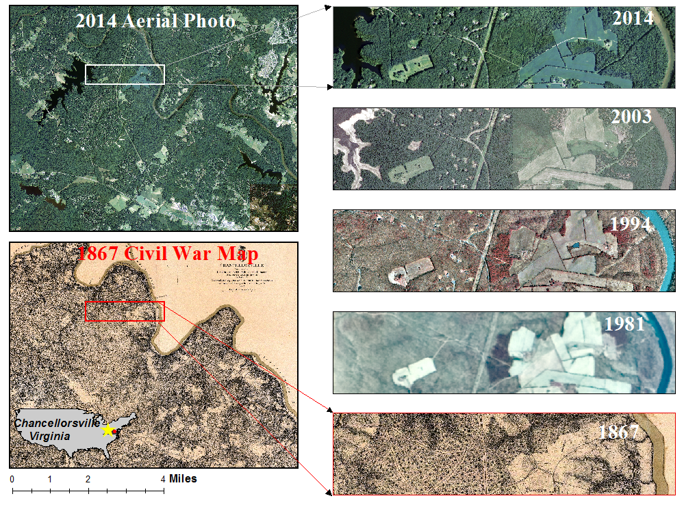
English: An 1867 old hachure paper US civil war map vs. modern aerial photos over Chancellorsville, Virginia. |
| Date | |
| Source | Own work |
| Author | Bnurs |
Licensing
I, the copyright holder of this work, hereby publish it under the following license:
This file is licensed under the Creative Commons Attribution-Share Alike 4.0 International license.
- You are free:
- to share – to copy, distribute and transmit the work
- to remix – to adapt the work
- Under the following conditions:
- attribution – You must give appropriate credit, provide a link to the license, and indicate if changes were made. You may do so in any reasonable manner, but not in any way that suggests the licensor endorses you or your use.
- share alike – If you remix, transform, or build upon the material, you must distribute your contributions under the same or compatible license as the original.
File history
Click on a date/time to view the file as it appeared at that time.
| Date/Time | Thumbnail | Dimensions | User | Comment | |
|---|---|---|---|---|---|
| current | 03:40, 24 June 2023 | | 999 × 738 (1.46 MB) | Bnurs | Uploaded own work with UploadWizard |
File usage
The following pages on the English Wikipedia use this file (pages on other projects are not listed):

Recent Comments