
How Can We Help?

Size of this preview: 800 × 600 pixels. Other resolutions: 320 × 240 pixels | 640 × 480 pixels | 1,024 × 768 pixels | 1,280 × 960 pixels | 2,272 × 1,704 pixels.
Original file (2,272 × 1,704 pixels, file size: 778 KB, MIME type: image/jpeg)
Summary
| Description |
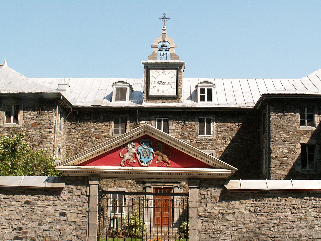
Français : Le Vieux Séminaire de Saint-Sulpice, au 116 Notre-Dame Ouest, à Montréal. Construit en 1684 sur des plans de François Dollier de Casson.
English: The Old Saint-Sulpice Seminary, at 116 Notre-Dame West, in Montreal. Built in 1684 based on plans by François Dollier de Casson.
Deutsch: Montréal, Québec, Kanada. Foto selbst gemacht. |
| Date | |
| Source | Own work |
| Author | Dickbauch |
This photo is of a cultural heritage site in Canada, number 17381
|
| Object location | | View this and other nearby images on: OpenStreetMap |
|---|
Licensing

|
Permission is granted to copy, distribute and/or modify this document under the terms of the GNU Free Documentation License, Version 1.2 or any later version published by the Free Software Foundation; with no Invariant Sections, no Front-Cover Texts, and no Back-Cover Texts. A copy of the license is included in the section entitled GNU Free Documentation License. |
| This file is licensed under the Creative Commons Attribution-Share Alike 3.0 Unported license. | ||
| ||
| This licensing tag was added to this file as part of the GFDL licensing update. |
File history
Click on a date/time to view the file as it appeared at that time.
| Date/Time | Thumbnail | Dimensions | User | Comment | |
|---|---|---|---|---|---|
| current | 18:54, 23 August 2005 | | 2,272 × 1,704 (778 KB) | Dickbauch~commonswiki | Montréal, Québec, Kanada. Foto selbst gemacht. {{GFDL}} Category:Québec |
File usage
The following pages on the English Wikipedia use this file (pages on other projects are not listed):
Global file usage
The following other wikis use this file:
- Usage on bg.wikipedia.org
- Usage on de.wikipedia.org
- Usage on fr.wikipedia.org
- Usage on hy.wikipedia.org
- Usage on pl.wikipedia.org
- Usage on zh.wikipedia.org

Recent Comments