Original file (5,648 × 3,530 pixels, file size: 9.3 MB, MIME type: image/jpeg)
Summary
DescriptionMercedes 300 SL Cabrio.jpg |
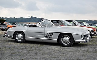
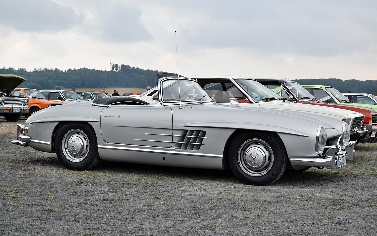
Deutsch: Mercedes 300 SL Roadster auf dem 5. "Werk II Old- und Youngtimertreffen" (2016) in Dreihausen |
Date | |
Source | Own work |
Author | Hydro |
Camera location | 50° 43′ 43.87″ N, 8° 51′ 49.58″ E | View this and other nearby images on: OpenStreetMap | 50.728853; 8.863772 |
---|
Licensing
- You are free:
- to share – to copy, distribute and transmit the work
- to remix – to adapt the work
- Under the following conditions:
- attribution – You must give appropriate credit, provide a link to the license, and indicate if changes were made. You may do so in any reasonable manner, but not in any way that suggests the licensor endorses you or your use.
- share alike – If you remix, transform, or build upon the material, you must distribute your contributions under the same or compatible license as the original.
This image has been assessed using the Quality image guidelines and is considered a Quality image.
العربية ∙ جازايرية ∙ беларуская ∙ беларуская (тарашкевіца) ∙ български ∙ বাংলা ∙ català ∙ čeština ∙ Cymraeg ∙ Deutsch ∙ Schweizer Hochdeutsch ∙ Zazaki ∙ Ελληνικά ∙ English ∙ Esperanto ∙ español ∙ eesti ∙ euskara ∙ فارسی ∙ suomi ∙ français ∙ galego ∙ עברית ∙ हिन्दी ∙ hrvatski ∙ magyar ∙ հայերեն ∙ Bahasa Indonesia ∙ italiano ∙ 日本語 ∙ Jawa ∙ ქართული ∙ 한국어 ∙ kurdî ∙ Lëtzebuergesch ∙ lietuvių ∙ македонски ∙ മലയാളം ∙ मराठी ∙ Bahasa Melayu ∙ Nederlands ∙ Norfuk / Pitkern ∙ polski ∙ português ∙ português do Brasil ∙ rumantsch ∙ română ∙ русский ∙ sicilianu ∙ slovenčina ∙ slovenščina ∙ shqip ∙ српски / srpski ∙ svenska ∙ தமிழ் ∙ తెలుగు ∙ ไทย ∙ Tagalog ∙ Türkçe ∙ toki pona ∙ українська ∙ vèneto ∙ Tiếng Việt ∙ 中文 ∙ 中文(简体) ∙ 中文(繁體) ∙ |
Items portrayed in this file
depicts
Mercedes-Benz 300 SL
creator
some value
copyright status
copyrighted
copyright license
Creative Commons Attribution-ShareAlike 4.0 International
Commons quality assessment
Wikimedia Commons quality image
source of file
original creation by uploader
inception
14 August 2016
coordinates of the point of view
50°43'43.871"N, 8°51'49.579"E
captured with
Nikon D5300
File history
Click on a date/time to view the file as it appeared at that time.
Date/Time | Thumbnail | Dimensions | User | Comment | |
---|---|---|---|---|---|
current | 09:47, 9 October 2017 | 5,648 × 3,530 (9.3 MB) | Hydro | User created page with UploadWizard |
File usage
Global file usage
The following other wikis use this file:
- Usage on de.wikipedia.org
Metadata
This file contains additional information, probably added from the digital camera or scanner used to create or digitize it.
If the file has been modified from its original state, some details may not fully reflect the modified file.
Camera manufacturer | NIKON CORPORATION |
---|---|
Camera model | NIKON D5300 |
Exposure time | 1/250 sec (0.004) |
F-number | f/8 |
ISO speed rating | 220 |
Date and time of data generation | 11:15, 14 August 2016 |
Lens focal length | 35 mm |
Latitude | 50° 43′ 43.87″ N |
Longitude | 8° 51′ 49.58″ E |
Altitude | 282 meters above sea level |
Width | 5,648 px |
Height | 3,530 px |
Bits per component |
|
Compression scheme | Deflate (Adobe) |
Pixel composition | RGB |
Orientation | Normal |
Number of components | 3 |
Horizontal resolution | 300 dpi |
Vertical resolution | 300 dpi |
Data arrangement | chunky format |
Software used | Adobe Photoshop Elements 13.0 (Windows) |
File change date and time | 23:23, 7 October 2017 |
Exposure Program | Not defined |
Exif version | 2.3 |
Date and time of digitizing | 11:15, 14 August 2016 |
Shutter speed | 7.965784 |
APEX aperture | 6 |
Exposure bias | 0 |
Maximum land aperture | 4.4 APEX (f/4.59) |
Metering mode | Pattern |
Light source | Unknown |
Flash | Flash did not fire, compulsory flash suppression |
DateTimeOriginal subseconds | 00 |
DateTimeDigitized subseconds | 00 |
Color space | sRGB |
White balance | Auto white balance |
Digital zoom ratio | 1 |
Focal length in 35 mm film | 52 mm |
Contrast | Normal |
Saturation | Normal |
Sharpness | Normal |
Satellites used for measurement | 09 |
Geodetic survey data used | WGS-84 |
GPS date | 14 August 2016 |
GPS tag version | 0.0.3.2 |
Date metadata was last modified | 01:23, 8 October 2017 |
Unique ID of original document | uuid:faf5bdd5-ba3d-11da-ad31-d33d75182f1b |
IIM version | 511 |
-
Annuals36
-
Bulbs, Corms & Tubers41
-
Ferns27
-
Fruits3
-
Garden Plants23
-
Grasses26
-
Herb17
-
Insects1
-
Mammals1
-
Midwest Native Plants0
-
Northeast Native Plants112
-
Perennials123
-
Rose1
-
Shrubs47
-
Trees112
-
Tropical Plants53
-
Upland Birds5
-
Vines18
-
Viola Tricolor1
-
Water Gardening & Plants9
-
Waterfowl0
-
Wetland Birds0
-
Wetland Plants4
-
Wildbirds172
-
Wildflowers1
-
Woodland Plants29
Recent Comments