
How Can We Help?
No higher resolution available.
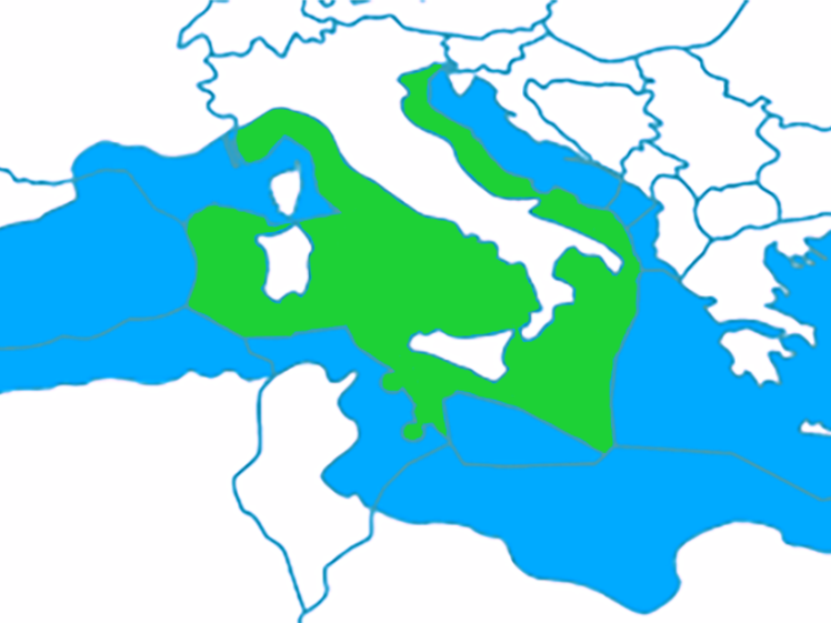
Italy-Exclusive-Economic-Zone-Map_(cropped).png (748 × 561 pixels, file size: 182 KB, MIME type: image/png)

|
This map image could be re-created using vector graphics as an SVG file. This has several advantages; see Commons:Media for cleanup for more information. If an SVG form of this image is available, please upload it and afterwards replace this template with
{{vector version available|new image name}}.
It is recommended to name the SVG file “Italy-Exclusive-Economic-Zone-Map (cropped).svg”—then the template Vector version available (or Vva) does not need the new image name parameter. |
Summary
| Description |
English: This map shows the exclusive economic zone of Italy (EEZ). It is located in the Mediterranean Sea which includes the Tyrrhenian Sea, Adriatic Sea and the Ionian Sea. |
| Date | |
| Source | Modified version of this map by B1mbo File:Territorial_waters_-_World.svg File:Territorial_waters_-_World.svg by B1mbo |
| Author | B1mbo |
| Other versions |
Licensing
This file is licensed under the Creative Commons Attribution 2.5 Generic license.
- You are free:
- to share – to copy, distribute and transmit the work
- to remix – to adapt the work
- Under the following conditions:
- attribution – You must give appropriate credit, provide a link to the license, and indicate if changes were made. You may do so in any reasonable manner, but not in any way that suggests the licensor endorses you or your use.
File history
Click on a date/time to view the file as it appeared at that time.
| Date/Time | Thumbnail | Dimensions | User | Comment | |
|---|---|---|---|---|---|
| current | 23:29, 12 October 2023 | | 748 × 561 (182 KB) | User-duck | File:Italy-Exclusive-Economic-Zone-Map.png cropped 53 % horizontally using CropTool with lossless mode. |
File usage
The following pages on the English Wikipedia use this file (pages on other projects are not listed):

Recent Comments