How Can We Help?
You are here:
< Back
Size of this preview: 800 × 600 pixels. Other resolutions: 320 × 240 pixels | 640 × 480 pixels | 1,024 × 768 pixels | 1,280 × 960 pixels | 2,592 × 1,944 pixels.
Original file (2,592 × 1,944 pixels, file size: 2.44 MB, MIME type: image/jpeg)
Summary
DescriptionHonshu Northernmost tip Monument.JPG |
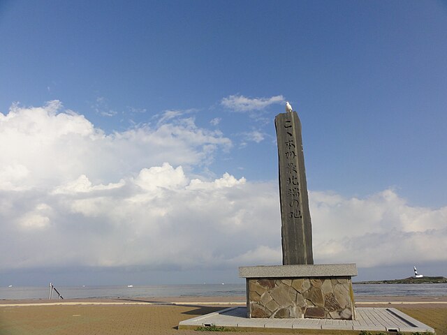
English: Monument of the northernmost point of Honshu at Omazaki in Ōma Town, Aomori Prefecture, Japan
日本語: 青森県大間町・大間崎にある本州最北端の石碑 |
Date | |
Source | Own work |
Author | クリオネサラダ |
Camera location | 41° 32′ 46.83″ N, 140° 54′ 45.78″ E ![]() ![]() | View this and other nearby images on: OpenStreetMap | ![]() |
---|
Licensing
I, the copyright holder of this work, hereby publish it under the following license:
![w:en:Creative Commons](https://upload.wikimedia.org/wikipedia/commons/thumb/7/79/CC_some_rights_reserved.svg/90px-CC_some_rights_reserved.svg.png)
![attribution](https://upload.wikimedia.org/wikipedia/commons/thumb/1/11/Cc-by_new_white.svg/24px-Cc-by_new_white.svg.png)
![share alike](https://upload.wikimedia.org/wikipedia/commons/thumb/d/df/Cc-sa_white.svg/24px-Cc-sa_white.svg.png)
This file is licensed under the Creative Commons Attribution-Share Alike 3.0 Unported license.
- You are free:
- to share – to copy, distribute and transmit the work
- to remix – to adapt the work
- Under the following conditions:
- attribution – You must give appropriate credit, provide a link to the license, and indicate if changes were made. You may do so in any reasonable manner, but not in any way that suggests the licensor endorses you or your use.
- share alike – If you remix, transform, or build upon the material, you must distribute your contributions under the same or compatible license as the original.
Captions
Monument of the northernmost point of Honshu at Omazaki in Ōma town
Items portrayed in this file
depicts
creator
some value
Wikimedia username: クリオネサラダ
author name string: クリオネサラダ
copyright status
copyrighted
copyright license
Creative Commons Attribution-ShareAlike 3.0 Unported
coordinates of the point of view
41°32'46.82900"N, 140°54'45.78502"E
heading: 329.75 degree
captured with
Sony Cyber-shot DSC-HX5V
inception
16 September 2012
source of file
original creation by uploader
File history
Click on a date/time to view the file as it appeared at that time.
Date/Time | Thumbnail | Dimensions | User | Comment | |
---|---|---|---|---|---|
current | 16:41, 19 September 2012 | 2,592 × 1,944 (2.44 MB) | クリオネサラダ~commonswiki | User created page with UploadWizard |
File usage
The following pages on the English Wikipedia use this file (pages on other projects are not listed):
Global file usage
The following other wikis use this file:
- Usage on id.wikipedia.org
- Usage on ja.wikipedia.org
- Usage on th.wikipedia.org
- Usage on uz.wikipedia.org
Metadata
This file contains additional information, probably added from the digital camera or scanner used to create or digitize it.
If the file has been modified from its original state, some details may not fully reflect the modified file.
Camera manufacturer | SONY |
---|---|
Camera model | DSC-HX5V |
Exposure time | 1/500 sec (0.002) |
F-number | f/8 |
ISO speed rating | 125 |
Date and time of data generation | 07:25, 16 September 2012 |
Lens focal length | 4.25 mm |
Latitude | 41° 32′ 46.83″ N |
Longitude | 140° 54′ 45.79″ E |
Altitude | 9.1 meters above sea level |
Orientation | Normal |
Horizontal resolution | 72 dpi |
Vertical resolution | 72 dpi |
File change date and time | 07:25, 16 September 2012 |
Y and C positioning | Co-sited |
Exposure Program | Normal program |
Exif version | 2.21 |
Date and time of digitizing | 07:25, 16 September 2012 |
Meaning of each component |
|
Image compression mode | 5 |
Exposure bias | 0 |
Maximum land aperture | 3.625 APEX (f/3.51) |
Metering mode | Pattern |
Light source | Unknown |
Flash | Flash did not fire, compulsory flash suppression |
Supported Flashpix version | 1 |
Color space | sRGB |
File source | Digital still camera |
Scene type | A directly photographed image |
Custom image processing | Normal process |
Exposure mode | Auto exposure |
White balance | Auto white balance |
Scene capture type | Landscape |
Contrast | Normal |
Saturation | Normal |
Sharpness | Normal |
GPS time (atomic clock) | 22:25:14.475 |
Receiver status | Measurement in progress |
Measurement mode | 3-dimensional measurement |
Speed unit | Kilometers per hour |
Speed of GPS receiver | 1.2 |
Reference for direction of movement | True direction |
Direction of movement | 185.27 |
Reference for direction of image | Magnetic direction |
Direction of image | 329.75 |
Geodetic survey data used | WGS-84 |
GPS date | 15 September 2012 |
GPS differential correction | 0 |
GPS tag version | 0.0.2.2 |
Categories
-
Annuals36
-
Bulbs, Corms & Tubers41
-
Ferns27
-
Fruits3
-
Garden Plants23
-
Grasses26
-
Herb17
-
Insects1
-
Mammals1
-
Midwest Native Plants0
-
Northeast Native Plants112
-
Perennials123
-
Rose1
-
Shrubs47
-
Trees112
-
Tropical Plants53
-
Upland Birds5
-
Vines18
-
Viola Tricolor1
-
Water Gardening & Plants9
-
Waterfowl0
-
Wetland Birds0
-
Wetland Plants4
-
Wildbirds172
-
Wildflowers1
-
Woodland Plants29
Table of Contents
Recent Comments