
How Can We Help?

Size of this PNG preview of this SVG file: 512 × 362 pixels. Other resolutions: 320 × 226 pixels | 640 × 453 pixels | 1,024 × 724 pixels | 1,280 × 905 pixels | 2,560 × 1,810 pixels.
Original file (SVG file, nominally 512 × 362 pixels, file size: 865 KB)
Summary
| Description |
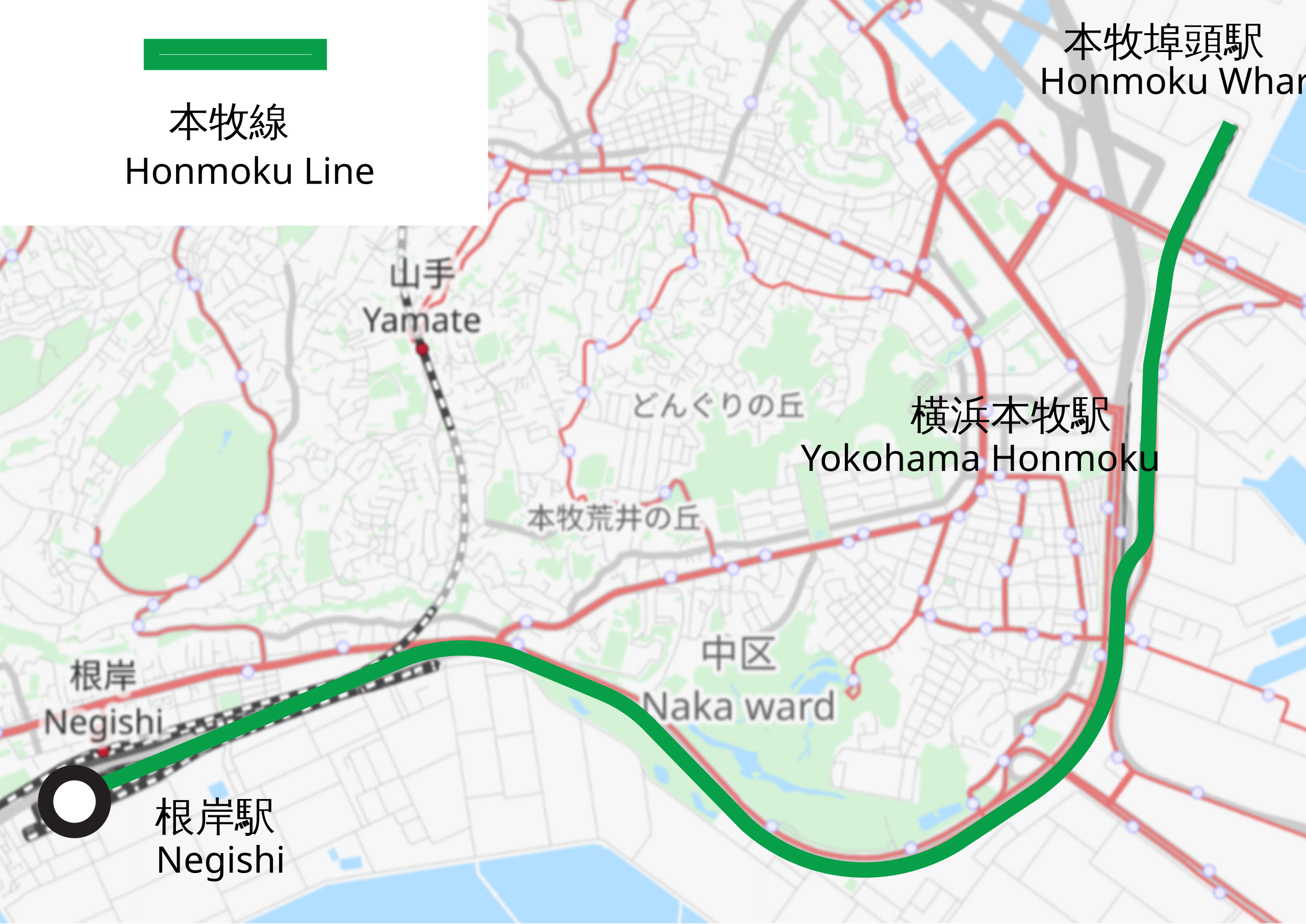
English: A map of the Kanagawa Rinkai Tetsudo freight railway's Honmoku line |
| Date | |
| Source | Own work |
| Author | Camapple1 |
| Camera location | | View this and other nearby images on: OpenStreetMap |
|---|
Licensing
I, the copyright holder of this work, hereby publish it under the following license:
This file is licensed under the Creative Commons Attribution 4.0 International license.
- You are free:
- to share – to copy, distribute and transmit the work
- to remix – to adapt the work
- Under the following conditions:
- attribution – You must give appropriate credit, provide a link to the license, and indicate if changes were made. You may do so in any reasonable manner, but not in any way that suggests the licensor endorses you or your use.
File history
Click on a date/time to view the file as it appeared at that time.
| Date/Time | Thumbnail | Dimensions | User | Comment | |
|---|---|---|---|---|---|
| current | 02:23, 3 April 2024 | | 512 × 362 (865 KB) | Camapple1 | Uploaded own work with UploadWizard |
File usage
The following pages on the English Wikipedia use this file (pages on other projects are not listed):
Global file usage
The following other wikis use this file:
- Usage on ja.wikipedia.org

Recent Comments