
How Can We Help?

Size of this preview: 397 × 599 pixels. Other resolutions: 159 × 240 pixels | 318 × 480 pixels | 509 × 768 pixels | 678 × 1,024 pixels | 1,356 × 2,048 pixels | 3,264 × 4,928 pixels.
Original file (3,264 × 4,928 pixels, file size: 4.89 MB, MIME type: image/jpeg)
Summary
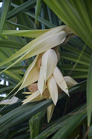
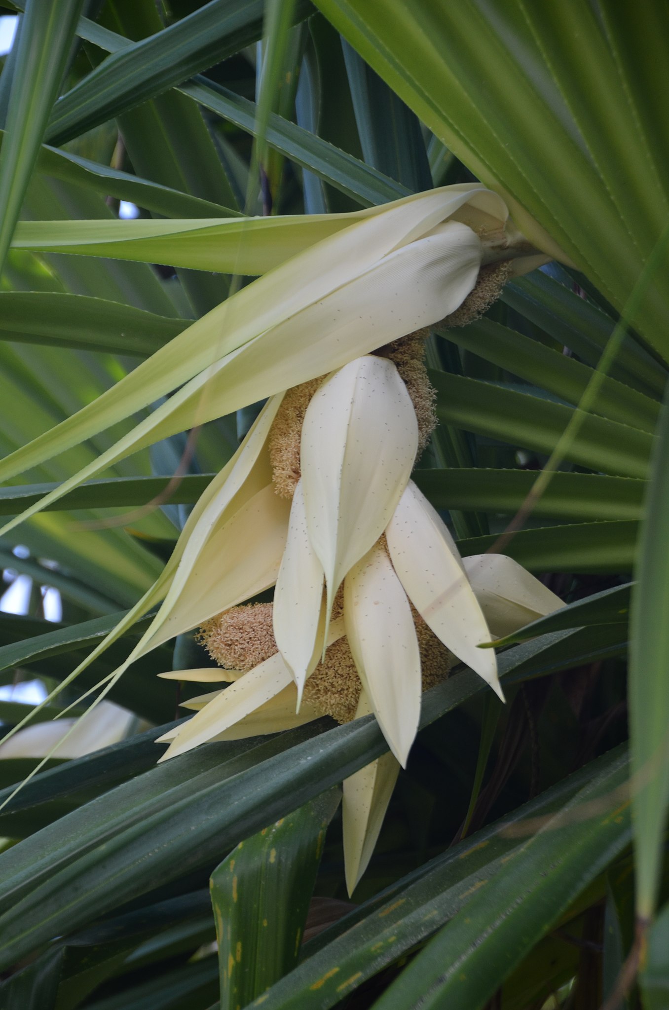
| Description | Hīnano | ||
| Tags (from Panoramio photo page) | Hawaii County, 2012, Flower, Hawaii, Hawaii County, Hawaiʻi, Kalani Honua, USA |
||
| Date | Taken on 2 October 2012 | ||
| Source | Own work | ||
| Author |
Deutsch: Urheber dieser Datei ist Thomas Tunsch. Sie ist nicht gemeinfrei und die Verwendung über die Lizenzbedingungen hinaus ist eine Urheberrechtsverletzung.
Als Rechtenachweis (Namensnennung des Urhebers) ist anzugeben: © CC BY-SA Thomas Tunsch / Hīnano - panoramio.jpg (Wikimedia Commons). Ein Quellennachweis durch Verknüpfung mit dieser Beschreibungsseite (//commons.wikimedia.org/wiki/File:H%C4%ABnano_-_panoramio.jpg) wird empfohlen. Der Lizenzhinweisgenerator kann dabei helfen, Bilder aus Wikipedia und dem freien Medienarchiv Wikimedia Commons einfach und rechtssicher nachzunutzen.English: This file was created by Thomas Tunsch. It is not in the public domain and use of this file outside of the licensing terms is a copyright violation.
Please credit authorship as follows: © CC BY-SA Thomas Tunsch / Hīnano - panoramio.jpg (Wikimedia Commons). Source attribution by linking to this file page (//commons.wikimedia.org/wiki/File:H%C4%ABnano_-_panoramio.jpg) is recommended. The application Lizenzhinweisgenerator can help to reuse pictures from Wikipedia and the free media file repository easily and legally. |
||
| Permission (Reusing this file) |
I, the copyright holder of this work, hereby publish it under the following license: This file is licensed under the Creative Commons Attribution-Share Alike 4.0 International license. Attribution: © CC BY-SA Thomas Tunsch / Hīnano - panoramio.jpg (Wikimedia Commons)
|
||
| Internet Archive | https://web.archive.org/web/20161026221235/http://www.panoramio.com/photo/80079309 |
| Camera location | | View this and other nearby images on: OpenStreetMap |
|---|
File history
Click on a date/time to view the file as it appeared at that time.
| Date/Time | Thumbnail | Dimensions | User | Comment | |
|---|---|---|---|---|---|
| current | 23:30, 14 January 2017 | | 3,264 × 4,928 (4.89 MB) | Panoramio upload bot | == {{int:filedesc}} == {{Information |description=Hīnano |date={{Taken on|2012-10-02}} |source=http://www.panoramio.com/photo/80079309 |author=[http://www.panoramio.com/user/6889981?with_photo_id=80079309 Thomas Tunsch] |permission={{cc-by-sa-3.0|Thom... |
File usage
The following pages on the English Wikipedia use this file (pages on other projects are not listed):
Global file usage
The following other wikis use this file:
- Usage on de.wikipedia.org

Recent Comments