
How Can We Help?

Size of this preview: 800 × 600 pixels. Other resolutions: 320 × 240 pixels | 640 × 480 pixels | 1,024 × 768 pixels | 1,280 × 960 pixels | 2,560 × 1,920 pixels | 3,264 × 2,448 pixels.
Original file (3,264 × 2,448 pixels, file size: 2.21 MB, MIME type: image/jpeg)
Summary
| Description |
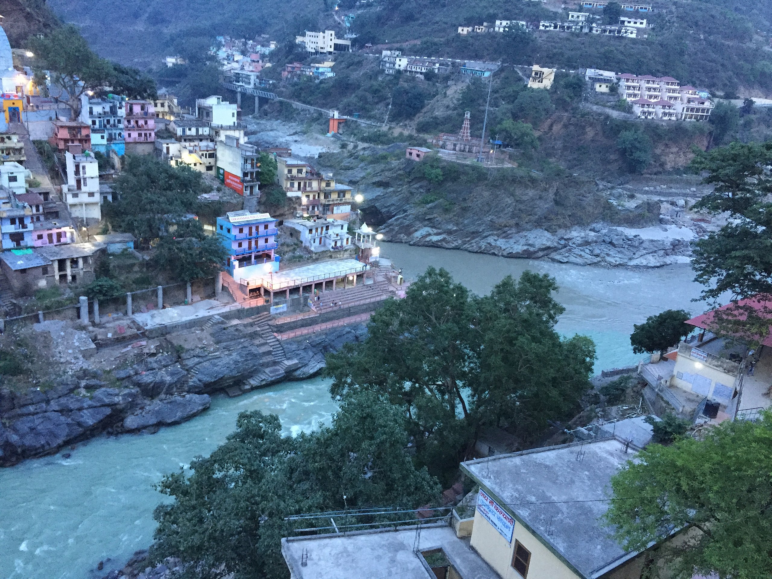
English: Devprayag, beauty of nature - where Alaknanda and Bhagirathi rivers meet and take the name Ganga or Ganges River.
We can see the color difference of Alaknanda & Bhagirathi. |
| Date | |
| Source | Own work |
| Author | Sssidhu789 |
| Camera location | | View this and other nearby images on: OpenStreetMap |
|---|
The Alaknanda rises at the confluence and feet of the Satopanth and Bhagirath Kharak glaciers in Uttarakhand near the border with Tibet. The headwaters of the Bhagirathi are formed at Gaumukh, at the foot of the Gangotri glacier and Khatling glaciers in the Garhwal Himalaya. These two sacred rivers join to form the Ganges (Ganga) in Devprayag.
Devprayag is 70 km from Rishikesh. Devprayag has an average elevation of 830 metres (2,723 feet)
Licensing
I, the copyright holder of this work, hereby publish it under the following license:
This file is licensed under the Creative Commons Attribution-Share Alike 4.0 International license.
- You are free:
- to share – to copy, distribute and transmit the work
- to remix – to adapt the work
- Under the following conditions:
- attribution – You must give appropriate credit, provide a link to the license, and indicate if changes were made. You may do so in any reasonable manner, but not in any way that suggests the licensor endorses you or your use.
- share alike – If you remix, transform, or build upon the material, you must distribute your contributions under the same or compatible license as the original.
This image was uploaded as part of Wiki Loves Earth 2017.
|
 |
File history
Click on a date/time to view the file as it appeared at that time.
| Date/Time | Thumbnail | Dimensions | User | Comment | |
|---|---|---|---|---|---|
| current | 05:54, 29 June 2017 | | 3,264 × 2,448 (2.21 MB) | Sssidhu789 | User created page with UploadWizard |
File usage
The following pages on the English Wikipedia use this file (pages on other projects are not listed):
Global file usage
The following other wikis use this file:
- Usage on hi.wikipedia.org

Recent Comments