
How Can We Help?

Size of this preview: 424 × 599 pixels. Other resolutions: 170 × 240 pixels | 463 × 654 pixels.
Original file (463 × 654 pixels, file size: 15 KB, MIME type: image/gif)
Summary
| Description |
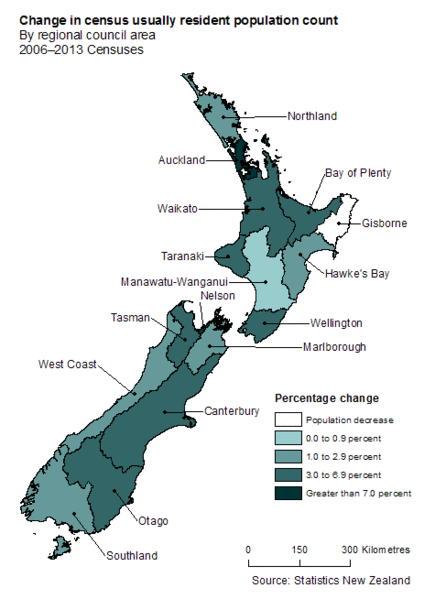
English: The map depicts the change in population by region in New Zealand based on the 2006 - 2013 censuses |
| Date | |
| Source | http://www.stats.govt.nz/browse_for_stats/population/census_counts/2013CensusUsuallyResidentPopulationCounts_MR2013Census.aspx |
| Author | Statistics New Zealand |
New Zealand
Licensing
This file is licensed under the Creative Commons Attribution 3.0 Unported license.
- You are free:
- to share – to copy, distribute and transmit the work
- to remix – to adapt the work
- Under the following conditions:
- attribution – You must give appropriate credit, provide a link to the license, and indicate if changes were made. You may do so in any reasonable manner, but not in any way that suggests the licensor endorses you or your use.
File history
Click on a date/time to view the file as it appeared at that time.
| Date/Time | Thumbnail | Dimensions | User | Comment | |
|---|---|---|---|---|---|
| current | 09:16, 5 April 2014 | | 463 × 654 (15 KB) | JefyWood | User created page with UploadWizard |
File usage
The following pages on the English Wikipedia use this file (pages on other projects are not listed):
Global file usage
The following other wikis use this file:
- Usage on ar.wikipedia.org

Recent Comments