How Can We Help?
You are here:
< Back
Size of this preview: 800 × 594 pixels. Other resolutions: 320 × 238 pixels | 640 × 476 pixels | 1,024 × 761 pixels | 1,280 × 951 pixels | 1,378 × 1,024 pixels.
Original file (1,378 × 1,024 pixels, file size: 541 KB, MIME type: image/jpeg)
Summary
DescriptionBdg Swieto3Maja strRynek 39 2014.jpg |
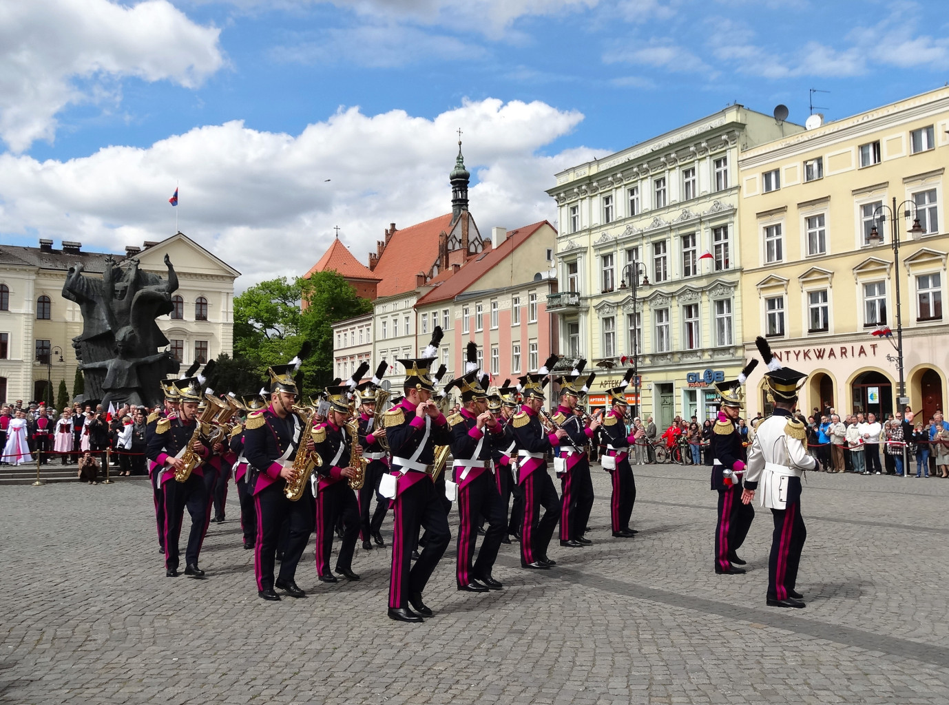
Polski: Święto Konstytucji 3 Maja 2014 roku na Starym Rynku w Bydgoszczy z udziałem orkiestry wojskowej garnizonu bydgoskiego oraz Zespołu Pieśni i Tańca Ziemia Bydgoska |
Date | |
Source | Own work |
Author | Pit1233 |
Camera location | 53° 07′ 19.09″ N, 18° 00′ 01.41″ E | View this and other nearby images on: OpenStreetMap | 53.121970; 18.000391 |
---|
Licensing
I, the copyright holder of this work, hereby publish it under the following license:
This file is made available under the Creative Commons CC0 1.0 Universal Public Domain Dedication. | |
The person who associated a work with this deed has dedicated the work to the public domain by waiving all of their rights to the work worldwide under copyright law, including all related and neighboring rights, to the extent allowed by law. You can copy, modify, distribute and perform the work, even for commercial purposes, all without asking permission.
http://creativecommons.org/publicdomain/zero/1.0/deed.enCC0Creative Commons Zero, Public Domain Dedicationfalsefalse |
Items portrayed in this file
depicts
creator
some value
author name string: Pit1233
Wikimedia username: Pit1233
object has role: photographer
copyright status
copyrighted
copyright license
Creative Commons CC0 License
inception
3 May 2014
coordinates of the point of view
53°7'19.09099"N, 18°0'1.40900"E
heading: 312.75 degree
source of file
original creation by uploader
captured with
Sony Cyber-shot DSC-HX20V
media type
image/jpeg
checksum
34a0a2c6413c000d9cf0a49a46b2a60f79f93fc6
determination method: SHA-1
data size
554,141 byte
height
1,024 pixel
width
1,378 pixel
File history
Click on a date/time to view the file as it appeared at that time.
Date/Time | Thumbnail | Dimensions | User | Comment | |
---|---|---|---|---|---|
current | 07:06, 31 May 2014 | 1,378 × 1,024 (541 KB) | Pit1233 | User created page with UploadWizard |
File usage
The following pages on the English Wikipedia use this file (pages on other projects are not listed):
Global file usage
The following other wikis use this file:
- Usage on el.wikipedia.org
- Usage on ne.wikipedia.org
- Usage on pl.wikipedia.org
- Usage on vi.wikipedia.org
Metadata
This file contains additional information, probably added from the digital camera or scanner used to create or digitize it.
If the file has been modified from its original state, some details may not fully reflect the modified file.
Camera manufacturer | SONY |
---|---|
Camera model | DSC-HX20V |
Exposure time | 1/1,250 sec (0.0008) |
F-number | f/3.5 |
ISO speed rating | 100 |
Date and time of data generation | 12:56, 3 May 2014 |
Lens focal length | 5.59 mm |
Latitude | 53° 7′ 19.09″ N |
Longitude | 18° 0′ 1.41″ E |
Altitude | 25.2 meters above sea level |
Orientation | Normal |
Horizontal resolution | 350 dpi |
Vertical resolution | 350 dpi |
Software used | PictureProject 1.7.5 W |
File change date and time | 17:26, 6 May 2014 |
Y and C positioning | Centered |
Exposure Program | Landscape mode (for landscape photos with the background in focus) |
Exif version | 2.3 |
Date and time of digitizing | 12:56, 3 May 2014 |
Meaning of each component |
|
APEX brightness | 10.06015625 |
Exposure bias | 0 |
Maximum land aperture | 3.6171875 APEX (f/3.5) |
Metering mode | Pattern |
Light source | Unknown |
Flash | Flash did not fire, compulsory flash suppression |
Supported Flashpix version | 1 |
Color space | sRGB |
File source | Digital still camera |
Scene type | A directly photographed image |
Custom image processing | Normal process |
Exposure mode | Auto exposure |
White balance | Auto white balance |
Digital zoom ratio | 1 |
Scene capture type | Landscape |
Contrast | Normal |
Saturation | Normal |
Sharpness | Normal |
GPS time (atomic clock) | 10:56 |
Receiver status | Measurement in progress |
Measurement mode | 3-dimensional measurement |
Measurement precision | Poor (1.44) |
Speed unit | Kilometers per hour |
Speed of GPS receiver | 1.26 |
Reference for direction of movement | True direction |
Direction of movement | 278.08 |
Reference for direction of image | Magnetic direction |
Direction of image | 312.75 |
Geodetic survey data used | WGS-84 |
GPS date | 3 May 2014 |
GPS tag version | 0.0.3.2 |
Categories
-
Annuals36
-
Bulbs, Corms & Tubers41
-
Ferns27
-
Fruits3
-
Garden Plants23
-
Grasses26
-
Herb17
-
Insects1
-
Mammals1
-
Midwest Native Plants0
-
Northeast Native Plants112
-
Perennials123
-
Rose1
-
Shrubs47
-
Trees112
-
Tropical Plants53
-
Upland Birds5
-
Vines18
-
Viola Tricolor1
-
Water Gardening & Plants9
-
Waterfowl0
-
Wetland Birds0
-
Wetland Plants4
-
Wildbirds172
-
Wildflowers1
-
Woodland Plants29
Table of Contents
Recent Comments