
How Can We Help?

Size of this preview: 508 × 599 pixels. Other resolutions: 204 × 240 pixels | 407 × 480 pixels | 749 × 883 pixels.
Original file (749 × 883 pixels, file size: 506 KB, MIME type: image/jpeg)
| Description | |
| Date | Unknown date |
| Source | NASA World Wind screenshot |
| Author | NASA (edited by Aqwis) |
| This image is in the public domain because it is a screenshot from NASA’s globe software World Wind using a public domain layer, such as Blue Marble, MODIS, Landsat, SRTM, USGS or GLOBE.
|
 |
File history
Click on a date/time to view the file as it appeared at that time.
| Date/Time | Thumbnail | Dimensions | User | Comment | |
|---|---|---|---|---|---|
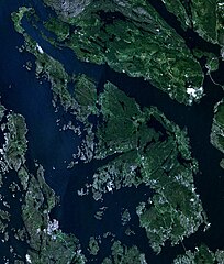
| current | 13:56, 28 December 2008 | | 749 × 883 (506 KB) | Aqwis | {{Information |Description={{en|Satellite image of Askøy, Hordaland, Norway.}} |Source=Own work |Date=Unknown. |Author=Aqwis |Permission=See below. }} Category:Askøy {{PD-WorldWind}} <!--{{ImageUpload|basic}}--> |
File usage
The following pages on the English Wikipedia use this file (pages on other projects are not listed):
Global file usage
The following other wikis use this file:

Recent Comments