
How Can We Help?
No higher resolution available.
Almshouses_Titchmarsh_-_geograph.org.uk_-_1024858.jpg (640 × 480 pixels, file size: 67 KB, MIME type: image/jpeg)
Summary
| Description |
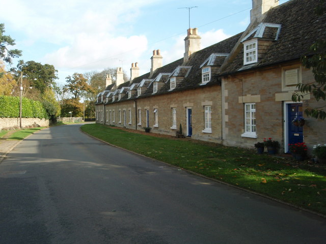
English: Almshouses Titchmarsh There are two distinct sections to this row of Almshouse. The middle consisting of 4 cottage was built as a hospital for 8 persons around 1756. At each end a "modern" extension to house Bedes men and women built in 1857 and 1863. |
| Date | |
| Source | From geograph.org.uk |
| Author | Michael Trolove |
| Attribution (required by the license) | Michael Trolove / Almshouses Titchmarsh / |
| Camera location | | View this and other nearby images on: OpenStreetMap |
|---|
| Object location | | View this and other nearby images on: OpenStreetMap |
|---|
Licensing

|
This image was taken from the Geograph project collection. See this photograph's page on the Geograph website for the photographer's contact details. The copyright on this image is owned by Michael Trolove and is licensed for reuse under the Creative Commons Attribution-ShareAlike 2.0 license.
|
This file is licensed under the Creative Commons Attribution-Share Alike 2.0 Generic license.
Attribution: Michael Trolove
- You are free:
- to share – to copy, distribute and transmit the work
- to remix – to adapt the work
- Under the following conditions:
- attribution – You must give appropriate credit, provide a link to the license, and indicate if changes were made. You may do so in any reasonable manner, but not in any way that suggests the licensor endorses you or your use.
- share alike – If you remix, transform, or build upon the material, you must distribute your contributions under the same or compatible license as the original.
File history
Click on a date/time to view the file as it appeared at that time.
| Date/Time | Thumbnail | Dimensions | User | Comment | |
|---|---|---|---|---|---|
| current | 13:29, 23 February 2011 | | 640 × 480 (67 KB) | GeographBot | == {{int:filedesc}} == {{Information |description={{en|1=Almshouses Titchmarsh There are two distinct sections to this row of Almshouse. The middle consisting of 4 cottage was built as a hospital for 8 persons around 1756. At each end a "modern" extensio |
File usage
The following pages on the English Wikipedia use this file (pages on other projects are not listed):

_heading:67.00&language=en)
_heading:67.00&language=en)
Recent Comments