How Can We Help?
You are here:
< Back
Size of this preview: 800 × 466 pixels. Other resolutions: 320 × 186 pixels | 640 × 373 pixels | 1,080 × 629 pixels.
Original file (1,080 × 629 pixels, file size: 433 KB, MIME type: image/jpeg)
Summary
DescriptionAlbuquerque-nighttime-cityscape-from-Sandia-Crest.jpg |
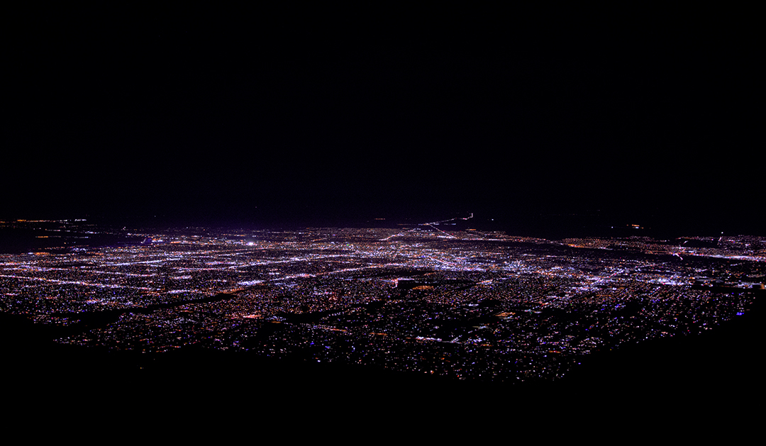
English: Photo shows the nighttime cityscape of Albuquerque as seen looking west by south from the upper terminal of Sandia Peak Tramway |
Date | |
Source | Own work |
Author | MateoTimateo |
Camera location | 35° 11′ 45.28″ N, 106° 26′ 03.35″ W | View this and other nearby images on: OpenStreetMap | 35.195912; -106.434265 |
---|
Licensing
I, the copyright holder of this work, hereby publish it under the following license:
This file is licensed under the Creative Commons Attribution-Share Alike 4.0 International license.
- You are free:
- to share – to copy, distribute and transmit the work
- to remix – to adapt the work
- Under the following conditions:
- attribution – You must give appropriate credit, provide a link to the license, and indicate if changes were made. You may do so in any reasonable manner, but not in any way that suggests the licensor endorses you or your use.
- share alike – If you remix, transform, or build upon the material, you must distribute your contributions under the same or compatible license as the original.
Items portrayed in this file
depicts
creator
some value
object has role: photographer
author name string: MateoTimateo
Wikimedia username: MateoTimateo
copyright status
copyrighted
copyright license
Creative Commons Attribution-ShareAlike 4.0 International
coordinates of the point of view
35°11'45.283"N, 106°26'3.354"W
heading: 254.04 degree
captured with
Pentax K-3 II
exposure time
0.5 second
f-number
7.1
focal length
21 millimetre
ISO speed
1,600
media type
image/jpeg
instance of
photograph
source of file
original creation by uploader
File history
Click on a date/time to view the file as it appeared at that time.
Date/Time | Thumbnail | Dimensions | User | Comment | |
---|---|---|---|---|---|
current | 19:24, 30 March 2024 | 1,080 × 629 (433 KB) | MateoTimateo | Uploaded own work with UploadWizard |
File usage
The following pages on the English Wikipedia use this file (pages on other projects are not listed):
Metadata
This file contains additional information, probably added from the digital camera or scanner used to create or digitize it.
If the file has been modified from its original state, some details may not fully reflect the modified file.
Camera manufacturer | RICOH IMAGING COMPANY, LTD. |
---|---|
Camera model | PENTAX K-3 II |
Author | Matthew Timothy Bradley |
Copyright holder |
|
Exposure time | 1/2 sec (0.5) |
F-number | f/7.1 |
ISO speed rating | 1,600 |
Date and time of data generation | 18:32, 16 December 2017 |
Lens focal length | 21 mm |
Latitude | 35° 11′ 45.28″ N |
Longitude | 106° 26′ 3.35″ W |
Altitude | 3,160.7 meters above sea level |
Width | 6,016 px |
Height | 3,503 px |
Bits per component |
|
Pixel composition | RGB |
Orientation | Normal |
Number of components | 3 |
Horizontal resolution | 240 dpi |
Vertical resolution | 240 dpi |
Software used | Adobe Photoshop CS5 Macintosh |
File change date and time | 22:13, 16 December 2017 |
Exposure Program | Manual |
Exif version | 2.3 |
Date and time of digitizing | 18:32, 16 December 2017 |
Shutter speed | 1 |
APEX aperture | 5.655638 |
Exposure bias | 0 |
Metering mode | Pattern |
Flash | Flash did not fire, compulsory flash suppression |
Color space | Uncalibrated |
Sensing method | One-chip color area sensor |
Custom image processing | Normal process |
Exposure mode | Manual exposure |
White balance | Auto white balance |
Focal length in 35 mm film | 31 mm |
Scene capture type | Standard |
Contrast | Normal |
Saturation | Normal |
Sharpness | Normal |
Subject distance range | Close view |
GPS time (atomic clock) | 01:32 |
Satellites used for measurement | 09 |
Receiver status | Measurement in progress |
Measurement mode | 3-dimensional measurement |
Speed unit | Kilometers per hour |
Speed of GPS receiver | 0.04 |
Reference for direction of movement | True direction |
Direction of movement | 240.64 |
Reference for direction of image | True direction |
Direction of image | 254.04 |
Geodetic survey data used | WGS-84 |
GPS date | 17 December 2017 |
GPS tag version | 0.0.3.2 |
Date metadata was last modified | 17:13, 16 December 2017 |
Unique ID of original document | E1D4EF1C8719F7D4120C541CBFB7DA70 |
IIM version | 4 |
Categories
-
Annuals36
-
Bulbs, Corms & Tubers41
-
Ferns27
-
Fruits3
-
Garden Plants23
-
Grasses26
-
Herb17
-
Insects1
-
Mammals1
-
Midwest Native Plants0
-
Northeast Native Plants112
-
Perennials123
-
Rose1
-
Shrubs47
-
Trees112
-
Tropical Plants53
-
Upland Birds5
-
Vines18
-
Viola Tricolor1
-
Water Gardening & Plants9
-
Waterfowl0
-
Wetland Birds0
-
Wetland Plants4
-
Wildbirds172
-
Wildflowers1
-
Woodland Plants29
Table of Contents
Recent Comments