

Original file (6,000 × 6,601 pixels, file size: 7.35 MB, MIME type: image/jpeg)
| Dai Nihon Chiri Zenzu | ||||||
|---|---|---|---|---|---|---|
| Artist | ||||||
| Title |
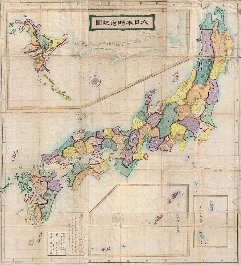
Dai Nihon Chiri Zenzu |
|||||
| Description |
English: This is a monumental Japanese map of Japan prepared in 1875 or Meiji 8. Covers the entirety of Japan inclusive of Hokkaido and the Ryukyu Islands. Cartographically this map, like most 18th century maps of Japan, harkens to the Ino Tadataka surveys of the 18th century, though this example does exhibit considerable revision. Even so, the influence of the Meiji Ishin or Meiji Restoration is evident in the form of the prefecture structure adopted in 1871. Stylistically, this map strays significantly from Edo period cartography prepared under the Tokugawa Shogunate, and, though issued early in the Meiji period, exhibits considerable western, particularly British, cartographic influence. One curious aspect of this map is that it appears unfinished. Various empty cartouches appear throughout the map but are empty and no specific area is textually identified. This unusual omission may stem from a politic decision to discontinue the map in anticipation of further revisions, or simply suggest that the completion of the map was interrupted for other, unknowable, reasons. |
|||||
| Date | 1875 (dated) | |||||
| Dimensions | height: 59 in (149.8 cm); width: 53 in (134.6 cm) | |||||
| Accession number |
Geographicus link: Japan-meiji8-1875 |
|||||
| Source/Photographer |
|
|||||
| Permission (Reusing this file) |
|
|||||
File history
Click on a date/time to view the file as it appeared at that time.
| Date/Time | Thumbnail | Dimensions | User | Comment | |
|---|---|---|---|---|---|
| current | 03:38, 25 March 2011 | | 6,000 × 6,601 (7.35 MB) | BotMultichillT | {{subst:User:Multichill/Geographicus |link=http://www.geographicus.com/P/AntiqueMap/Japan-meiji8-1875 |product_name=1875 Meiji 8 Japanese Wall Map of Japan |map_title=Dai Nihon Chiri Zenzu |description=This is a monumental Japanese map of Japan prepared i |
File usage
Global file usage
The following other wikis use this file:
- Usage on th.wikipedia.org

Recent Comments