
Chocontá is a municipality and town of Colombia in the Almeidas Province, part of the department of Cundinamarca. It is located on the Pan-American Highway. In 1938 Chocontá had a population of 2,041.[2]
Etymology
In the Chibcha language of the Muisca, Chocontá means: "Farmlands of the good ally" or "Garden of the neighbour".[3]
History
Chocontá is located in the territories of the Muisca on the border between the area led by the cacique of Vélez and the southern Muisca zipazgo reign. Around 1490 the armies of the northern Muisca led by Michuá and the warriors of the southern Muisca ruled by Saguamanchica confronted each other in the bloody Battle of Chocontá.
The Spanish conquistadors led by Gonzalo Jiménez de Quesada reached the Colombian highlands in 1537. On 9 June 1537, Pentecostal day, the Spanish arrived in Chocontá and Father Fray Domingo de las Casas named it Pueblo del Espíritu Santo ("Town of the Holy Spirit") with a mass. The village was founded by Tómas López on 6 September 1563 and relocated in 1573.[3]
In 1854 the presidential headquarters was located in Chocontá and on 21 April 1854 Tomás de Herrera was proclaimed president in the rectory of the town. On 9 August 1819 at 2 pm liberator Simón Bolívar arrived to Chocontá and stayed to rest in what currently is the House of Culture after his triumph, defining the fate of the Colombian Republic.[4]
Trivia
- Chocontá is the principal producer of strawberries in Colombia
- The town is nicknamed La ciudad satélite de Colombia ("The satellite town of Colombia") because of the satellite dishes of Telecom[5]
- The Sisga Reservoir is located within Chocontá
- The genus Choconta with species Choconta circulata, found near Bogotá, have been named after Chocontá
Climate
| Climate data for Chocontá (Silos), elevation 2,709 m (8,888 ft), (1981–2010) | |||||||||||||
|---|---|---|---|---|---|---|---|---|---|---|---|---|---|
| Month | Jan | Feb | Mar | Apr | May | Jun | Jul | Aug | Sep | Oct | Nov | Dec | Year |
| Mean daily maximum °C (°F) | 18.2 (64.8) |
18.4 (65.1) |
18.4 (65.1) |
17.6 (63.7) |
17.0 (62.6) |
15.7 (60.3) |
15.1 (59.2) |
15.7 (60.3) |
16.5 (61.7) |
17.2 (63.0) |
17.5 (63.5) |
17.7 (63.9) |
17.1 (62.8) |
| Daily mean °C (°F) | 12.0 (53.6) |
12.5 (54.5) |
12.8 (55.0) |
12.8 (55.0) |
12.6 (54.7) |
11.9 (53.4) |
11.4 (52.5) |
11.6 (52.9) |
11.9 (53.4) |
12.4 (54.3) |
12.6 (54.7) |
12.2 (54.0) |
12.2 (54.0) |
| Mean daily minimum °C (°F) | 6.6 (43.9) |
7.6 (45.7) |
8.2 (46.8) |
9.0 (48.2) |
9.1 (48.4) |
8.9 (48.0) |
8.5 (47.3) |
8.5 (47.3) |
7.9 (46.2) |
8.2 (46.8) |
8.4 (47.1) |
7.3 (45.1) |
8.2 (46.8) |
| Average precipitation mm (inches) | 17.6 (0.69) |
38.9 (1.53) |
58.3 (2.30) |
87.8 (3.46) |
119.9 (4.72) |
129.2 (5.09) |
144.3 (5.68) |
107.4 (4.23) |
70.0 (2.76) |
77.6 (3.06) |
61.6 (2.43) |
24.6 (0.97) |
937.3 (36.90) |
| Average precipitation days | 7 | 9 | 13 | 18 | 23 | 25 | 25 | 23 | 18 | 17 | 16 | 9 | 202 |
| Average relative humidity (%) | 83 | 83 | 84 | 87 | 88 | 90 | 91 | 90 | 87 | 86 | 86 | 85 | 87 |
| Mean monthly sunshine hours | 204.6 | 163.7 | 145.7 | 111.0 | 114.7 | 75.0 | 96.1 | 108.5 | 123.0 | 133.3 | 138.0 | 182.9 | 1,596.5 |
| Mean daily sunshine hours | 6.6 | 5.8 | 4.7 | 3.7 | 3.7 | 2.5 | 3.1 | 3.5 | 4.1 | 4.3 | 4.6 | 5.9 | 4.4 |
| Source: Instituto de Hidrologia Meteorologia y Estudios Ambientales[6] | |||||||||||||
Gallery
-
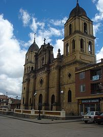 Church
 -
 Train station Chocontá
 -
 Train station


References
- ^ Citypopulation.de
- ^ Columbia-Lippincott Gazetteer. (New York: Columbia University Press, 1952) p. 403
- ^ a b (in Spanish) Official website Chocontá Archived 10 March 2014 at archive.today
- ^ (in Spanish) History of Chocontá Archived 10 March 2014 at archive.today
- ^ (in Spanish) Version of Spanish language Wikipedia – accessed 20-04-2016
- ^ "Promedios Climatológicos 1981–2010" (in Spanish). Instituto de Hidrologia Meteorologia y Estudios Ambientales. Archived from the original on 15 August 2016. Retrieved 17 June 2024.
External links
- (in Spanish) Government of Cundinamarca – Chocontá
| International | |
|---|---|
| National | |

Recent Comments