![File:Plank Museum and Visitor Center, Fort Snelling 2022-05-30.jpg](https://upload.wikimedia.org/wikipedia/commons/thumb/c/cd/Plank_Museum_and_Visitor_Center%2C_Fort_Snelling_2022-05-30.jpg/800px-Plank_Museum_and_Visitor_Center%2C_Fort_Snelling_2022-05-30.jpg?20240311001038)
Original file (7,009 × 4,678 pixels, file size: 7.82 MB, MIME type: image/jpeg)
Captions
Captions
Summary
DescriptionPlank Museum and Visitor Center, Fort Snelling 2022-05-30.jpg |
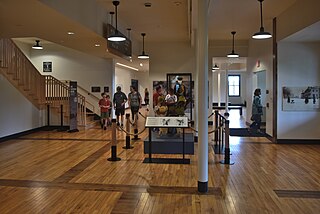
English: The Minnesota Historical Society recently demolished the 1970s-era visitor center built under the site of the old post cemetery, repurposing one of the military buildings of the New Fort for its replacement. |
Date | |
Source | Own work |
Author | Schwerdf |
Camera location | 44° 53′ 35.41″ N, 93° 11′ 04.94″ W ![]() | View this and other nearby images on: OpenStreetMap | ![]() |
---|
![]() |
This is an image of a place or building that is listed on the National Register of Historic Places in the United States of America. Its reference number is 66000401. |
Licensing
![w:en:Creative Commons](https://upload.wikimedia.org/wikipedia/commons/thumb/7/79/CC_some_rights_reserved.svg/90px-CC_some_rights_reserved.svg.png)
![attribution](https://upload.wikimedia.org/wikipedia/commons/thumb/1/11/Cc-by_new_white.svg/24px-Cc-by_new_white.svg.png)
- You are free:
- to share – to copy, distribute and transmit the work
- to remix – to adapt the work
- Under the following conditions:
- attribution – You must give appropriate credit, provide a link to the license, and indicate if changes were made. You may do so in any reasonable manner, but not in any way that suggests the licensor endorses you or your use.
File history
Click on a date/time to view the file as it appeared at that time.
Date/Time | Thumbnail | Dimensions | User | Comment | |
---|---|---|---|---|---|
current | 00:10, 11 March 2024 | ![]() | 7,009 × 4,678 (7.82 MB) | Schwerdf (talk | contribs) | Uploaded own work with UploadWizard |
You cannot overwrite this file.
File usage on Commons
There are no pages that use this file.
Metadata
This file contains additional information such as Exif metadata which may have been added by the digital camera, scanner, or software program used to create or digitize it. If the file has been modified from its original state, some details such as the timestamp may not fully reflect those of the original file. The timestamp is only as accurate as the clock in the camera, and it may be completely wrong.
Image title |
|
---|---|
Camera manufacturer | NIKON CORPORATION |
Camera model | NIKON D810 |
Author | August Schwerdfeger |
Copyright holder |
|
Exposure time | 1/125 sec (0.008) |
F-number | f/3.5 |
ISO speed rating | 450 |
Date and time of data generation | 11:45, 30 May 2022 |
Lens focal length | 28 mm |
Latitude | 44° 53′ 35.41″ N |
Longitude | 93° 11′ 4.94″ W |
Altitude | 224.9 meters above sea level |
Short title |
|
Orientation | Normal |
Horizontal resolution | 300 dpi |
Vertical resolution | 300 dpi |
Software used | darktable 4.4.1 |
File change date and time | 17:27, 10 March 2024 |
Y and C positioning | Co-sited |
Exposure Program | Normal program |
Exif version | 2.3 |
Date and time of digitizing | 11:45, 30 May 2022 |
Meaning of each component |
|
Image compression mode | 2 |
APEX exposure bias | −0.66666666666667 |
Maximum land aperture | 3.7 APEX (f/3.61) |
Metering mode | Pattern |
Light source | Unknown |
Flash | Flash did not fire, compulsory flash suppression |
DateTime subseconds | 42 |
DateTimeDigitized subseconds | 42 |
Supported Flashpix version | 1 |
Color space | sRGB |
File source | Digital still camera |
Scene type | A directly photographed image |
Custom image processing | Normal process |
Exposure mode | Auto exposure |
White balance | Auto white balance |
Digital zoom ratio | 1 |
Focal length in 35 mm film | 28 mm |
Scene capture type | Landscape |
Scene control | Low gain up |
Contrast | Normal |
Saturation | Normal |
Sharpness | Normal |
Subject distance range | Unknown |
GPS tag version | 0.0.2.2 |
Rating (out of 5) | 0 |
Keywords |
|
Structured data
Items portrayed in this file
depicts
Fort Snelling
creator
some value
copyright status
copyrighted
copyright license
Creative Commons Attribution 4.0 International
source of file
original creation by uploader
inception
30 May 2022
coordinates of the point of view
44°53'35.412"N, 93°11'4.938"W
captured with
Nikon D810
-
Annuals36
-
Bulbs, Corms & Tubers41
-
Ferns27
-
Fruits3
-
Garden Plants23
-
Grasses26
-
Herb17
-
Insects1
-
Mammals1
-
Midwest Native Plants0
-
Northeast Native Plants112
-
Perennials123
-
Rose1
-
Shrubs47
-
Trees112
-
Tropical Plants53
-
Upland Birds5
-
Vines18
-
Viola Tricolor1
-
Water Gardening & Plants9
-
Waterfowl0
-
Wetland Birds0
-
Wetland Plants4
-
Wildbirds172
-
Wildflowers1
-
Woodland Plants29
Recent Comments