
How Can We Help?
No higher resolution available.
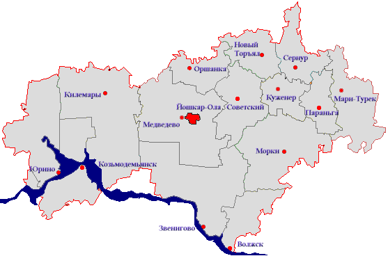
Mary_El_map.png (557 × 368 pixels, file size: 31 KB, MIME type: image/png)
Captions
Captions
Add a one-line explanation of what this file represents

|
This locator map image could be re-created using vector graphics as an SVG file. This has several advantages; see Commons:Media for cleanup for more information. If an SVG form of this image is available, please upload it and afterwards replace this template with
{{vector version available|new image name}}.
It is recommended to name the SVG file “Mary El map.svg”—then the template Vector version available (or Vva) does not need the new image name parameter. |
Summary
| Description |
Русский: Карта Марий Эл |
| Date | |
| Source | Transferred from ru.wikipedia |
| Author | Torin at ru.wikipedia |
| Permission (Reusing this file) |
Released into the public domain (by the author) |
Licensing
| |
This work has been released into the public domain by its author, Torin, at the English Wikipedia project. This applies worldwide. In case this is not legally possible: |
Original upload log
Original description page is/was here. All user names refer to ru.wikipedia:
- 2006-10-30 10:19 Torin 557×368×8 (32254 bytes) {{Изображение |Название = Карта Марий Эл |Описание = карта |Автор = Torin |Время создания = 30 октября 2006 |Источник = Источник |Лицензия = {{PD-user|Torin
File history
Click on a date/time to view the file as it appeared at that time.
| Date/Time | Thumbnail | Dimensions | User | Comment | |
|---|---|---|---|---|---|
| current | 17:23, 31 March 2007 | | 557 × 368 (31 KB) | Electionworld (talk | contribs) | {{Information |Description={{Изображение |Название = Карта Марий Эл |Описание = карта |Автор = Torin |Время создания = 30 октября 2006 |Источник = Источник |Лиц� |
You cannot overwrite this file.
File usage on Commons
The following page uses this file:
File usage on other wikis
The following other wikis use this file:
- Usage on be-tarask.wikipedia.org
- Usage on cv.wikipedia.org
- Usage on pl.wikipedia.org
- Usage on tr.wikipedia.org
- Usage on uk.wikipedia.org

Recent Comments