
How Can We Help?
Size of this preview: 594 × 599 pixels. Other resolutions: 238 × 240 pixels | 476 × 480 pixels | 761 × 768 pixels | 1,015 × 1,024 pixels | 2,030 × 2,048 pixels | 5,257 × 5,303 pixels.
Original file (5,257 × 5,303 pixels, file size: 9.42 MB, MIME type: image/jpeg)
Captions
Captions
Add a one-line explanation of what this file represents
Summary
| Description |
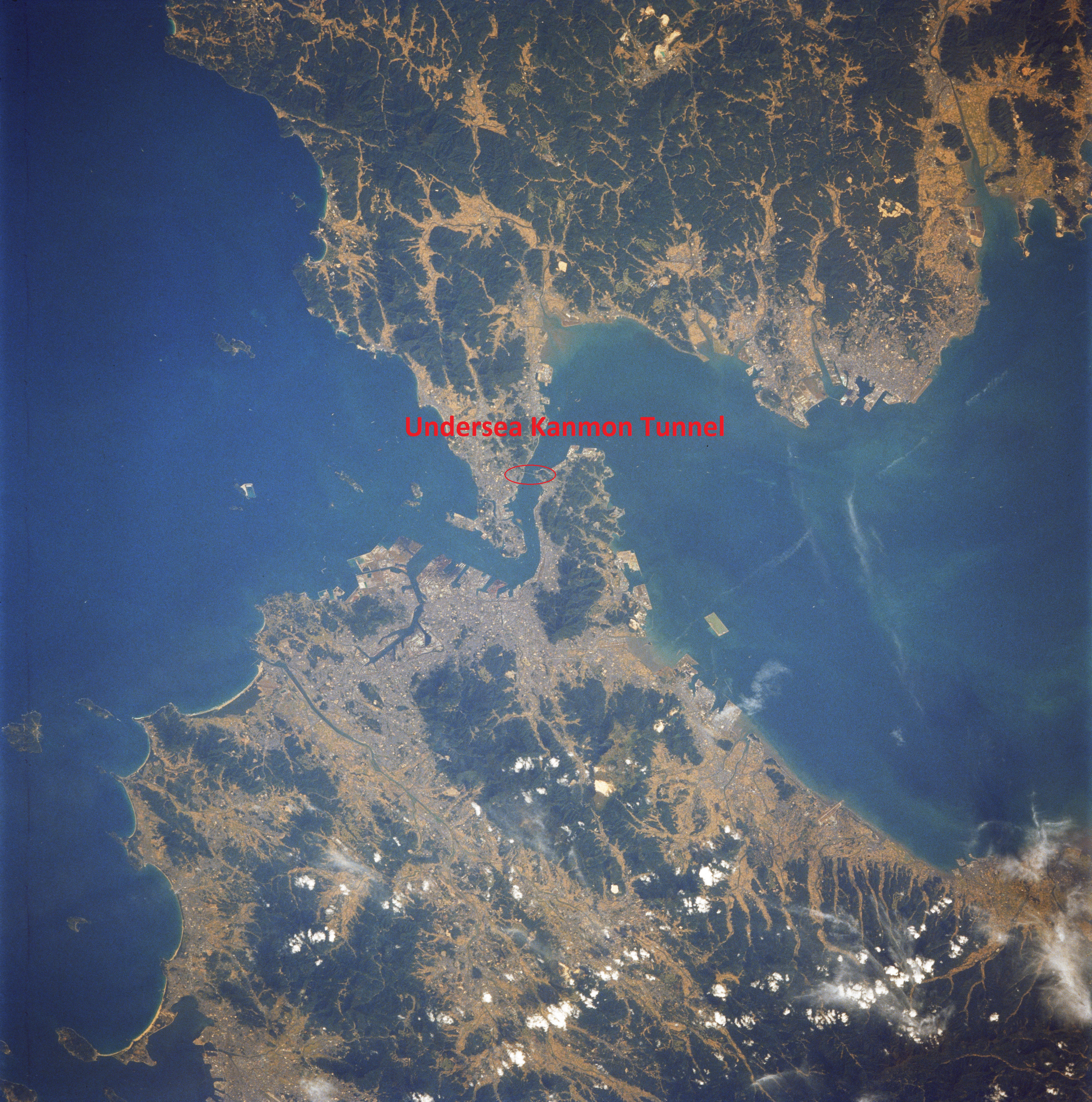
English: Kanmon Tunnel, the first undersea tunnel in Japan. |
| Date | |
| Source | Own work |
| Author | Masgatotkaca |
| Camera location | | View this and other nearby images on: OpenStreetMap |
|---|
located undersea between Honshu and Kyushu islands (Mojiko town on Kyushu side)
Licensing
I, the copyright holder of this work, hereby publish it under the following license:
This file is licensed under the Creative Commons Attribution-Share Alike 4.0 International license.
- You are free:
- to share – to copy, distribute and transmit the work
- to remix – to adapt the work
- Under the following conditions:
- attribution – You must give appropriate credit, provide a link to the license, and indicate if changes were made. You may do so in any reasonable manner, but not in any way that suggests the licensor endorses you or your use.
- share alike – If you remix, transform, or build upon the material, you must distribute your contributions under the same or compatible license as the original.
File history
Click on a date/time to view the file as it appeared at that time.
| Date/Time | Thumbnail | Dimensions | User | Comment | |
|---|---|---|---|---|---|
| current | 23:07, 14 October 2023 | | 5,257 × 5,303 (9.42 MB) | Masgatotkaca (talk | contribs) | Uploaded own work with UploadWizard |
You cannot overwrite this file.
File usage on Commons
There are no pages that use this file.
File usage on other wikis
The following other wikis use this file:
- Usage on en.wikipedia.org
- Usage on zh.wikipedia.org

Recent Comments