How Can We Help?
You are here:
< Back
Size of this preview: 800 × 600 pixels. Other resolutions: 320 × 240 pixels | 640 × 480 pixels | 1,024 × 768 pixels | 1,280 × 960 pixels | 2,560 × 1,920 pixels | 4,054 × 3,040 pixels.
Original file (4,054 × 3,040 pixels, file size: 5.44 MB, MIME type: image/jpeg)
File information
Structured data
Captions
Summary
DescriptionAussichtsturm Burgholzhof-03-Infotafel.jpg |
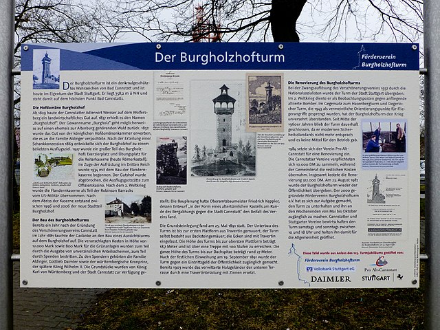
Deutsch: Aussichtsturm Burgholzhof; Informationstafel neben dem Turm |
Date | |
Source | Own work |
Author | Muck |
Camera location | 48° 49′ 07.31″ N, 9° 11′ 40.1″ E | View this and other nearby images on: OpenStreetMap | 48.818697; 9.194472 |
---|
Licensing
I, the copyright holder of this work, hereby publish it under the following license:
This file is licensed under the Creative Commons Attribution-Share Alike 4.0 International license.
- You are free:
- to share – to copy, distribute and transmit the work
- to remix – to adapt the work
- Under the following conditions:
- attribution – You must give appropriate credit, provide a link to the license, and indicate if changes were made. You may do so in any reasonable manner, but not in any way that suggests the licensor endorses you or your use.
- share alike – If you remix, transform, or build upon the material, you must distribute your contributions under the same or compatible license as the original.
File history
Click on a date/time to view the file as it appeared at that time.
Date/Time | Thumbnail | Dimensions | User | Comment | |
---|---|---|---|---|---|
current | 16:13, 20 March 2018 | 4,054 × 3,040 (5.44 MB) | Muck50 (talk | contribs) | User created page with UploadWizard |
You cannot overwrite this file.
File usage on Commons
There are no pages that use this file.
Metadata
This file contains additional information such as Exif metadata which may have been added by the digital camera, scanner, or software program used to create or digitize it. If the file has been modified from its original state, some details such as the timestamp may not fully reflect those of the original file. The timestamp is only as accurate as the clock in the camera, and it may be completely wrong.
Camera manufacturer | Panasonic |
---|---|
Camera model | DMC-TZ31 |
Exposure time | 1/160 sec (0.00625) |
F-number | f/3.7 |
ISO speed rating | 100 |
Date and time of data generation | 16:13, 10 March 2018 |
Lens focal length | 6.1 mm |
Latitude | 48° 49′ 7.31″ N |
Longitude | 9° 11′ 40.1″ E |
Horizontal resolution | 240 dpi |
Vertical resolution | 240 dpi |
Software used | Adobe Photoshop Lightroom 3.6 (Windows) |
File change date and time | 17:06, 20 March 2018 |
Exposure Program | Normal program |
Exif version | 2.3 |
Date and time of digitizing | 16:13, 10 March 2018 |
APEX shutter speed | 7.321928 |
APEX aperture | 3.775051 |
APEX exposure bias | 0 |
Maximum land aperture | 3.7734375 APEX (f/3.7) |
Metering mode | Pattern |
Light source | Unknown |
Flash | Flash did not fire, compulsory flash suppression |
Sensing method | One-chip color area sensor |
File source | Digital still camera |
Scene type | A directly photographed image |
Custom image processing | Normal process |
Exposure mode | Auto exposure |
White balance | Auto white balance |
Digital zoom ratio | 0 |
Focal length in 35 mm film | 34 mm |
Scene capture type | Standard |
Scene control | None |
Contrast | Normal |
Saturation | Normal |
Sharpness | Normal |
GPS time (atomic clock) | 15:13 |
Receiver status | Measurement in progress |
Measurement mode | 2-dimensional measurement |
Measurement precision | Poor (2.8) |
Geodetic survey data used | WGS-84 |
Name of GPS area | Aussichtsturm Burgholzhof |
GPS date | 10 March 2018 |
GPS tag version | 0.0.3.2 |
Y and C positioning | Co-sited |
Supported Flashpix version | 1 |
Color space | sRGB |
Image compression mode | 4 |
Date metadata was last modified | 18:06, 20 March 2018 |
Unique ID of original document | xmp.did:53958559562CE811B74996BE7A2760DD |
IIM version | 4 |
Structured data
Items portrayed in this file
depicts
creator
some value
object has role: photographer
author name string: Muck
Wikimedia username: Muck50
copyright status
copyrighted
copyright license
Creative Commons Attribution-ShareAlike 4.0 International
inception
10 March 2018
coordinates of the point of view
48°49'7.309"N, 9°11'40.099"E
source of file
original creation by uploader
media type
image/jpeg
checksum
5b688c1f02cb9e378104fc396e488114490dd929
determination method: SHA-1
data size
5,701,254 byte
height
3,040 pixel
width
4,054 pixel
Categories
-
Annuals36
-
Bulbs, Corms & Tubers41
-
Ferns27
-
Fruits3
-
Garden Plants23
-
Grasses26
-
Herb17
-
Insects1
-
Mammals1
-
Midwest Native Plants0
-
Northeast Native Plants112
-
Perennials123
-
Rose1
-
Shrubs47
-
Trees112
-
Tropical Plants53
-
Upland Birds5
-
Vines18
-
Viola Tricolor1
-
Water Gardening & Plants9
-
Waterfowl0
-
Wetland Birds0
-
Wetland Plants4
-
Wildbirds172
-
Wildflowers1
-
Woodland Plants29
Table of Contents
Recent Comments