
Original file (3,264 × 2,448 pixels, file size: 3.64 MB, MIME type: image/jpeg)
Captions
Captions
Summary
| Description |
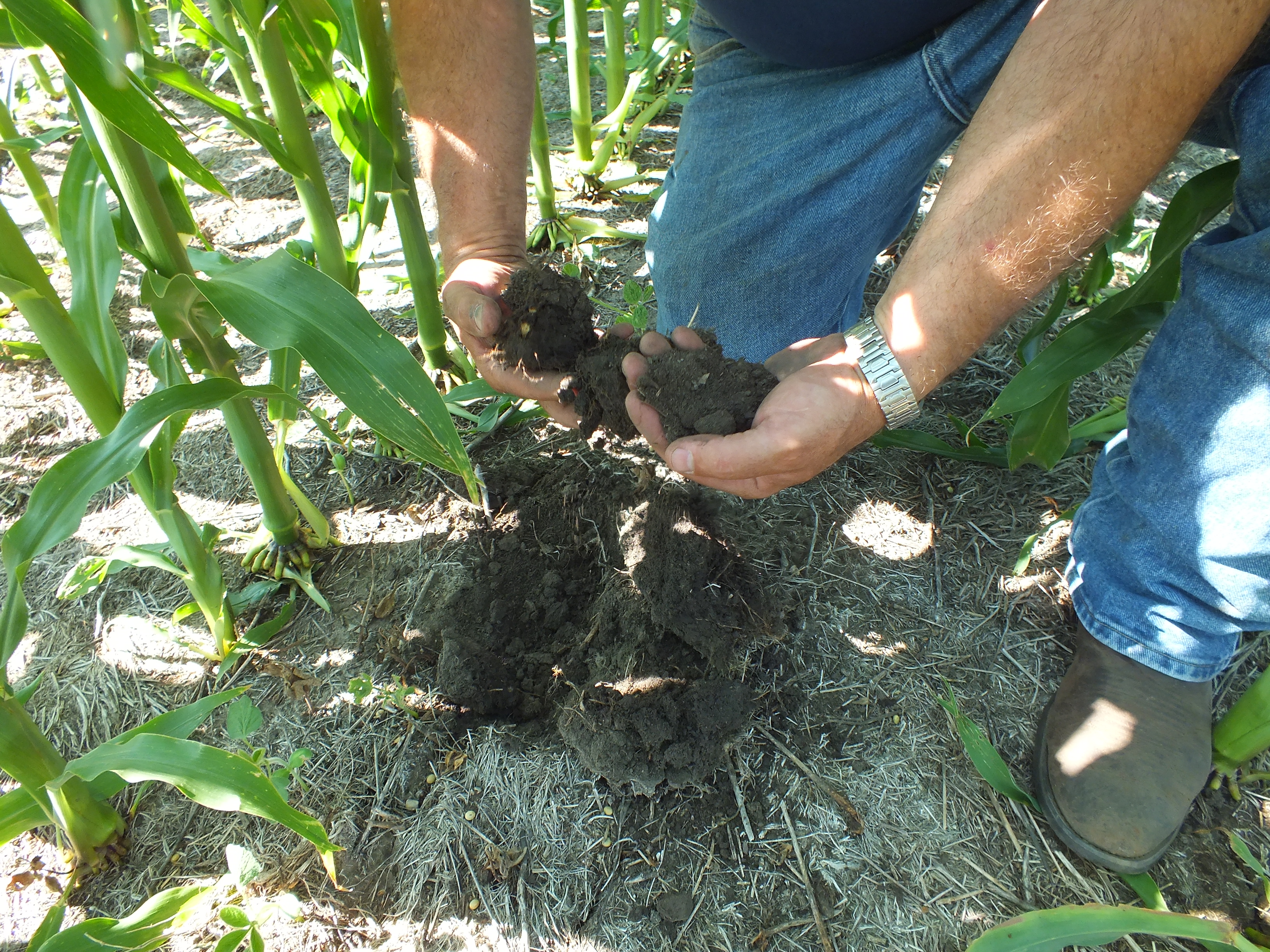
Field Day at the Southeast South Dakota Research Farm near Beresford, SD. In this photo, a research section at the farm has a four-year rotation study with half the fields under a conventional and half under a no-till farming system. The structure of the topsoil from the no-till field plot (shown left) has better biological activity and is more healthy than the powdery topsoil found in the conventional plot (shown right). The infiltration rates were much better in the no-till plots than the conventional. For information about the Southeast South Dakota Research Farm and the research being conducted there, contact either Dr. Peter Sexton or Ruth Stevens: Dr. Sexton Peter Associate Professor SDSU Dept. of Plant Science Plant Science-Box 2207A Brookings, SD 57007 (605) 688-6179 peter.sexton@sdstate.edu Ruth Stevens SDSU – Southeast Research Farm 29974 University Road Beresford, SD 57004 (605) 563-2989 ruth.stevens@sdstate.edu For information regarding conservation, the Rainfall Simulator, infiltration studies and soil health in South Dakota, contact: Jeffrey Hemenway USDA Natural Resources Conservation Service Soil Quality Specialist 200 Fourth St. SW Huron, SD 57350 Office: (605) 352-1239 Jeffery.hemeway@sd.usda.gov |
| Date | |
| Source | 4YrSoilStructure020 |
| Author | USDA NRCS South Dakota |
| Camera location | | View this and other nearby images on: OpenStreetMap |
|---|
Licensing
- You are free:
- to share – to copy, distribute and transmit the work
- to remix – to adapt the work
- Under the following conditions:
- attribution – You must give appropriate credit, provide a link to the license, and indicate if changes were made. You may do so in any reasonable manner, but not in any way that suggests the licensor endorses you or your use.
- share alike – If you remix, transform, or build upon the material, you must distribute your contributions under the same or compatible license as the original.
| This image was originally posted to Flickr by USDA NRCS South Dakota at https://flickr.com/photos/68847506@N08/9272971112 (archive). It was reviewed on 27 January 2018 by FlickreviewR 2 and was confirmed to be licensed under the terms of the cc-by-sa-2.0. |
| This image is a work of the Natural Resources Conservation Service, part of the United States Department of Agriculture, taken or made as part of an employee's official duties. As a work of the U.S. federal government, the image is in the public domain in the United States. |
File history
Click on a date/time to view the file as it appeared at that time.
| Date/Time | Thumbnail | Dimensions | User | Comment | |
|---|---|---|---|---|---|
| current | 13:47, 27 January 2018 | | 3,264 × 2,448 (3.64 MB) | Artix Kreiger 2 (talk | contribs) | Transferred from Flickr via Flickr2Commons |
You cannot overwrite this file.
File usage on Commons
There are no pages that use this file.

.jpg¶ms=043.043544_N_-096.904327_E_globe:Earth_type:camera_source:Flickr_&language=en)
Recent Comments