

Original file (3,802 × 3,042 pixels, file size: 3.08 MB, MIME type: image/jpeg)
Captions
Captions
Summary
| Description |
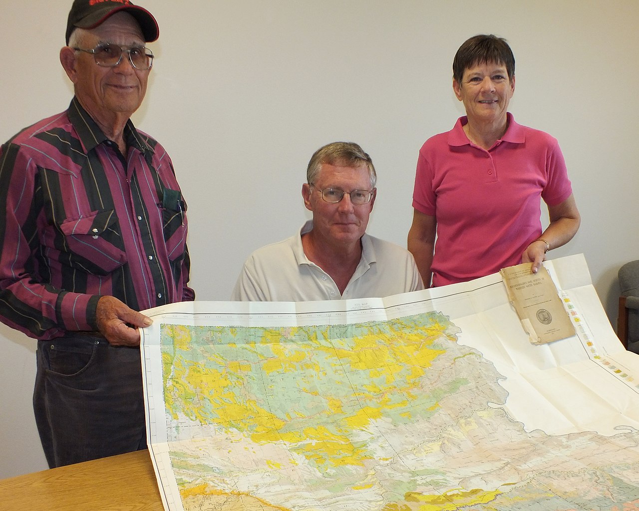
(group of five images) Deb Shiefelbein was doing some historical renovation work in the old Sansarc School in Ft. Pierre, SD, when she came across a soil survey map of western South Dakota from 1909. Deb salvaged the document and brought it to the USDA office. The map is in fantastic condition and the colors are terrific! Thank you, Deb, for recovering and sharing this amazing piece of history! The text below is from the inside of the front cover. The U.S. Department of Agriculture publication is titled “Reconnaissance Soil Survey of Western South Dakota” and was issued February 25, 1911 by the Bureau of Soils – Milton Whitney, Chief. in cooperation with the South Dakota Agricultural Experiment Station, James W. Wilson, Director; Clifford Willis, Agronomist. The map was initiated in 1905 and produced by the Field Operations of the United States Bureau of Soils in 1909 by George N. Coffey and Party, Washington: Government Printing Office. 1911. Public Resolution – No. 9. JOINT RESOLUTION amending public resolution numbered eight, Fifty-sixth Congress, second session, approved February twenty-third, nineteen hundred and one, “providing for the printing annually of the report on field operations of the Division of Soils, Department of Agriculture.” Resolved by the Senate and House of Representatives of the United States of America in Congress assembled, That public resolution numbered eight, Fifty-sixth Congress, second session, approved February twenty-third, nineteen hundred and one, be is amended by striking out all after the resolving clause and inserting in lieu thereof the following: That there shall be printed ten thousand five hundred copies of the report on field operations of the Divisions of Soils, Department of Agriculture, of which one thousand five hundred copies shall be for the use of the Senate, three thousand copies for the use of the House of Representatives, and six thousand copies for the use of the Department of Agriculture: Provided, That in addition to the number of copies above the provided for there shall be printed, as soon as the manuscript can be prepared, with the necessary maps and illustrations ot accompany it, a report on each area surveyed, in the form of advance sheets, bound in paper covers, of which five hundred copies shall be for the use of each Senator from the State, two thousand copies for the use of each Representative for the Congressional district or districts in which the survey is made, and one thousand copies for the use of the Department of Agriculture. Approved March 14, 1904. [On July 1, 1901, the Division of Soils was reorganized as the Bureau of Soils.]
Submitted by April Boltjes, Soil Conservationist, USDA NRCS, Pierre, SD. The 1911 Reconnaissance Soil Survey of Western South Dakota is now available online at www.nrcs.usda.gov/wps/portal/nrcs/surveylist/soils/survey.... Please note that the bookmarks that allow access to the soil map are not visible in all configurations of browsers and pdf readers. If you have problems finding the soil map, use Internet Explorer with the Adobe Acrobat Reader plugin. Alternatively, you can use other browsers (e.g. Firefox, Chrome) by following the directions at helpx.adobe.com/acrobat/using/display-pdf-browser-acrobat.... Also note that the soil map is large (20 MB) and may therefore take a longer-than-expected amount of time to download. www.nrcs.usda.gov/Internet/FSE_MANUSCRIPTS/south_dakota/r... |
| Date | |
| Source | 100+ Year-Old Soils Map Found in South Dakota |
| Author | USDA NRCS South Dakota |
Licensing
- You are free:
- to share – to copy, distribute and transmit the work
- to remix – to adapt the work
- Under the following conditions:
- attribution – You must give appropriate credit, provide a link to the license, and indicate if changes were made. You may do so in any reasonable manner, but not in any way that suggests the licensor endorses you or your use.
- share alike – If you remix, transform, or build upon the material, you must distribute your contributions under the same or compatible license as the original.
| This image was originally posted to Flickr by USDA NRCS South Dakota at https://flickr.com/photos/68847506@N08/14641521586 (archive). It was reviewed on 27 January 2018 by FlickreviewR 2 and was confirmed to be licensed under the terms of the cc-by-sa-2.0. |
| This image is a work of the Natural Resources Conservation Service, part of the United States Department of Agriculture, taken or made as part of an employee's official duties. As a work of the U.S. federal government, the image is in the public domain in the United States. |
File history
Click on a date/time to view the file as it appeared at that time.
| Date/Time | Thumbnail | Dimensions | User | Comment | |
|---|---|---|---|---|---|
| current | 05:08, 27 January 2018 | | 3,802 × 3,042 (3.08 MB) | Artix Kreiger 2 (talk | contribs) | Transferred from Flickr via Flickr2Commons |
You cannot overwrite this file.
File usage on Commons
There are no pages that use this file.

Recent Comments