
How Can We Help?
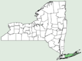
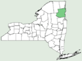
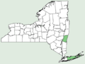
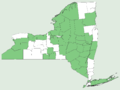
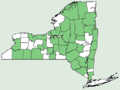
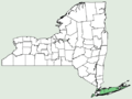
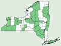
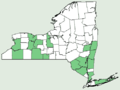
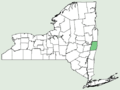
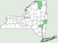
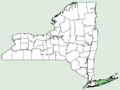
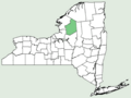
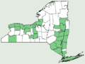
English: United States Department of Agriculture—USDA Natural Resources Conservation Service distribution maps of the Flora of New York.
- These maps are from the USDA Natural Resources Conservation Service PLANTS Database (www.plants.usda.gov/java/).
- Note
- The USDA PLANTS Database contains the disclaimer:
- Our county data are based primarily on the literature, herbarium specimens, and confirmed observations. However, not all populations have been documented, so some gaps in the distribution shown above may not be real.
- Remember that only native and naturalized populations are mapped.
- These maps have been modified from the originals as follows:
- Width was reduced from 600px to 500px by reducing horizontal resolution (to remove stretch).
- Height was reduced from 450px to 375px by cropping the "PLANTS Database" logo from the bottom and taking a little off the top to center the map vertically.
- Format was changed from JPEG to 8-color indexed PNG with no dithering, as a quick way to get rid of the more obvious high-compression JPEG artifacts in the original, while reducing file size.
- This mode change usually, but not always, results in the field colors RGB(225-235-224) and (121-204-132). The very rare obvious deviations have been fixed.
- More recent maps have been converted to the indexed mode using the fixed color table:
00 00 00   FF FF FF   82 CC 82   E0 EB E0
33 33 33   66 66 66   99 99 99   CC CC CC
- This precludes the rare occasions of a missing color (like when the only reports of a plant have been from ballast piles in The Bronx).
Pages in category "NRCS New York (state) distribution maps"
The following 13 pages are in this category, out of 13 total.
- NRCS New York distribution maps
- NRCS New York distribution maps - Equisetales…Salviniales
- NRCS New York distribution maps - Pinales
- NRCS New York distribution maps - Dioscoreales…Liliales
- NRCS New York distribution maps - Fabales
- NRCS New York distribution maps - Rosales
- NRCS New York distribution maps - Violales
- NRCS New York distribution maps - Myrtales…Crossosomatales
- NRCS New York distribution maps - Sapindales
- NRCS New York distribution maps - Malvales
- NRCS New York distribution maps - Solanales
- NRCS New York distribution maps - Lamiales
- NRCS New York distribution maps - Asterales
Media in category "NRCS New York (state) distribution maps"
The following 200 files are in this category, out of 1,648 total.
(previous page) (next page)-
 Abies balsamea NY-dist-map.png 2,000 × 1,500; 62 KB
-
 Abies magnifica NY-dist-map.png 2,000 × 1,500; 64 KB
-
 Abutilon theophrasti NY-dist-map.png 2,000 × 1,500; 62 KB
-
 Acanthospermum hispidum NY-dist-map.png 2,000 × 1,500; 64 KB
-
 Acer campestre NY-dist-map.png 2,000 × 1,500; 64 KB
-
 Acer ginnala NY-dist-map.png 2,000 × 1,500; 64 KB
-
 Acer negundo var negundo NY-dist-map.png 2,000 × 1,500; 62 KB
-
 Acer negundo var violaceum NY-dist-map.png 2,000 × 1,500; 64 KB
-
 Acer nigrum NY-dist-map.png 500 × 375; 14 KB
-
 Acer palmatum NY-dist-map.png 500 × 375; 12 KB
-
 Acer pensylvanicum NY-dist-map.png 500 × 375; 13 KB
-
 Acer platanoides NY-dist-map.png 500 × 375; 13 KB
-
 Acer pseudoplatanus NY-dist-map.png 500 × 375; 13 KB
-
 Acer rubrum var rubrum NY-dist-map.png 500 × 375; 14 KB
-
 Acer rubrum var trilobum NY-dist-map.png 500 × 375; 13 KB
-
 Acer saccharinum NY-dist-map.png 500 × 375; 14 KB
-
 Acer saccharum var saccharum NY-dist-map.png 500 × 375; 12 KB
-
 Acer spicatum NY-dist-map.png 500 × 375; 14 KB
-
 Acer × freemanii NY-dist-map.png 500 × 375; 18 KB
-
 Achillea ageratum NY-dist-map.png 500 × 375; 15 KB
-
 Achillea distans NY-dist-map.png 500 × 375; 15 KB
-
 Achillea filipendulina NY-dist-map.png 500 × 375; 11 KB
-
 Achillea ligustica NY-dist-map.png 500 × 375; 15 KB
-
 Achillea millefolium var millefolium NY-dist-map.png 500 × 375; 12 KB
-
 Achillea millefolium var nigrescens NY-dist-map.png 500 × 375; 15 KB
-
 Achillea millefolium var occidentalis NY-dist-map.png 500 × 375; 11 KB
-
 Achillea nobilis NY-dist-map.png 500 × 375; 15 KB
-
 Achillea ptarmica NY-dist-map.png 500 × 375; 11 KB
-
 Aconitum noveboracense NY-dist-map.png 500 × 375; 11 KB
-
 Acorus americanus NY-dist-map.png 500 × 375; 14 KB
-
 Acorus calamus NY-dist-map.png 500 × 375; 13 KB
-
 Actinidia polygama NY-dist-map.png 500 × 375; 18 KB
-
 Adiantum pedatum NY-dist-map.png 500 × 375; 15 KB
-
 Adonis aestivalis NY-dist-map.png 500 × 375; 12 KB
-
 Adonis vernalis NY-dist-map.png 500 × 375; 11 KB
-
 Adoxa moschatellina NY-dist-map.png 500 × 375; 11 KB
-
 Aegilops crassa NY-dist-map.png 500 × 375; 11 KB
-
 Aegopodium podagraria NY-dist-map.png 500 × 375; 13 KB
-
 Aesculus glabra var glabra NY-dist-map.png 500 × 375; 16 KB
-
 Aesculus hippocastanum NY-dist-map.png 500 × 375; 13 KB
-
 Aethusa cynapium NY-dist-map.png 500 × 375; 13 KB
-
 Agalinis acuta NY-dist-map.png 500 × 375; 13 KB
-
 Agalinis auriculata NY-dist-map.png 500 × 375; 17 KB
-
 Agalinis fasciculata NY-dist-map.png 500 × 375; 13 KB
-
 Agalinis maritima var maritima NY-dist-map.png 500 × 375; 13 KB
-
 Agalinis paupercula var borealis NY-dist-map.png 500 × 375; 13 KB
-
 Agalinis paupercula var paupercula NY-dist-map.png 500 × 375; 13 KB
-
 Agalinis purpurea NY-dist-map.png 500 × 375; 16 KB
-
 Agalinis setacea NY-dist-map.png 500 × 375; 13 KB
-
 Agalinis tenuifolia var macrophylla NY-dist-map.png 500 × 375; 17 KB
-
 Agalinis tenuifolia var parviflora NY-dist-map.png 500 × 375; 13 KB
-
 Agalinis tenuifolia var tenuifolia NY-dist-map.png 500 × 375; 14 KB
-
 Agastache nepetoides NY-dist-map.png 500 × 375; 11 KB
-
 Agrimonia eupatoria NY-dist-map.png 500 × 375; 12 KB
-
 Agrimonia gryposepala NY-dist-map.png 500 × 375; 13 KB
-
 Agrimonia parviflora NY-dist-map.png 500 × 375; 13 KB
-
 Agrimonia pubescens NY-dist-map.png 500 × 375; 13 KB
-
 Agrimonia rostellata NY-dist-map.png 500 × 375; 13 KB
-
 Agrimonia striata NY-dist-map.png 500 × 375; 14 KB
-
 Agropyron cristatum NY-dist-map.png 500 × 375; 11 KB
-
 Ailanthus altissima NY-dist-map.png 500 × 375; 13 KB
-
 Aira caryophyllea NY-dist-map.png 500 × 375; 11 KB
-
 Aira praecox NY-dist-map.png 500 × 375; 11 KB
-
 Ajuga genevensis NY-dist-map.png 500 × 375; 16 KB
-
 Ajuga reptans NY-dist-map.png 500 × 375; 13 KB
-
 Alcea rosea NY-dist-map.png 500 × 375; 11 KB
-
 Aletris farinosa NY-dist-map.png 500 × 375; 11 KB
-
 Alisma gramineum NY-dist-map.png 500 × 375; 13 KB
-
 Alisma subcordatum NY-dist-map.png 500 × 375; 13 KB
-
 Alisma triviale NY-dist-map.png 500 × 375; 13 KB
-
 All counties NY-dist-map.png 2,000 × 1,500; 59 KB
-
 Allium ampeloprasum NY-dist-map.png 500 × 375; 11 KB
-
 Allium canadense var canadense NY-dist-map.png 500 × 375; 11 KB
-
 Allium cepa NY-dist-map.png 500 × 375; 11 KB
-
 Allium cernuum var cernuum NY-dist-map.png 500 × 375; 11 KB
-
 Allium neapolitanum NY-dist-map.png 500 × 375; 12 KB
-
 Allium oleraceum NY-dist-map.png 500 × 375; 11 KB
-
 Allium paniculatum var paniculatum NY-dist-map.png 500 × 375; 12 KB
-
 Allium porrum NY-dist-map.png 500 × 375; 11 KB
-
 Allium schoenoprasum NY-dist-map.png 500 × 375; 15 KB
-
 Allium tricoccum var burdickii NY-dist-map.png 500 × 375; 11 KB
-
 Allium vineale NY-dist-map.png 500 × 375; 11 KB
-
 Althaea hirsuta NY-dist-map.png 500 × 375; 12 KB
-
 Althaea officinalis NY-dist-map.png 500 × 375; 11 KB
-
 Amaranthus cannabinus NY-dist-map.png 500 × 375; 11 KB
-
 Amaranthus retroflexus NY-dist-map.png 500 × 375; 11 KB
-
 Amaranthus tuberculatus NY-dist-map.png 500 × 375; 11 KB
-
 Ambrosia artemisiifolia NY-dist-map.png 500 × 375; 14 KB
-
 Ambrosia bidentata NY-dist-map.png 500 × 375; 17 KB
-
 Ambrosia trifida var trifida NY-dist-map.png 500 × 375; 11 KB
-
 Ambrosia × helenae NY-dist-map.png 500 × 375; 11 KB
-
 Amelanchier amabilis NY-dist-map.png 2,000 × 1,500; 64 KB
-
 Amelanchier arborea var arborea NY-dist-map.png 2,000 × 1,500; 62 KB
-
 Amelanchier bartramiana NY-dist-map.png 2,000 × 1,500; 63 KB
-
 Amelanchier canadensis NY-dist-map.png 2,000 × 1,500; 62 KB
-
 Amelanchier humilis NY-dist-map.png 2,000 × 1,500; 64 KB
-
 Amelanchier humilis × laevis NY-dist-map.png 2,000 × 1,500; 66 KB
-
 Amelanchier interior NY-dist-map.png 2,000 × 1,500; 64 KB
-
 Amelanchier intermedia NY-dist-map.png 2,000 × 1,500; 63 KB
-
 Amelanchier laevis NY-dist-map.png 2,000 × 1,500; 62 KB
-
 Amelanchier nantucketensis NY-dist-map.png 2,000 × 1,500; 64 KB
-
 Amelanchier sanguinea NY-dist-map.png 2,000 × 1,500; 62 KB
-
 Amelanchier spicata NY-dist-map.png 2,000 × 1,500; 63 KB
-
 Amerorchis rotundifolia NY-dist-map.png 500 × 375; 11 KB
-
 Amianthium muscitoxicum NY-dist-map.png 500 × 375; 11 KB
-
 Amorpha fruticosa NY-dist-map.png 500 × 375; 13 KB
-
 Ampelopsis brevipedunculata NY-dist-map.png 500 × 375; 13 KB
-
 Amsonia tabernaemontana var tabernaemontana NY-dist-map.png 500 × 375; 11 KB
-
 Anaphalis margaritacea NY-dist-map.png 500 × 375; 14 KB
-
 Andromeda polifolia var glaucophylla NY-dist-map.png 500 × 375; 11 KB
-
 Andropogon gerardii NY-dist-map.png 500 × 375; 11 KB
-
 Andropogon glomeratus var glomeratus NY-dist-map.png 500 × 375; 11 KB
-
 Androsace maxima NY-dist-map.png 500 × 375; 11 KB
-
 Anemone acutiloba NY-dist-map.png 500 × 375; 11 KB
-
 Anemone americana NY-dist-map.png 500 × 375; 11 KB
-
 Anemone canadensis NY-dist-map.png 500 × 375; 11 KB
-
 Anemone cylindrica NY-dist-map.png 500 × 375; 11 KB
-
 Anemone multifida var multifida NY-dist-map.png 500 × 375; 11 KB
-
 Anemone quinquefolia var quinquefolia NY-dist-map.png 500 × 375; 11 KB
-
 Anemone virginiana var alba NY-dist-map.png 500 × 375; 11 KB
-
 Anemone virginiana var cylindroidea NY-dist-map.png 500 × 375; 12 KB
-
 Anemone virginiana var virginiana NY-dist-map.png 500 × 375; 11 KB
-
 Anethum graveolens NY-dist-map.png 500 × 375; 13 KB
-
 Angelica atropurpurea NY-dist-map.png 500 × 375; 14 KB
-
 Angelica lucida NY-dist-map.png 500 × 375; 17 KB
-
 Angelica venenosa NY-dist-map.png 500 × 375; 13 KB
-
 Anthemis arvensis NY-dist-map.png 500 × 375; 11 KB
-
 Anthemis cotula NY-dist-map.png 500 × 375; 12 KB
-
 Anthoxanthum monticola ssp monticola NY-dist-map.png 500 × 375; 11 KB
-
 Anthriscus sylvestris NY-dist-map.png 500 × 375; 11 KB
-
 Antirrhinum majus NY-dist-map.png 500 × 375; 12 KB
-
 Apium graveolens NY-dist-map.png 500 × 375; 17 KB
-
 Apocynum androsaemifolium NY-dist-map.png 500 × 375; 11 KB
-
 Apocynum × floribundum NY-dist-map.png 500 × 375; 11 KB
-
 Arctium lappa NY-dist-map.png 500 × 375; 13 KB
-
 Arctium minus NY-dist-map.png 500 × 375; 14 KB
-
 Arctium tomentosum NY-dist-map.png 500 × 375; 16 KB
-
 Arctium vulgare ssp nemorosum NY-dist-map.png 500 × 375; 13 KB
-
 Argemone albiflora NY-dist-map.png 500 × 375; 14 KB
-
 Argemone mexicana NY-dist-map.png 500 × 375; 11 KB
-
 Arisaema dracontium NY-dist-map.png 500 × 375; 13 KB
-
 Arisaema triphyllum ssp pusillum NY-dist-map.png 500 × 375; 13 KB
-
 Arisaema triphyllum ssp stewardsonii NY-dist-map.png 500 × 375; 11 KB
-
 Arisaema triphyllum ssp triphyllum NY-dist-map.png 500 × 375; 11 KB
-
 Aristida adscensionis NY-dist-map.png 500 × 375; 17 KB
-
 Aristida basiramea NY-dist-map.png 500 × 375; 11 KB
-
 Aristida dichotoma var dichotoma NY-dist-map.png 500 × 375; 11 KB
-
 Aristolochia clematitis NY-dist-map.png 500 × 375; 13 KB
-
 Aristolochia macrophylla NY-dist-map.png 500 × 375; 13 KB
-
 Aristolochia serpentaria NY-dist-map.png 500 × 375; 13 KB
-
 Armoracia rusticana NY-dist-map.png 500 × 375; 11 KB
-
 Arnica lanceolata NY-dist-map.png 500 × 375; 11 KB
-
 Arnoglossum atriplicifolium NY-dist-map.png 500 × 375; 11 KB
-
 Arnoseris minima NY-dist-map.png 500 × 375; 13 KB
-
 Aronia arbutifolia NY-dist-map.png 2,000 × 1,500; 63 KB
-
 Aronia floribunda NY-dist-map.png 2,000 × 1,500; 63 KB
-
 Aronia melanocarpa NY-dist-map.png 2,000 × 1,500; 61 KB
-
 Artemisia abrotanum NY-dist-map.png 500 × 375; 14 KB
-
 Artemisia absinthium NY-dist-map.png 500 × 375; 11 KB
-
 Artemisia annua NY-dist-map.png 500 × 375; 11 KB
-
 Artemisia biennis var biennis NY-dist-map.png 500 × 375; 11 KB
-
 Artemisia campestris ssp borealis NY-dist-map.png 500 × 375; 11 KB
-
 Artemisia campestris ssp caudata NY-dist-map.png 500 × 375; 11 KB
-
 Artemisia carruthii NY-dist-map.png 500 × 375; 14 KB
-
 Artemisia dracunculus NY-dist-map.png 500 × 375; 14 KB
-
 Artemisia filifolia NY-dist-map.png 500 × 375; 12 KB
-
 Artemisia frigida NY-dist-map.png 500 × 375; 11 KB
-
 Artemisia ludoviciana ssp albula NY-dist-map.png 500 × 375; 11 KB
-
 Artemisia ludoviciana ssp ludoviciana NY-dist-map.png 500 × 375; 11 KB
-
 Artemisia ludoviciana var albula NY-dist-map.png 500 × 375; 11 KB
-
 Artemisia pontica NY-dist-map.png 500 × 375; 11 KB
-
 Artemisia serrata NY-dist-map.png 500 × 375; 11 KB
-
 Artemisia stelleriana NY-dist-map.png 500 × 375; 11 KB
-
 Artemisia tridentata ssp tridentata NY-dist-map.png 500 × 375; 14 KB
-
 Artemisia umbelliformis NY-dist-map.png 500 × 375; 12 KB
-
 Arthraxon hispidus NY-dist-map.png 500 × 375; 11 KB
-
 Arundinaria gigantea NY-dist-map.png 500 × 375; 17 KB
-
 Asarum canadense NY-dist-map.png 500 × 375; 11 KB
-
 Asclepias amplexicaulis NY-dist-map.png 500 × 375; 11 KB
-
 Asclepias exaltata NY-dist-map.png 500 × 375; 11 KB
-
 Asclepias incarnata ssp incarnata NY-dist-map.png 500 × 375; 11 KB
-
 Asclepias incarnata ssp pulchra NY-dist-map.png 500 × 375; 11 KB
-
 Asclepias quadrifolia NY-dist-map.png 500 × 375; 11 KB
-
 Asclepias syriaca NY-dist-map.png 500 × 375; 11 KB
-
 Asimina triloba NY-dist-map.png 500 × 375; 11 KB
-
 Asplenium bradleyi NY-dist-map.png 500 × 375; 13 KB
-
 Asplenium montanum NY-dist-map.png 500 × 375; 13 KB
-
 Asplenium platyneuron var platyneuron NY-dist-map.png 500 × 375; 14 KB
-
 Asplenium rhizophyllum NY-dist-map.png 500 × 375; 14 KB
-
 Asplenium ruta-muraria var cryptolepis NY-dist-map.png 500 × 375; 14 KB
-
 Asplenium scolopendrium var americanum NY-dist-map.png 500 × 375; 13 KB
-
 Asplenium trichomanes ssp quadrivalens NY-dist-map.png 500 × 375; 19 KB
-
 Asplenium trichomanes ssp trichomanes NY-dist-map.png 500 × 375; 14 KB
-
 Asplenium viride NY-dist-map.png 500 × 375; 19 KB
-
 Asplenium × ebenoides NY-dist-map.png 500 × 375; 13 KB
-
 Astilbe japonica NY-dist-map.png 500 × 375; 13 KB
-
 Atriplex dioica NY-dist-map.png 500 × 375; 11 KB
-
 Aureolaria flava var flava NY-dist-map.png 500 × 375; 11 KB
-
 Aureolaria flava var macrantha NY-dist-map.png 500 × 375; 11 KB
-
 Aureolaria pedicularia NY-dist-map.png 500 × 375; 13 KB


Recent Comments