
How Can We Help?
Subcategories
This category has only the following subcategory.
Media in category "Maps of Astrakhan Governorate"
The following 23 files are in this category, out of 23 total.
-
 (1834) Карта Астраханской Губернии.jpg 3,565 × 2,839; 1.76 MB
-
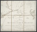 Allgemeine Post- und Strassen-Karte des Russischen Reichs in Europa 12.jpg 5,287 × 4,662; 5.83 MB
-
 Astrakhan Governorate (1913).png 4,925 × 4,616; 18.92 MB
-
 Astrakhan governorate 1823.jpg 4,896 × 4,758; 4.17 MB
-
 Astrakhan governorate 1823.png 4,896 × 4,758; 36.69 MB
-
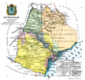
 Astrakhan gubernia.jpg 858 × 1,239; 130 KB
-
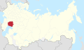 Astrakhan in Russian Empire (1914).svg 581 × 343; 310 KB
-
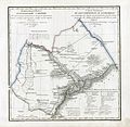
 Astrakhanskaia Governorate map (1808).jpg 1,146 × 912; 217 KB
-
 Atlas of Russian Empire (1800). Astrakhan governorate.jpg 8,858 × 7,271; 10.17 MB
-
 Brockhaus and Efron Encyclopedic Dictionary b3 359-0.jpg 1,716 × 2,478; 1.13 MB
-
-
 KartaZemelAstrakhanskogoKW.jpg 14,055 × 11,929; 13.73 MB
-
 Map 1857 Saratov and Astrakhan Province.png 3,763 × 2,897; 21.79 MB
-
 Map of Astrakhan Governorate, 1835.gif 1,426 × 1,860; 1.06 MB
-
 Map of railways in Russia, South-East, 1918.gif 1,135 × 966; 735 KB
-
 Russian Empire 1745 (Map X in Latin).jpg 7,448 × 6,562; 15.21 MB
-
 Russian Empire 1745 (Map XI in Latin).jpg 7,496 × 6,562; 15.16 MB
-
 RussianEmpireMap1800-37-AstrakhanskayaProvince.jpg 4,000 × 3,244; 1.75 MB
-
 Volga-1745.jpg 4,603 × 4,094; 4.3 MB
-
 Zemly Astrakhanskogo voyska 1911.jpg 2,786 × 3,753; 1.52 MB
-
 Калмыцкая степь (1864).jpg 9,164 × 9,349; 19.85 MB
-
 Карта Астраханской Губернии.jpg 4,896 × 4,758; 6.46 MB
-
 Карта волостей Астраханской губернии.jpg 1,966 × 2,743; 795 KB


Recent Comments