
How Can We Help?
- (en) Map
- (an) Mapa
- (ar) خريطة
- (as) মানচিত্র
- (ast) Mapa
- (bg) Карта
- (bn) মানচিত্র
- (bs) Karta
- (ca) Plànol
- (cs) Mapa
- (cy) Map
- (da) Kort (geografi)
- (de) Karte (Kartografie)
- (eo) Mapo
- (es) Mapa
- (et) Kaart (kartograafia)
- (fa) نقشه
- (fi) Kartta
- (fr) Carte géographique
- (gan) 地圖
- (gl) Mapa
- (he) מפה
- (hi) मानचित्र
- (hr) Karta
- (hu) Térkép
- (id) Peta
- (is) Kort
- (it) Mappa
- (ja) 地図
- (ka) გეოგრაფიული რუკა
- (ko) 지도
- (la) Tabula geographica
- (lb) Landkaart
- (lt) Žemėlapis
- (ml) ഭൂപടം
- (ms) Peta
- (nl) Kaart (cartografie)
- (nn) Kart
- (no) Kart
- (oc) Mapa
- (pl) Mapa
- (pt) Mapa
- (ro) Hartă
- (ru) Географическая карта
- (sa) Хаарта
- (sco) Cairt
- (si) ple:Map
- (sk) Mapa
- (sl) Zemljevid
- (sq) Harta
- (sr) Карта (мапа)
- (su) Atlas
- (sv) Karta
- (sw) Ramani
- (ta) நிலப்படம்
- (tg) Харита
- (th) แผนที่
- (tl) Mapa
- (tr) Harita
- (uk) Географічна карта
- (vi) Bản đồ
- (yi) מאפע
- (zh) 地图
- (zh-classical) 地圖
- (zh-yue) 地圖
Before changing or adding maps, please read the brief guideline on the organizational schema About this Category developed during an eight month effort by a working group in 2007–2008.
- See also maps needing categories in Category:Unidentified maps
- See also these related categories: (These categories may contain more maps. Please categorize them in map categories.)
- Category:Cartography – for map symbols, projections, etc.
- Category:Demography
- Category:Geography
- Category:Aerial photographs
- Category:Satellite pictures
- Category:Astronomical maps – maps and star charts
- Category:Cartographic reliefs for models of landscape profiles
Resources:
Subcategories
This category has the following 28 subcategories, out of 28 total.
Pages in category "Maps"
The following 5 pages are in this category, out of 5 total.
Media in category "Maps"
The following 200 files are in this category, out of 514 total.
(previous page) (next page)-
-

-
 371 of 'Histoire d'Hesdin' (11234373443).jpg 1,283 × 2,191; 593 KB
-
 371 of 'Les Guerres de la Révolution' (11184406285).jpg 5,604 × 5,033; 5.97 MB
-

-

-
 373 of 'History of the King's German Legion. (With plates.)' (11008526946).jpg 2,528 × 1,455; 786 KB
-

-
-

-

-
-
 377 of 'Journal et correspondance ... Publiés par W. G. Barttelot' (11212743175).jpg 2,487 × 2,119; 1.05 MB
-

-

-
 378 of 'Histoire de la guerre du Pacifique, 1879-1880 (1880-1881)' (11144615855).jpg 1,341 × 2,464; 592 KB
-
 378 of 'Lands, classical and sacred' (11024055956).jpg 1,247 × 1,959; 749 KB
-

-
 379 of 'Journal et correspondance ... Publiés par W. G. Barttelot' (11213975673).jpg 4,009 × 2,125; 1.89 MB
-

-
 4 colors.jpg 1,920 × 1,080; 460 KB
-

-
 Ahmar Laglalcha Map - 2021.jpg 1,471 × 1,054; 496 KB
-
 Algeria extradition treaties-ar.svg 2,754 × 1,398; 1.19 MB
-
 Alternative.Map.Bryansk.Oblast.png 1,200 × 933; 206 KB
-
 AmericanRevolutionaryWar.png 1,357 × 628; 35 KB
-
 Anshan-Stadt.jpg 2,484 × 941; 439 KB
-
 APERA Conference Locations.png 360 × 223; 26 KB
-
 Approximate map of Comancheria (borders in flux).png 359 × 399; 37 KB
-
 Ares Vallis Karte.jpg 1,080 × 1,439; 1.25 MB
-
 Barangay San Miguel, Lobo Map.png 1,624 × 1,343; 467 KB
-
 Barca map took by me.png 1,024 × 853; 690 KB
-
 Barrios y Comunas de Buenos Aires.jpg 800 × 815; 126 KB
-
 BASALDE MAPA.jpg 1,989 × 3,771; 1.03 MB
-
 Base para preparar mapa - no publicar.png 766 × 732; 518 KB
-
 Bat mappa.gif 430 × 507; 40 KB
-
 BAUNGON BMAP.jpg 582 × 791; 34 KB
-
 Binan Map.jpg 598 × 856; 80 KB
-
 Black Sea map lld.png 2,006 × 1,541; 748 KB
-
 BlankMap-World 16 April 2024.svg 2,754 × 1,398; 1.1 MB
-
 BlankMap-World-v6pt6 small states.svg 512 × 260; 804 KB
-
 BlankMap-World-with-Circles 17 April 2024.svg 2,754 × 1,398; 1.1 MB
-
 Blue Water Michigan Map.jpg 119 × 164; 30 KB
-
 Borghetto Battle Map 30May1796.JPG 720 × 586; 70 KB
-
 Boston Massachusetts US map vector svg free.svg 5,806 × 7,434; 7.77 MB
-
 Boudikka1-c6f5e4de5f8e5e9cd8179cc5ec80750b.jpg 837 × 789; 67 KB
-
 Bourgogne-Franche-Comté région.png 280 × 269; 27 KB
-
 Brabantse wouden kaart en legende-022.jpg 3,508 × 2,480; 613 KB
-
 Brain Maps.JPG 1,915 × 1,033; 340 KB
-
 Bristol 3rd District.svg 388 × 210; 59 KB
-
 Brooklyn census tracts by percent Black, 2020.svg 619 × 409; 480 KB
-
 BRUMMWAY.png 486 × 623; 110 KB
-
 Bulgaria 1994 CIA map Modifiziert Route.jpg 800 × 791; 1.2 MB
-
 Buxoro shahar hunarmandchilik markazlari.jpg 4,032 × 2,268; 2.35 MB
-
 Bản đồ huyện Xonbuly.png 480 × 300; 6 KB
-
 CapillaDelSauce 123.jpg 400 × 255; 52 KB
-
 Catamarca Provincia.jpg 1,221 × 1,722; 364 KB
-
 Centro de Endemismo Belém.png 456 × 451; 327 KB
-
 ChanuForges.jpg 2,829 × 2,109; 1.29 MB
-
 Chicago Portage National Historic Site.png 2,134 × 2,159; 1.41 MB
-
 Classification and Distribution Map of the Ngái Ethnic Group in Vietnam.jpg 1,280 × 720; 94 KB
-
 Cole's Map.png 1,633 × 821; 432 KB
-
 Commonwealth of Nations Map.png 7,192 × 3,318; 1.07 MB
-
 Communauté de communes Provence Verdon.png 674 × 599; 83 KB
-
 Convention on the Rights of the Child Map.svg 863 × 443; 1.54 MB
-
 Countries Most Affected by Hepatitis C in 2019.png 1,089 × 577; 329 KB
-
 Countries that recognise the state of Palestine (Finnish).png 4,767 × 6,000; 1.52 MB
-
 Courlans-Jura.jpg 1,930 × 1,929; 1.12 MB
-
 CrimeAnticipation.png 965 × 470; 689 KB
-
 Cucknells wood surrey map.jpg 1,799 × 2,250; 1.7 MB
-
 Dean Trust 2024 Map.png 801 × 431; 149 KB
-
 Deathswarsandgangwars.jpg 867 × 480; 224 KB
-
 Democracy in the world.png 483 × 850; 121 KB
-
 Dendermonde en deelgemeenten.png 934 × 657; 129 KB
-
 Detail of Anthony Hurdts map of Java, 1678.jpg 1,351 × 1,573; 788 KB
-
 Deustuko ondare kulturala.png 483 × 428; 480 KB
-
 Dhana-Governorate.png 1,080 × 1,080; 58 KB
-
 Diofwa.png 1,287 × 1,037; 327 KB
-
 Dispositif de traque-affût.png 1,001 × 669; 979 KB
-
 Distribution of the Acheulean cultural tradition as it is currently understood.webp 1,743 × 1,048; 239 KB
-
 District map of Anupgarh.jpg 1,080 × 610; 38 KB
-
 Divisao Administrativa de Ulongue.jpg 837 × 615; 114 KB
-
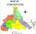 División territorial de Nueva Concepción.png 753 × 720; 168 KB
-
 DPC Complete Map cropped.jpg 5,544 × 3,826; 1.12 MB
-
 Drift.jpg 842 × 595; 33 KB
-
 Dyuktai Cave map location.png 785 × 647; 140 KB
-
 Dz 15 Bouarfa.png 1,024 × 1,024; 135 KB
-
 Députés des français de l'étranger XVIe législature.svg 512 × 260; 912 KB
-
 Détail des cantons du district de Toul tel que défini en 1789.jpg 1,570 × 2,409; 1.02 MB
-
 Easternpro.png 1,080 × 1,080; 63 KB
-
 ECSA-HC-Map.jpg 596 × 584; 65 KB
-
 Ekinops corporate presence.png 4,130 × 1,824; 1.32 MB
-
 Eleccions legislatives amb la plantilla infobox election.svg 2,754 × 1,398; 1.15 MB
-
 Elmanfy map.jpg 1,280 × 720; 182 KB
-
 Emplacement Caméra d'Arnaudin.jpg 1,237 × 559; 224 KB
-
 Emplacement Villas romaines Villers.jpg 1,509 × 1,404; 1.15 MB
-
 England Project Emily relief location map.jpg 754 × 792; 80 KB
-
 English Antalas Presence map.png 1,024 × 901; 214 KB
-
 Ernest.png 1,891 × 840; 302 KB
-
 Etats membres du Groupe Pompidou.jpg 6,457 × 3,269; 1.34 MB
-
 Etats membres du MedNet.jpg 4,093 × 2,095; 388 KB
-
 ETS 2 Map DLC.png 4,592 × 3,196; 1.56 MB
-
 ETS 2 Map.png 4,592 × 3,196; 1.54 MB
-
 EU air carrier restrictions map revised Feb 2022.png 2,754 × 1,398; 467 KB
-
 European Intervention Initiative map.png 1,920 × 1,468; 506 KB
-
 Evacuation-cost-map-based-on-land-use-and-slope.jpg 1,260 × 1,059; 1.66 MB
-
 Everett Smelter Contaminated Soil Cleanup Map.png 890 × 1,126; 366 KB
-
 Evergreen Map.png 861 × 626; 29 KB
-
 Exilien atlasbassinversantdetroisrivieres2015 2~2.jpg 1,232 × 1,272; 316 KB
-
 Exposure-left-and-relative-risk-right-map-for-infrastructure-roads-railways-pathways.png 1,831 × 1,329; 1.12 MB
-
 ExtremePuntenVlaanderen.png 1,102 × 458; 73 KB
-
 Falk Oberdorf Karte Bergkirchen.png 620 × 596; 59 KB
-
 Fascist France early map.png 450 × 456; 45 KB
-

-
 FINABEL Countries 2024.png 1,479 × 1,078; 439 KB
-
 First Sino-Japanese War - Chinese version.jpg 2,000 × 2,615; 407 KB
-
 Fogo Cruzado Mapa Grupos Armados 5.png 598 × 391; 254 KB
-
 Fort Irwin National Training Center USGS Map.jpg 1,230 × 1,304; 548 KB
-
 Fourth fol. (reverse) after title page (map of Vaucluse) LCCN2005692058.jpg 1,536 × 1,134; 468 KB
-
 Fourth World map.png 220 × 141; 35 KB
-
 Friendship park map 2019.01.03.pdf 1,275 × 1,650; 2.38 MB
-
 Frisian Norsemen Locator.png 446 × 499; 52 KB
-
 From Map of North America by Edward Wells, M.A. 1722 - NARA - 135841385.jpg 7,520 × 6,005; 1.9 MB
-
 From Map of North America by Thomas Jefferys 1782 - NARA - 135841387.jpg 7,552 × 6,004; 2.12 MB
-
 From Mud Lake Peak to Lassen's Meadows Reduced From Beckwith's Map - NARA - 93193311.jpg 4,720 × 3,228; 836 KB
-

-
 From U.S. Coast Survey Chart of the Gulf Coast of the United States - NARA - 122206749.jpg 6,856 × 5,897; 1.74 MB
-
 Ft-Heath-Map-1921.jpg 678 × 464; 133 KB
-
 G commonwealth g map.gif 800 × 400; 61 KB
-
 G11695.png 3,558 × 2,516; 9.2 MB
-
 Galabert projet Louis-Philippe-Ville.pdf 1,239 × 1,752; 290 KB
-
 Gaziantep Kahramanmaraş depremleri harita 2.jpg 3,933 × 2,002; 2.29 MB
-
 Geographic regions of Europe.png 6,300 × 3,499; 1.79 MB
-
 Geographical Coverage of IW.jpg 720 × 405; 44 KB
-
 Gibara 4979-II.jpg 4,684 × 4,243; 3.66 MB
-
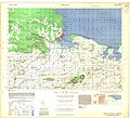
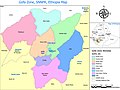 Gofa Zone Map 2.jpg 24,000 × 18,000; 15.14 MB
-
 Gomboc map.jpg 3,205 × 1,611; 339 KB
-
 Greats Migration african american's in USA 1910-1970.png 2,048 × 1,150; 744 KB
-
 Grenzen Naturschutzgebiet.png 832 × 999; 1.86 MB
-
 Hamilton Burlington Niagara (44th Parl).png 257 × 175; 8 KB
-
 Haplogroup-r1b-m269-asia.png 1,418 × 1,150; 2.12 MB
-
 Harispattuwa PS ward map.png 617 × 660; 241 KB
-
 Harispattuwa ward map.png 923 × 678; 207 KB
-
 Harta fizike e rrethit Tropoje.png 656 × 506; 431 KB
-
 Hartă.jpg 225 × 225; 6 KB
-
 Hazara Division Map and Jagirdars.jpg 1,080 × 1,710; 841 KB
-
 Hk416 map 2024 02 08.png 6,460 × 3,403; 2.24 MB
-
 Hotakid-Dynasty-1728.png 620 × 429; 232 KB
-
 IEA Family Map - Digital Blue 2022.png 5,394 × 2,698; 708 KB
-
 IHM שביל דרום הגולן.jpeg 1,600 × 1,267; 322 KB
-
 Image خريطة تقريبية لقرية ام الزينات عشية النكبة.png 2,550 × 3,507; 914 KB
-
 Indicator exilis range map.png 2,036 × 814; 158 KB
-
 Infog carte zad france.png 697 × 1,481; 489 KB
-
 Internationa Flight Route Map.gif 720 × 360; 67 KB
-
 International Recognition of the State of Palestine.png 7,000 × 4,192; 4.29 MB
-
 Islam World.png 1,920 × 848; 284 KB
-
 ISSP map june 2022.png 1,112 × 527; 129 KB
-
 JTWC Tropical Depression 04E (Four) warning map.gif 1,966 × 1,541; 78 KB
-
 JTWC Tropical Depression 05E (Five) map.gif 2,385 × 1,541; 101 KB
-
 Just for user I never cry.jpg 176 × 180; 12 KB
-
 Kadena and Yomitan, January to December 1945.png 2,418 × 1,144; 2.62 MB
-
 Karaca Dag Rivers.jpg 1,626 × 1,032; 269 KB
-
 KarooLamb Map.jpg 1,920 × 1,347; 285 KB
-
 Karta Ulug Ulus 1220.jpg 810 × 609; 97 KB
-
 Karta Ulug Ulus.jpg 811 × 594; 104 KB
-
 Karte Handelsweg Brandau rot.jpg 964 × 1,459; 288 KB
-
 Karte Handelsweg Brandau.jpg 964 × 1,459; 282 KB
-
 Kazakh Horde (Khanate) map.png 1,658 × 1,247; 150 KB
-
 Kec.pamenangselata.jpg 700 × 523; 62 KB
-
 Kecamatan244.jpg 467 × 486; 55 KB
-
 KempensDialectKaart.png 881 × 653; 29 KB
-
 KempensDialectKaartV2.png 800 × 593; 210 KB
-
 Kesselschlacht von Kamenez-Podolski (Hube-Kessel).png 2,470 × 1,245; 909 KB
-
 Khasavyurtovsky district locator map.svg 744 × 1,064; 481 KB
-
 Kinson map, highlighting Cunningham Crescent and Moorside Close.png 2,064 × 1,227; 2.1 MB
-
 Kraje, w których Answear jest obecny.png 18,879 × 13,318; 5.62 MB
-
 Land is missing within the red line.png 967 × 828; 852 KB
-
 Las Calles de las Mujeres.png 2,818 × 1,374; 658 KB
-
 Legality HHC EU (corrected legend) Map.png 4,592 × 3,196; 1.18 MB
-
 Legality HHC EU Map.png 4,592 × 3,196; 1.44 MB
-
 Legislation map.png 1,280 × 561; 229 KB
-
 Legislationmap.png 1,280 × 561; 288 KB
-
 LGBMap.jpg 1,506 × 1,699; 510 KB
-
 Libya Province Location.jpg 1,508 × 1,173; 279 KB
-
 Localisation Apsus Vallis.png 1,215 × 552; 1.63 MB
-
 Localisation des projets de George Masquet.jpg 1,870 × 1,322; 827 KB
-
 Localisation Machu Picchu Deflexion Abancay.png 597 × 898; 1.12 MB
-
 Localisation Meknassa VIIIe siècle.png 851 × 368; 41 KB
-
 Localización de Sosote en la Parroquia Sosote.jpg 610 × 705; 109 KB
-

-
 Locaties turborotondes wereldwijd.png 462 × 520; 573 KB
-
 Location map1.gif 361 × 292; 10 KB
-
 Location of teams in the 2019–20 PSL.png 508 × 438; 68 KB
-
 Location of teams in the 2020–21 PSL.png 564 × 482; 99 KB
-
 Location of teams in the 2021–22 PSL.jpg 447 × 384; 34 KB
-
 Location of the Pacaya River.png 850 × 1,191; 116 KB
-
 Location plan.webp 649 × 790; 77 KB
-
 Locator Kacamatan Kabangka.jpg 866 × 827; 195 KB
-
 Lược đồ căn cứ Trà Lũ, tại Nam Định.png 742 × 690; 108 KB
-
 M 6.3 Explosion - 22km ENE of Sungjibaegam, North Korea.png 1,429 × 1,014; 317 KB


Recent Comments