
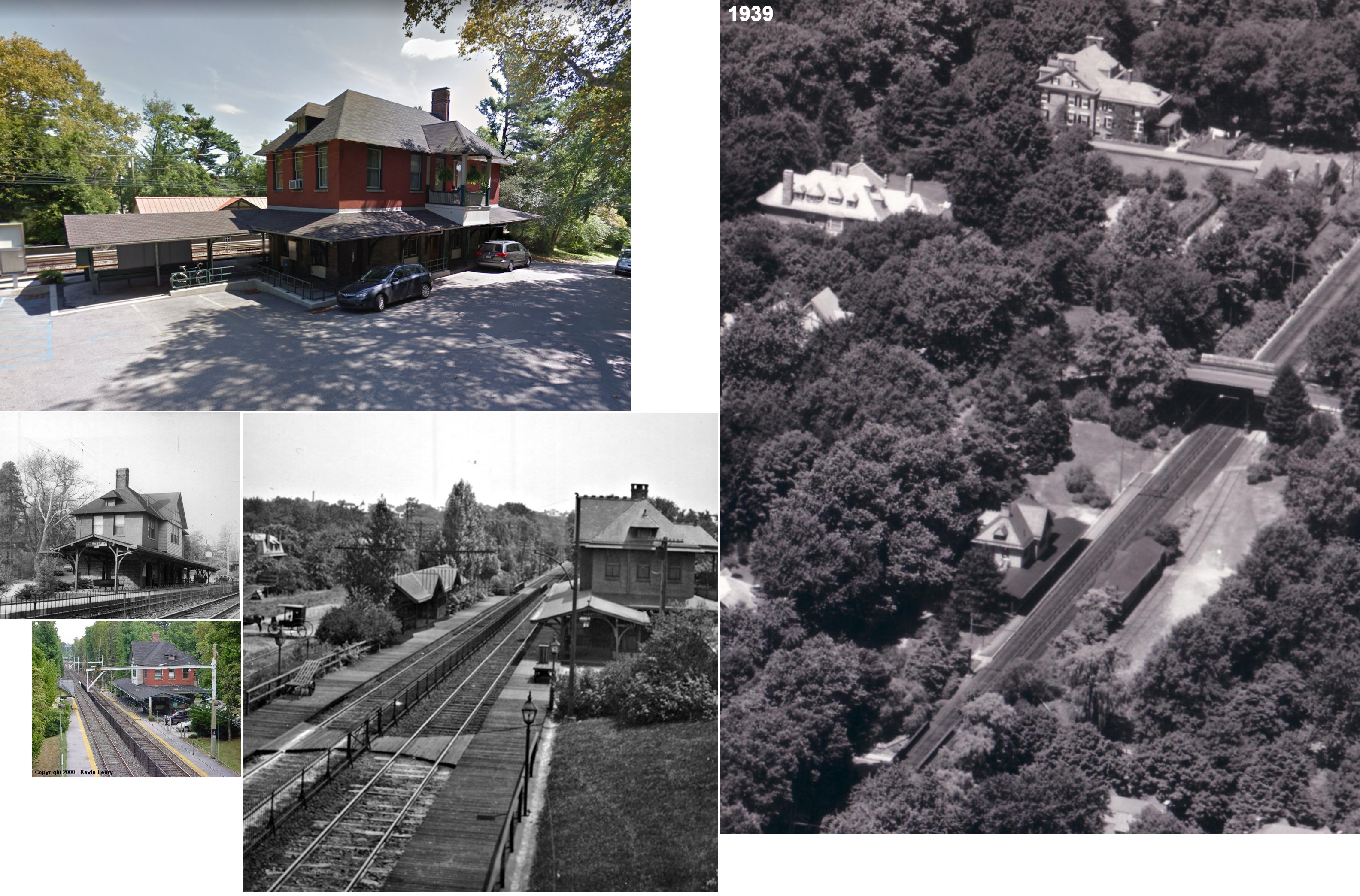
Saint Martins station is a SEPTA Regional Rail station in Philadelphia, Pennsylvania. Located at 311 West Springfield Avenue near the intersection of West Willow Grove and Seminole Avenues, it serves the Chestnut Hill West Line. The station was built by the Pennsylvania Railroad in 1883 and was known as Wissahickon Heights until 1906. The station and adjoining St Martins/St Martin's Lane take their present name from the Church of Saint Martin in the Fields, which stands a few hundred feet to the west.
The station is in zone 2 on the Chestnut Hill West Line and is 10.9 track miles from Suburban Station. In 2004, this station saw 215 boardings on an average weekday. It serves numerous Springside Chestnut Hill Academy students daily. It is also a contributing property of the Chestnut Hill Historic District.
The bridge that carries Willow Grove Avenue over the tracks was under repair from Fall 2005 to late Summer 2006, and has a 3-ton weight limit.[4] The bridge was replaced in the summer of 2016.[5]
References
- ^ a b Baer, Christopher T. (April 2015). "A General Chronology of the Pennsylvania Railroad Company, Its Predecessors and Successors and Its Historical Context: 1884" (PDF). Pennsylvania Railroad Technical & Historical Society. p. 45. Retrieved December 12, 2023.
- ^ "Electric Train Has Trial Trip". The Harrisburg Telegraph. March 23, 1918. p. 10. Retrieved August 1, 2021 – via Newspapers.com.

- ^ Baer, Christopher T. (April 2015). "A General Chronology of the Pennsylvania Railroad Company, Its Predecessors and Successors and Its Historical Context: 1906" (PDF). Pennsylvania Railroad Technical & Historical Society. p. 45. Retrieved December 12, 2023.
- ^ "MPMS #76870: Willow Grove Avenue Bridge over SEPTA R8 Rail Line (page 228)" (PDF). DVRPC FY 2011-2014 Transportation Improvement Program for Pennsylvania. Delaware Valley Regional Planning Commission. Retrieved 23 May 2012.
- ^ Slabbers, Bastiaan (25 May 2016). "Willow Grove Avenue Bridge opens to traffic [photos]". WHYY. Retrieved 12 April 2022.
External links
- SEPTA – St. Martins station
- 2000 Kevin Leary photo
- Springfield Avenue entrance from Google Maps Street View
- Willow Grove Avenue entrance from Google Maps Street View

Recent Comments