The Blue Marble, a photograph of the planet Earth made on 7 December 1972 by the crew of the Apollo 17 spacecraft.
The world is the totality of entities, the whole of reality, or everything that exists. The nature of the world has been conceptualized differently in different fields. Some conceptions see the world as unique while others talk of a "plurality of worlds". Some treat the world as one simple object while others analyze the world as a complex made up of parts.
In scientific cosmology, the world or universe is commonly defined as "[t]he totality of all space and time; all that is, has been, and will be". Theories of modality talk of possible worlds as complete and consistent ways how things could have been. Phenomenology, starting from the horizon of co-given objects present in the periphery of every experience, defines the world as the biggest horizon or the "horizon of all horizons". In philosophy of mind, the world is contrasted with the mind as that which is represented by the mind. Theology conceptualizes the world in relation to God, for example, as God's creation, as identical to God or as the two being interdependent. In religions, there is a tendency to downgrade the material or sensory world in favor of a spiritual world to be sought through religious practice. A comprehensive representation of the world and our place in it, as is found in religions, is known as a worldview. Cosmogony is the field that studies the origin or creation of the world while eschatology refers to the science or doctrine of the last things or of the end of the world.
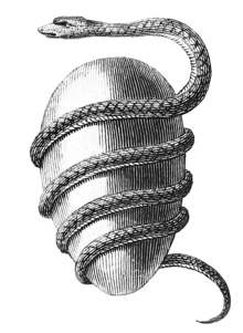
Jacob Bryant's Orphic Egg (1774)The cosmic egg, world egg or mundane egg is a mythologicalmotif found in the cosmogonies of many cultures and civilizations, including in Proto-Indo-European mythology. Typically, there is an egg which, upon "hatching", either gives rise to the universe itself or gives rise to a primordial being who, in turn, creates the universe. The egg is sometimes lain on the primordial waters of the Earth. Typically, the upper half of the egg, or its outer shell, becomes the heaven (firmament) and the lower half, or the inner yolk, becomes the Earth. The motif likely stems from simple elements of an egg, including its ability to offer nourishment and give rise to new life, as is reflected by the Latin proverbomne vivum ex ovo ('all life comes from an egg').
The goals of the Red List are to provide scientifically based information on the status of species and subspecies at a global level, to draw attention to the magnitude and importance of threatened biodiversity, to influence national and international policy and decision-making, and to provide information to guide actions to conserve biological diversity. (Full article...)
Image 3
Economic globalization is one of the three main dimensions of globalization commonly found in academic literature, with the two others being political globalization and cultural globalization, as well as the general term of globalization. Economic globalization refers to the widespread international movement of goods, capital, services, technology and information. It is the increasing economic integration and interdependence of national, regional, and local economies across the world through an intensification of cross-border movement of goods, services, technologies and capital. Economic globalization primarily comprises the globalization of production, finance, markets, technology, organizational regimes, institutions, corporations, and people.
While economic globalization has been expanding since the emergence of trans-national trade, it has grown at an increased rate due to improvements in the efficiency of long-distance transportation, advances in telecommunication, the importance of information rather than physical capital in the modern economy, and by developments in science and technology. The rate of globalization has also increased under the framework of the General Agreement on Tariffs and Trade and the World Trade Organization, in which countries gradually cut down trade barriers and opened up their current accounts and capital accounts. This recent boom has been largely supported by developed economies integrating with developing countries through foreign direct investment, lowering costs of doing business, the reduction of trade barriers, and in many cases cross-border migration. (Full article...)
Image 4
The history of the Internet has its origin in the efforts of scientists and engineers to build and interconnect computer networks. The Internet Protocol Suite, the set of rules used to communicate between networks and devices on the Internet, arose from research and development in the United States and involved international collaboration, particularly with researchers in the United Kingdom and France.
The United Nations Climate Change Conferences are yearly conferences held in the framework of the United Nations Framework Convention on Climate Change (UNFCCC). They serve as the formal meeting of the UNFCCC parties – the Conference of the Parties (COP) – to assess progress in dealing with climate change, and beginning in the mid-1990s, to negotiate the Kyoto Protocol to establish legally binding obligations for developed countries to reduce their greenhouse gas emissions. Starting in 2005 the conferences have also served as the "Conference of the Parties Serving as the Meeting of Parties to the Kyoto Protocol" (CMP); also parties to the convention that are not parties to the protocol can participate in protocol-related meetings as observers. From 2011 to 2015 the meetings were used to negotiate the Paris Agreement as part of the Durban platform, which created a general path towards climate action. Any final text of a COP must be agreed by consensus.
The first UN Climate Change Conference was held in 1995 in Berlin. (Full article...)
The etymology of the title derives from the ancient Sumerian city of Kish (Sumerian: kiš, Akkadian: kiššatu), the original meaning being King of Kish. Although the equation of šar kiššatim as literally meaning "King of the Universe" was made during the Akkadian period, the title of "King of Kish" is older and was already seen as particularly prestigious, as the city of Kish was seen as having primacy over all other Mesopotamian cities. In Sumerian legend, Kish was the location where the kingship was lowered to from heaven after the legendary Flood. (Full article...)
This period is characterized by changes in emphasis on particular areas of space exploration and applications. Initially, the United States and the Soviet Union invested unprecedented amounts of resources in breaking records and being first to meet milestones in crewed and uncrewed exploration. The United States established the National Aeronautics and Space Administration (NASA) and the USSR established the Kosmicheskaya programma SSSR to meet these goals. This period of competition gave way to cooperation between those nations and emphasis on scientific research and commercial applications of space-based technology. (Full article...)
Image 3The replicator in virtually all known life is deoxyribonucleic acid. DNA is far more complex than the original replicator and its replication systems are highly elaborate. (from History of Earth)
Image 4Artist's impression of the enormous collision that probably formed the Moon (from History of Earth)
Image 7Geologic map of North America, color-coded by age. From most recent to oldest, age is indicated by yellow, green, blue, and red. The reds and pinks indicate rock from the Archean.
Image 8First airplane, the Wright Flyer, flew on 17 December 1903.
Image 14Artist's impression of Earth during the later Archean, the largely cooled planetary crust and water-rich barren surface, marked by volcanoes and continents, features already roundmicrobialites. The Moon, still orbiting Earth much closer than today and still dominating Earth's sky, produced strong tides. (from History of Earth)
Image 16Change in average surface air temperature and drivers for that change. Human activity has caused increased temperatures, with natural forces adding some variability. (from Earth)
Image 17An animation of the changing density of productive vegetation on land (low in brown; heavy in dark green) and phytoplankton at the ocean surface (low in purple; high in yellow) (from Earth)
Image 18A 2012 artistic impression of the early Solar System's protoplanetary disk from which Earth and other Solar System bodies were formed (from Earth)
Image 19Artist's impression of a Hadean landscape with the relatively newly formed Moon still looming closely over Earth and both bodies sustaining strong volcanism. (from History of Earth)
Image 20Artist's rendition of an oxinated fully-frozen Snowball Earth with no remaining liquid surface water. (from History of Earth)
Image 22Pangaea was a supercontinent that existed from about 300 to 180 Ma. The outlines of the modern continents and other landmasses are indicated on this map. (from History of Earth)
Image 33A view of Earth with its global ocean and cloud cover, which dominate Earth's surface and hydrosphere; at Earth's polar regions, its hydrosphere forms larger areas of ice cover. (from Earth)
Image 38Trilobites first appeared during the Cambrian period and were among the most widespread and diverse groups of Paleozoic organisms. (from History of Earth)
Image 39Japanese depiction of a Portuguese carrack. European maritime innovations led to proto-globalization.
Image 43Exaggerated illustration of Earth's elliptical orbit around the Sun, marking that the orbital extreme points (apoapsis and periapsis) are not the same as the four seasonal extreme points, the equinox and solstice (from Earth)
Image 52Earth's night-side upper atmosphere appearing from the bottom as bands of afterglow illuminating the troposphere in orange with silhouettes of clouds, and the stratosphere in white and blue. Next the mesosphere (pink area) extends to the orange and faintly green line of the lowest airglow, at about one hundred kilometers at the edge of space and the lower edge of the thermosphere (invisible). Continuing with green and red bands of aurorae stretching over several hundred kilometers. (from Earth)
Image 53Tiktaalik, a fish with limb-like fins and a predecessor of tetrapods. Reconstruction from fossils about 375 million years old. (from History of Earth)
Image 76Earth's western hemisphere showing topography relative to Earth's center instead of to mean sea level, as in common topographic maps (from Earth)
Image 77A reconstruction of Pannotia (550 Ma). (from History of Earth)
Image 78An artist's impression of the Archean, the eon after Earth's formation, featuring round stromatolites, which are early oxygen-producing forms of life from billions of years ago. After the Late Heavy Bombardment, Earth's crust had cooled, its water-rich barren surface is marked by continents and volcanoes, with the Moon still orbiting Earth half as far as it is today, appearing 2.8 times larger and producing strong tides. (from Earth)
The Seven Wonders of Colombia (Spanish: Siete maravillas de Colombia) was a 2007 competition sponsored by El Tiempo. The newspaper asked readers to nominate and vote for man-made structures whose engineering, architectural or historical value deserved special recognition. (Full article...)
The main protected areas of Croatia are national parks, nature parks and strict reserves. There are 444 protected areas of Croatia, encompassing 9% of the country. Those include 8 national parks in Croatia, 2 strict reserves and 11 nature parks. The most famous protected area and the oldest national park in Croatia is the Plitvice Lakes National Park, a UNESCO World Heritage Site. Velebit Nature Park is a part of the UNESCO Man and the Biosphere Programme. The strict and special reserves, as well as the national and nature parks, are managed and protected by the central government, while other protected areas are managed by counties. In 2005, the National Ecological Network was set up, as the first step in preparation of the EU accession and joining of the Natura 2000 network.
The total area of all national parks in the country is 994 km2 (384 sq mi), of which 235 km2 (91 sq mi) is sea surface. Each of the national parks is maintained by a separate institution, overseen and funded by the government ministry of nature conservation and spatial development. The State Institute for Nature Protection provides centralized oversight and expertise. (Full article...)
Strict nature reserve — Area of unmodified natural features with representative ecosystems set aside for the preservation of its biodiversity and for scientific research and monitoring.
Special nature reserve — Area of unmodified or slightly modified natural features of great importance due to uniqueness and rarity which includes the habitats of endangered species set aside for the preservation of its unique features, education, limited tourism and for scientific research and monitoring.
National park — Area with large number of diverse ecosystems of national value, with outstanding natural features and/or cultural heritage set aside for the preservation of its natural resources and for educational, scientific and tourist use.
Natural monument — Small unmodified or slightly modified natural feature, object or phenomenon, easily detectable and unique, with unique natural attributes.
Protected habitat — Area which includes habitats of one or more wildlife species.
Landscape of outstanding features — Area of remarkable appearance with important natural and cultural value.
Nature park — Area of well-preserved natural values with preserved natural ecosystems and picturesque landscape set aside for the preservation of biodiversity and for educational, tourist, recreational and scientific use.
This is a list of the nationally designated protected areas of China. There are many forms of protected areas in China. Based on their relative importance, each type of protected area can be further graded into two to three levels (national, provincial and prefectural/county level). Nevertheless, the highest rank for "pocket nature preserve" (social and mass-based), "no-hunting area", "no-fishing area", "no-logging area", "wild medicinal material resources conservation area", "crop germplasm resources conservation area", "forest tree germplasm resources conservation area" or "source water protection area" is practically restricted to provincial level. The local government at county level is also responsible for the delimitation and declaration of "basic farmland protection area" and "basic grassland".
Take note that many protected areas in China have multiple official designations, and the statutory boundaries of these multi-designated PAs may be identical or may vary one from the other. For instance, the boundaries of Huangshan NSHA coincide with those of the Huangshan NGP, whereas Fujian province's Wuyi Mountains NNR, NSHA and NFP are adjacent to each other. In Heilongjiang, 27,642.14 hectares out of 115,340.27 hectares of Huzhong NFP are intersected with the experiment zone of Huzhong NNR. (Full article...)
Image 10
Protected areas of Canada consist of approximately 12.1 percent of the nation's landmass and freshwater are considered conservation areas, including 11.4 percent designated as protected areas. Approximately 13.8 percent of Canada's territorial waters are conserved, including 8.9 percent designated as protected areas. Terrestrial areas conserved have increased by 65 percent in the 21st century, while marine areas conserved have increased by more than 3,800 percent.
Conservation and protected areas have different mandates depending on the organization which manages them, with some areas having a greater focus on ecological integrity, historical preservation, public usage, scientific research, or a combination of usages. Some areas such as the Polar Bear Pass, are co-managed and overseen by government and local indigenous agencies. (Full article...)
Protected areas of Slovakia are areas that need protection because of their environmental, historical or cultural value to the nation. Protected areas in Slovakia are managed by institutions and organizations governed by the Ministry of the Environment.
Image 5Only a few of the largest large igneous provinces appear (coloured dark purple) on this geological map, which depicts crustal geologic provinces as seen in seismic refraction data
Image 6A plate tectonics map with volcano locations indicated with red circles


 A composite image of artificial light emissions at night on a map of Earth (from Earth)
 Taj Mahal, Mughal Empire, India
 The replicator in virtually all known life is deoxyribonucleic acid. DNA is far more complex than the original replicator and its replication systems are highly elaborate. (from History of Earth)
 Artist's impression of the enormous collision that probably formed the Moon (from History of Earth)
 Fall of the Berlin Wall, 1989
 Image of the physical world, captured by the Hubble Space Telescope (from World)
 Geologic map of North America, color-coded by age. From most recent to oldest, age is indicated by yellow, green, blue, and red. The reds and pinks indicate rock from the Archean.
 First airplane, the Wright Flyer, flew on 17 December 1903.
 Dinosaurs were the dominant terrestrial vertebrates throughout most of the Mesozoic (from History of Earth)
 Obelisk of Axum, Ethiopia
 View of Earth from the Moon by the Lunar Reconnaissance Orbiter (from Earth)
 Graph showing range of estimated partial pressure of atmospheric oxygen through geologic time (from History of Earth)
 Artist's impression of Earth during the later Archean, the largely cooled planetary crust and water-rich barren surface, marked by volcanoes and continents, features already round microbialites. The Moon, still orbiting Earth much closer than today and still dominating Earth's sky, produced strong tides. (from History of Earth)
 Peopling of the world, the Southern Dispersal scenario
 Change in average surface air temperature and drivers for that change. Human activity has caused increased temperatures, with natural forces adding some variability. (from Earth)
 An animation of the changing density of productive vegetation on land (low in brown; heavy in dark green) and phytoplankton at the ocean surface (low in purple; high in yellow) (from Earth)
 A 2012 artistic impression of the early Solar System's protoplanetary disk from which Earth and other Solar System bodies were formed (from Earth)
 Artist's impression of a Hadean landscape with the relatively newly formed Moon still looming closely over Earth and both bodies sustaining strong volcanism. (from History of Earth)
 Artist's rendition of an oxinated fully-frozen Snowball Earth with no remaining liquid surface water. (from History of Earth)
 Pangaea was a supercontinent that existed from about 300 to 180 Ma. The outlines of the modern continents and other landmasses are indicated on this map. (from History of Earth)
 Empires of the world in 1898
 Standing Buddha from Gandhara, 2nd century CE
 Ajloun Castle, Jordan
 Great Mosque of Kairouan, Tunisia, founded 670 CE
 A pillar at Göbekli Tepe
 Battle during the 1281 Mongol invasion of Japan
 An artist's impression of ice age Earth at glacial maximum. (from History of Earth)
 An artist's rendering of a protoplanetary disk (from History of Earth)
 A view of Earth with its global ocean and cloud cover, which dominate Earth's surface and hydrosphere; at Earth's polar regions, its hydrosphere forms larger areas of ice cover. (from Earth)
 A 580 million year old fossil of Spriggina floundensi, an animal from the Ediacaran period. Such life forms could have been ancestors to the many new forms that originated in the Cambrian Explosion. (from History of Earth)
 Florence, birthplace of the Italian Renaissance
 "Lucy", the first Australopithecus afarensis skeleton found, was only 1.06 m (3 ft 6 in) tall.
 Trilobites first appeared during the Cambrian period and were among the most widespread and diverse groups of Paleozoic organisms. (from History of Earth)
 Japanese depiction of a Portuguese carrack. European maritime innovations led to proto-globalization.
 A schematic view of Earth's magnetosphere with solar wind flowing from left to right (from Earth)
 Artist's conception of Devonian flora (from History of Earth)

 Satellite time lapse imagery of Earth's rotation showing axis tilt (from Earth)
 Earth's land use for human agriculture in 2019 (from Earth)
 Shanghai. China urbanized rapidly in the 21st century.
 Yggdrasil, an attempt to reconstruct the Norse world tree which connects the heavens, the world, and the underworld. (from World)
 A reconstruction of human history based on fossil data. (from History of Earth)
 Persepolis, Achaemenid Empire, 6th century BCE
 Earth's night-side upper atmosphere appearing from the bottom as bands of afterglow illuminating the troposphere in orange with silhouettes of clouds, and the stratosphere in white and blue. Next the mesosphere (pink area) extends to the orange and faintly green line of the lowest airglow, at about one hundred kilometers at the edge of space and the lower edge of the thermosphere (invisible). Continuing with green and red bands of aurorae stretching over several hundred kilometers. (from Earth)
 Tiktaalik, a fish with limb-like fins and a predecessor of tetrapods. Reconstruction from fossils about 375 million years old. (from History of Earth)
 Benin Bronze head from Nigeria


 The pale orange dot, an artist's impression of the early Earth which might have appeared orange through its hazy methane rich prebiotic second atmosphere. Earth's atmosphere at this stage was somewhat comparable to today's atmosphere of Titan. (from History of Earth)

 Ming dynasty section, Great Wall of China
 A banded iron formation from the 3.15 Ga Moodies Group, Barberton Greenstone Belt, South Africa. Red layers represent the times when oxygen was available; gray layers were formed in anoxic circumstances. (from History of Earth)
 A composite image of Earth, with its different types of surface discernible: Earth's surface dominating Ocean (blue), Africa with lush (green) to dry (brown) land and Earth's polar ice in the form of Antarctic sea ice (grey) covering the Antarctic or Southern Ocean and the Antarctic ice sheet (white) covering Antarctica. (from Earth)
 A view of Earth with different layers of its atmosphere visible: the troposphere with its clouds casting shadows, a band of stratospheric blue sky at the horizon, and a line of green airglow of the lower thermosphere around an altitude of 100 km, at the edge of space (from Earth)
 Notre-Dame de Paris, France
 Chloroplasts in the cells of a moss (from History of Earth)
 Chennakesava Temple, Belur, India
 A map of heat flow from Earth's interior to the surface of Earth's crust, mostly along the oceanic ridges (from Earth)
 Earth's axial tilt causing different angles of seasonal illumination at different orbital positions around the Sun (from Earth)
 Angkor Wat temple complex, Cambodia, early 12th century
 Earth's history with time-spans of the eons to scale (from History of Earth)
 Vitruvian Man by Leonardo da Vinci epitomizes the advances in art and science seen during the Renaissance. (from History of Earth)
 Earth's western hemisphere showing topography relative to Earth's center instead of to mean sea level, as in common topographic maps (from Earth)
 A reconstruction of Pannotia (550 Ma). (from History of Earth)
 Cross-section through a liposome (from History of Earth)
 Lithified stromatolites on the shores of Lake Thetis, Western Australia. Archean stromatolites are the first direct fossil traces of life on Earth. (from History of Earth)
 Tracy Caldwell Dyson, a NASA astronaut, observing Earth from the Cupola module at the International Space Station on 11 September 2010 (from Earth)
 Olmec colossal head, now at the Museo de Antropología de Xalapa
 A computer-generated image mapping the prevalence of artificial satellites and space debris around Earth in geosynchronous and low Earth orbit (from Earth)
 Machu Picchu, Inca Empire, Peru
 Artist's conception of Hadean Eon Earth, when it was much hotter and inhospitable to all forms of life. (from History of Earth)
 Great Pyramids of Giza, Egypt
 Last Moon landing: Apollo 17 (1972)


 The world map by Gerardus Mercator (1569), the first map in the well-known Mercator projection
 The Goode homolosine projection is a pseudocylindrical, equal-area, composite map projection used for world maps.
 Index map from the International Map of the World (1:1,000,000 scale)
 Time zones of the world
 Only a few of the largest large igneous provinces appear (coloured dark purple) on this geological map, which depicts crustal geologic provinces as seen in seismic refraction data
 A plate tectonics map with volcano locations indicated with red circles
 1516 map of the world by Martin Waldseemüller
 United Nations Human Development Index map by country (2016)
 Mollweide projection of the world


 Commons
 Wikibooks
 Wikidata
 Wikinews
 Wikiquote
 Wikisource
 Wikispecies
 Wikiversity
 Wikivoyage
 Wiktionary


Recent Comments