The Tropical Cyclones Portal
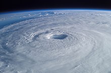
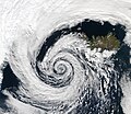
A tropical cyclone is a storm system characterized by a large low-pressure center, a closed low-level circulation and a spiral arrangement of numerous thunderstorms that produce strong winds and heavy rainfall. Tropical cyclones feed on the heat released when moist air rises, resulting in condensation of water vapor contained in the moist air. They are fueled by a different heat mechanism than other cyclonic windstorms such as Nor'easters, European windstorms and polar lows, leading to their classification as "warm core" storm systems. Most tropical cyclones originate in the doldrums, approximately ten degrees from the Equator.
The term "tropical" refers to both the geographic origin of these systems, which form almost exclusively in tropical regions of the globe, as well as to their formation in maritime tropical air masses. The term "cyclone" refers to such storms' cyclonic nature, with anticlockwise rotation in the Northern Hemisphere and clockwise rotation in the Southern Hemisphere. Depending on its location and intensity, a tropical cyclone may be referred to by names such as "hurricane", "typhoon", "tropical storm", "cyclonic storm", "tropical depression" or simply "cyclone".
Types of cyclone: 1. A "Typhoon" is a tropical cyclone located in the North-west Pacific Ocean which has the most cyclonic activity and storms occur year-round. 2. A "Hurricane" is also a tropical cyclone located at the North Atlantic Ocean or North-east Pacific Ocean which have an average storm activity and storms typically form between May 15 and November 30. 3. A "Cyclone" is a tropical cyclone that occurs in the South Pacific and Indian Oceans.
Selected named cyclone -
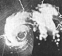
Hurricane Audrey was one of the deadliest hurricanes in U.S. history, killing at least 416 people as it devastated the southwestern Louisiana coast in 1957. Along with Hurricane Alex in 2010, it was also the strongest June hurricane ever recorded in the Atlantic basin as measured by pressure. The rapidly developing storm struck southwestern Louisiana as an intense Category 3 hurricane, destroying coastal communities with a powerful storm surge that penetrated as far as 20 mi (32 km) inland. The first named storm and hurricane of the 1957 hurricane season, Audrey formed on June 24 from a tropical wave that moved into the Bay of Campeche. Situated within ideal conditions for tropical development, Audrey quickly strengthened, reaching hurricane status a day afterwards. Moving north, it continued to strengthen and accelerate as it approached the United States Gulf Coast. On June 27, the hurricane reached peak sustained winds of 125 mph (205 km/h), making it a major hurricane. At the time, Audrey had a minimum barometric pressure of 946 mbar (hPa; 27.91 inHg). The hurricane made landfall with the same intensity between the mouth of the Sabine River and Cameron, Louisiana, later that day, causing unprecedented destruction across the region. Once inland, Audrey weakened and turned extratropical over West Virginia on June 29. Audrey was the first major hurricane to form in the Gulf of Mexico since 1945.
Prior to making landfall, Audrey severely disrupted offshore drilling operations in the Gulf of Mexico. Damages from offshore oil facilities alone was estimated at $16 million. Audrey caused much of its destruction near the border between Texas and Louisiana. The hurricane's strong winds resulted in widespread property and infrastructural damage. Power outages also resulted from the strong winds. However, as is typical with most landfalling tropical cyclones, most of the destruction at the coast was the result of the hurricane's strong storm surge, which was amplified by Audrey's rapid strengthening just prior to landfall. The storm surge was reported to have peaked as high as 12 ft (3.7 m), inundating coastal areas. Damage from the surge alone extended 25 mi (40 km) inland. The rough seas killed nine people offshore after capsizing the boat they were in. Further inland in Louisiana, the storm spawned two tornadoes, causing additional damage. Audrey also dropped heavy rainfall, peaking at 10.63 in (270 mm) near Basile. In Louisiana and Texas, where Audrey first impacted, the damage toll was $128 million. (Full article...)Selected article -

Selected image -

Selected season -

The 2016 Atlantic hurricane season was the first above-average hurricane season since 2012, producing 15 named storms, 7 hurricanes and 4 major hurricanes. The season officially started on June 1 and ended on November 30, though the first storm, Hurricane Alex which formed in the Northeastern Atlantic, developed on January 12, being the first hurricane to develop in January since 1938. The final storm, Otto, crossed into the Eastern Pacific on November 25, a few days before the official end. Following Alex, Tropical Storm Bonnie brought flooding to South Carolina and portions of North Carolina. Tropical Storm Colin in early June brought minor flooding and wind damage to parts of the Southeastern United States, especially Florida. Hurricane Earl left 94 fatalities in the Dominican Republic and Mexico, 81 of which occurred in the latter. In early September, Hurricane Hermine, the first hurricane to make landfall in Florida since Hurricane Wilma in 2005, brought extensive coastal flooding damage especially to the Forgotten and Nature coasts of Florida. Hermine was responsible for five fatalities and about $550 million (2016 USD) in damage.
The strongest, costliest, and deadliest storm of the season was Hurricane Matthew, the southernmost Category 5 Atlantic hurricane on record and the first to reach that intensity since Felix in 2007, ending the longest streak of seasons without a hurricane of such intensity in the Satellite Era. With at least 603 deaths attributed to it, Matthew was the deadliest Atlantic hurricane since Stan of 2005. Furthermore, damage from Matthew is estimated to be at least $16.5 billion, making it the ninth costliest Atlantic hurricane on record at the time. Hurricane Nicole became the first major hurricane to directly impact Bermuda since Hurricane Fabian in 2003, leaving widespread but relatively moderate damage on the island. The final tropical cyclone of the season – Hurricane Otto – brought severe flooding to Central America in November, particularly in Costa Rica and Nicaragua. Otto left 23 deaths and about $190 million in damage. On November 25, the storm emerged into the Eastern Pacific basin, the first such occurrence since Hurricane Cesar–Douglas in 1996. Most of the season's tropical cyclones impacted land, and nine of those storms caused loss of life. Collectively, the storms left at least 736 fatalities and $17.49 billion in damage, making the season the costliest since 2012. (Full article...)Related portals
Currently active tropical cyclones

Italicized basins are unofficial.
- East and Central Pacific (2024)
- No active systems
- West Pacific (2024)
- Severe Tropical Storm Ampil
- Severe Tropical Storm Maria
- Tropical Storm Son-Tinh
- Tropical Storm Wukong
- North Indian Ocean (2024)
- No active systems
- Mediterranean (2024–25)
- No active systems
- South-West Indian Ocean (2024–25)
- No active systems
- Australian region (2024–25)
- No active systems
- South Pacific (2024–25)
- No active systems
- South Atlantic (2024–25)
- No active systems
Last updated: 10:28, 13 August 2024 (UTC)
Tropical cyclone anniversaries
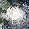
- August 12, 2004 - Typhoon Rananim (pictured) reached its peak intensity to the east of Taiwan with 170 km/h (105 mph) winds. Ranamin later made landfall in Zhejiang, China killing 115 people and causing over $4 billion in damage.

August 13,
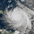
- 2004 - Hurricane Charley (pictured) made landfall as a Category 4 hurricane near Punta Gorda, Florida. Charley caused over $16 billion in damage.
- 2009 - Tropical Storm Maka enters the Pacific typhoon basin from the Central Pacific.

August 14,
- 1970 - Typhoon Wilda made landfall on western Kyushu, Japan as a typhoon with 170 km/h (105 mph) winds. Wilda brought heavy rain to Japan which killed 11 people.
- 2013 - Typhoon Utor (pictured) makes landfall over in Yanjiang, Guangdong as a Category 2 typhoon. Damages in China topped ¥13.4 billion (US$2.2 billion).
Did you know…
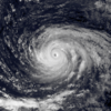


- …that the Joint Typhoon Warning Center considers that Typhoon Vera (pictured) of 1986 is actually two distinct systems, formed from two separated low-level circulations?
- …that Hurricane Agatha (pictured) was the strongest Pacific hurricane to make landfall in Mexico in May since records began in 1949?
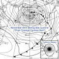
- …that Cyclone Raquel (track pictured) travelled between the Australian and South Pacific basins between the 2014–15 and 2015–16 seasons, spanning both seasons in both basins?
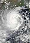
- …that Cyclone Amphan (pictured) in 2020 was the first storm to be classified as a Super Cyclonic Storm in the Bay of Bengal since 1999?
General images -

The 1990 Atlantic hurricane season featured the most named storms of any hurricane season at the time. During the season, 14 tropical cyclones in the Atlantic Ocean became named storms. The season officially started on June 1, 1990, and ended on November 30. These dates, adopted by the convention, historically delimit the period each year when most Atlantic tropical systems form. However, storm formation is possible at any time of the year, as was the case this season, when Tropical Depression One formed on May 24; Hurricane Nana, the season's final storm, dissipated on October 21.
The season produced 16 tropical depressions, of which 14 intensified into tropical storms, 8 became hurricanes, and 1 became a major hurricane. Although the season had the highest number of named storms at the time, it featured only two notable storms, primarily because many of the tropical cyclones remained either weak or at sea. The two most significant storms of the season, in terms of damage and loss of life, were Hurricane Diana and Tropical Storm Marco. However, the strongest tropical cyclone of the season was Hurricane Gustav. (Full article...)Topics
Subcategories
Related WikiProjects
WikiProject Tropical cyclones is the central point of coordination for Wikipedia's coverage of tropical cyclones. Feel free to help!
WikiProject Weather is the main center point of coordination for Wikipedia's coverage of meteorology in general, and the parent project of WikiProject Tropical cyclones. Three other branches of WikiProject Weather in particular share significant overlaps with WikiProject Tropical cyclones:
- The Non-tropical storms task force coordinates most of Wikipedia's coverage on extratropical cyclones, which tropical cyclones often transition into near the end of their lifespan.
- The Floods task force takes on the scope of flooding events all over the world, with rainfall from tropical cyclones a significant factor in many of them.
- WikiProject Severe weather documents the effects of extreme weather such as tornadoes, which landfalling tropical cyclones can produce.
Things you can do
 |
Here are some tasks awaiting attention:
|
Wikimedia
The following Wikimedia Foundation sister projects provide more on this subject:
-
 Commons
Free media repository -
 Wikibooks
Free textbooks and manuals -
 Wikidata
Free knowledge base -
 Wikinews
Free-content news -
 Wikiquote
Collection of quotations -
 Wikisource
Free-content library -
 Wikiversity
Free learning tools -
 Wikivoyage
Free travel guide -
 Wiktionary
Dictionary and thesaurus








Recent Comments