
How Can We Help?

|
Wikimedia Commons Atlas of the World The Wikimedia Atlas of the World is an organized and commented collection of geographical, political and historical maps available at Wikimedia Commons. Discussion • Update the atlas • Index of the Atlas • Atlas in categories • Other atlases on line |
The introductions of the country, dependency and region entries are in the native languages and in English. The other introductions are in English.
|
| ||||||||||||||||||||||||||||||||||||||||


General maps

|
Map of Xinjiang |

|
Nationalities of Xinjiang |

|
Xinjiang Macroregions |

|
Languages of Xinjiang |

|
Xinjiang Space View |
Maps of divisions
This section holds maps of the administrative divisions.
-
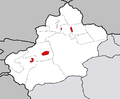
 Urumqi (乌鲁木齐) City, capital of the Region
 -
 Aksu (阿克苏) Prefecture
 -
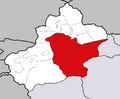 Bayin Gholin (巴音郭楞) Mongolian Autonomous Prefecture
 -
 Bortala (博尔塔拉) Mongolian Autonomous Prefecture
 -
 Changji (昌吉) Hui Nationality Autonomous Prefecture
 -
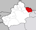 Kumul (哈密) Prefecture
 -
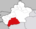 Hotan (和田) Prefecture
 -
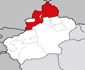 Ili (伊犁) Kazak Autonomous Prefecture
 -
 Karamay (克拉玛依) City
 -
 Kashgar (喀什) Prefecture
 -
 Kizilsu (克孜勒苏) Kirgiz Autonomous Prefecture
 -
 Turpan (吐鲁番) Prefecture
 -
 County level cities direct under the Regional Government


History maps
This section holds a short summary of the history of the area of present-day {{{1}}}, illustrated with maps, including historical maps of former countries and empires that included present-day {{{1}}}.

|
Xinjiang during 3rd century A.D. |

|
Tang Emperor Taizong's campaign in Xinjiang, 640-648 |
Old maps
This section holds copies of original general maps more than 70 years old.
-
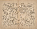
 Xinjiang in 1759, Overview
 -
 West of Jiayuguan, 1759
 -
 Kumul, 1759
 -
 Barköl, 1759
 -
 Qitai, 1759
 -
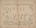
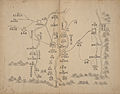
 Urumqi, 1759
 -
 Lake Balkhash to Lake Zaysan, 1759
 -

-
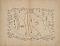
 Korla, 1759
 -
 Kucha, 1759
 -
-
 Aksu, 1759
 -
 Uqturpan, 1759
 -
 Hotan, 1759
 -
 Yarkand, 1759
 -
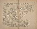
 Kashgar, 1759


Notes and references
|
General remarks:
|

Recent Comments